Mud Springs Topo Map Texas
To zoom in, hover over the map of Mud Springs
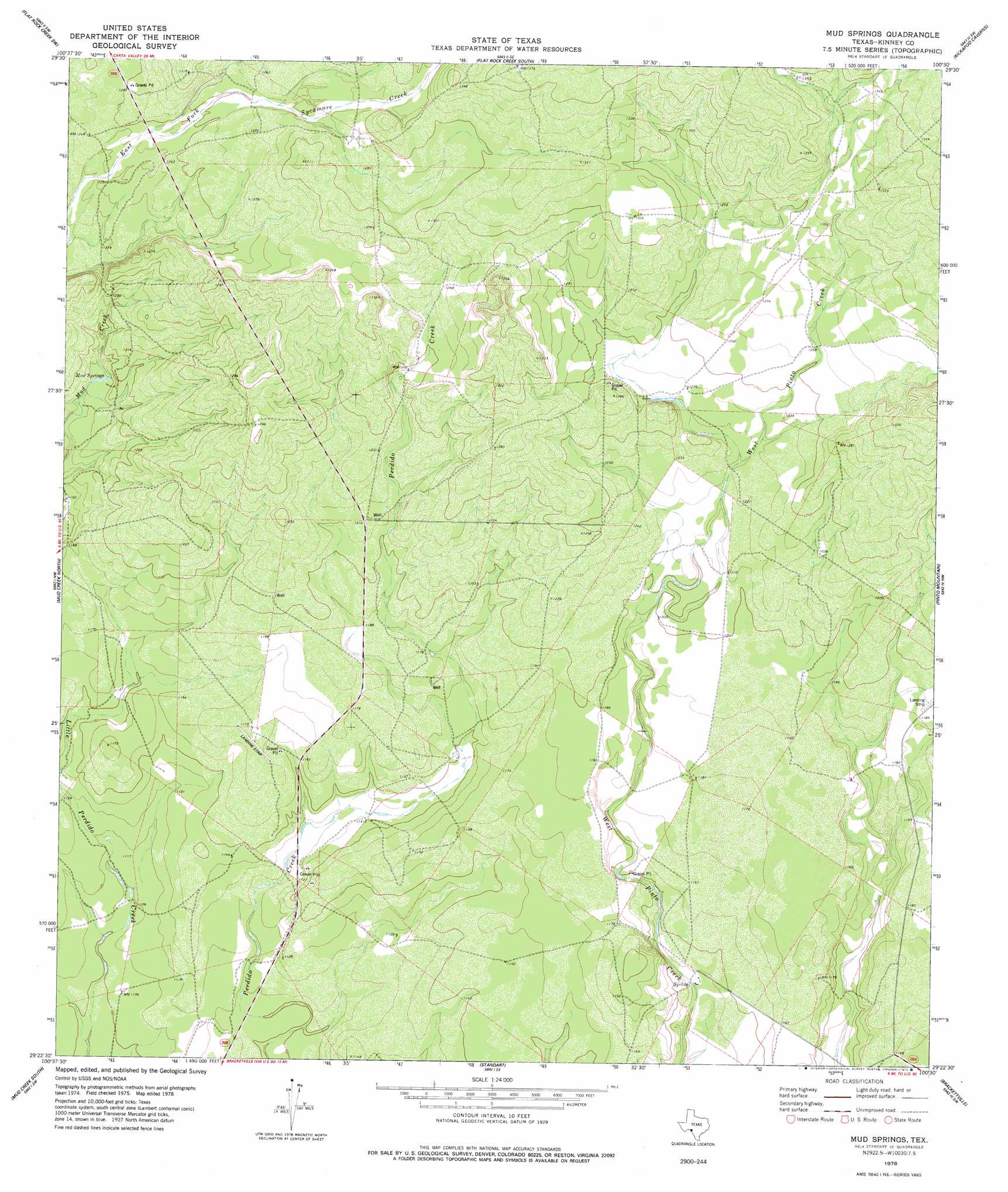
USGS Topo Quad 29100d5 - 1:24,000 scale
| Topo Map Name: | Mud Springs |
| USGS Topo Quad ID: | 29100d5 |
| Print Size: | ca. 21 1/4" wide x 27" high |
| Southeast Coordinates: | 29.375° N latitude / 100.5° W longitude |
| Map Center Coordinates: | 29.4375° N latitude / 100.5625° W longitude |
| U.S. State: | TX |
| Filename: | o29100d5.jpg |
| Download Map JPG Image: | Mud Springs topo map 1:24,000 scale |
| Map Type: | Topographic |
| Topo Series: | 7.5´ |
| Map Scale: | 1:24,000 |
| Source of Map Images: | United States Geological Survey (USGS) |
| Alternate Map Versions: |
Mud Springs TX 1978, updated 1978 Download PDF Buy paper map Mud Springs TX 2010 Download PDF Buy paper map Mud Springs TX 2013 Download PDF Buy paper map Mud Springs TX 2016 Download PDF Buy paper map |
1:24,000 Topo Quads surrounding Mud Springs
Miers Ranch |
Flat Rock Creek Nw |
Flat Rock Creek North |
Wiley Waterhole |
Indian Mountain |
Rough Canyon Se |
Flat Rock Creek Sw |
Flat Rock Creek South |
Kickapoo Caverns |
Silver Lake |
Del Rio Ne |
Mud Creek North |
Mud Springs |
Pinto Mountain |
Brackettville Ne |
Del Rio Se |
Mud Creek South |
Standart |
Brackettville |
Elm Mountain |
Maverick Dam |
Cow Creek Tank |
Tequesquite Creek Ne |
Spofford |
Anacacho |
> Back to 29100a1 at 1:100,000 scale
> Back to 29100a1 at 1:250,000 scale
> Back to U.S. Topo Maps home
Mud Springs topo map: Gazetteer
Mud Springs: Springs
Mud Springs elevation 359m 1177′Mud Springs elevation 360m 1181′
Pecan Springs elevation 394m 1292′
Mud Springs digital topo map on disk
Buy this Mud Springs topo map showing relief, roads, GPS coordinates and other geographical features, as a high-resolution digital map file on DVD: