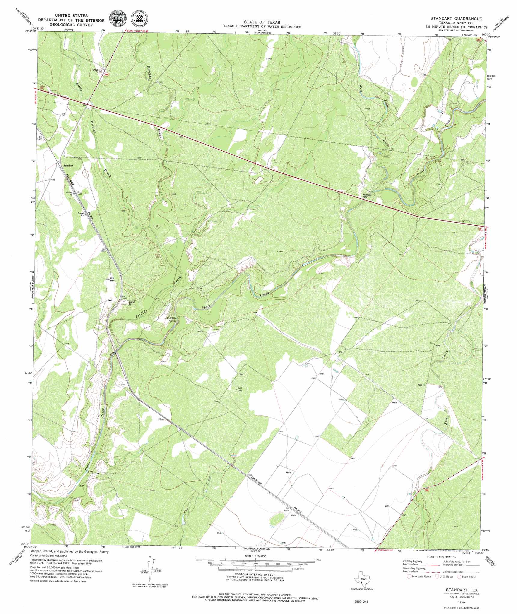
Standart Topo Map Texas
To zoom in, hover over the map of Standart
USGS Topo Quad 29100c5 - 1:24,000 scale
| Topo Map Name: | Standart |
| USGS Topo Quad ID: | 29100c5 |
| Print Size: | ca. 21 1/4" wide x 27" high |
| Southeast Coordinates: | 29.25° N latitude / 100.5° W longitude |
| Map Center Coordinates: | 29.3125° N latitude / 100.5625° W longitude |
| U.S. State: | TX |
| Filename: | o29100c5.jpg |
| Download Map JPG Image: | Standart topo map 1:24,000 scale |
| Map Type: | Topographic |
| Topo Series: | 7.5´ |
| Map Scale: | 1:24,000 |
| Source of Map Images: | United States Geological Survey (USGS) |
| Alternate Map Versions: |
Standart TX 1979, updated 1979 Download PDF Buy paper map Standart TX 2010 Download PDF Buy paper map Standart TX 2012 Download PDF Buy paper map Standart TX 2016 Download PDF Buy paper map |
1:24,000 Topo Quads surrounding Standart
Rough Canyon Se |
Flat Rock Creek Sw |
Flat Rock Creek South |
Kickapoo Caverns |
Silver Lake |
Del Rio Ne |
Mud Creek North |
Mud Springs |
Pinto Mountain |
Brackettville Ne |
Del Rio Se |
Mud Creek South |
Standart |
Brackettville |
Elm Mountain |
Maverick Dam |
Cow Creek Tank |
Tequesquite Creek Ne |
Spofford |
Anacacho |
Tequesquite Creek Sw |
Tequesquite Spring |
Imperialist Tank |
Peloncillo Peak |
> Back to 29100a1 at 1:100,000 scale
> Back to 29100a1 at 1:250,000 scale
> Back to U.S. Topo Maps home
Standart topo map: Gazetteer
Standart: Populated Places
Pinto elevation 320m 1049′Standart elevation 331m 1085′
Standart: Springs
Stricklin Spring elevation 307m 1007′Standart: Streams
Little Perdido Creek elevation 315m 1033′Perdido Creek elevation 301m 987′
West Pinto Creek elevation 323m 1059′
Standart digital topo map on disk
Buy this Standart topo map showing relief, roads, GPS coordinates and other geographical features, as a high-resolution digital map file on DVD: