Nankin Topo Map Georgia
To zoom in, hover over the map of Nankin
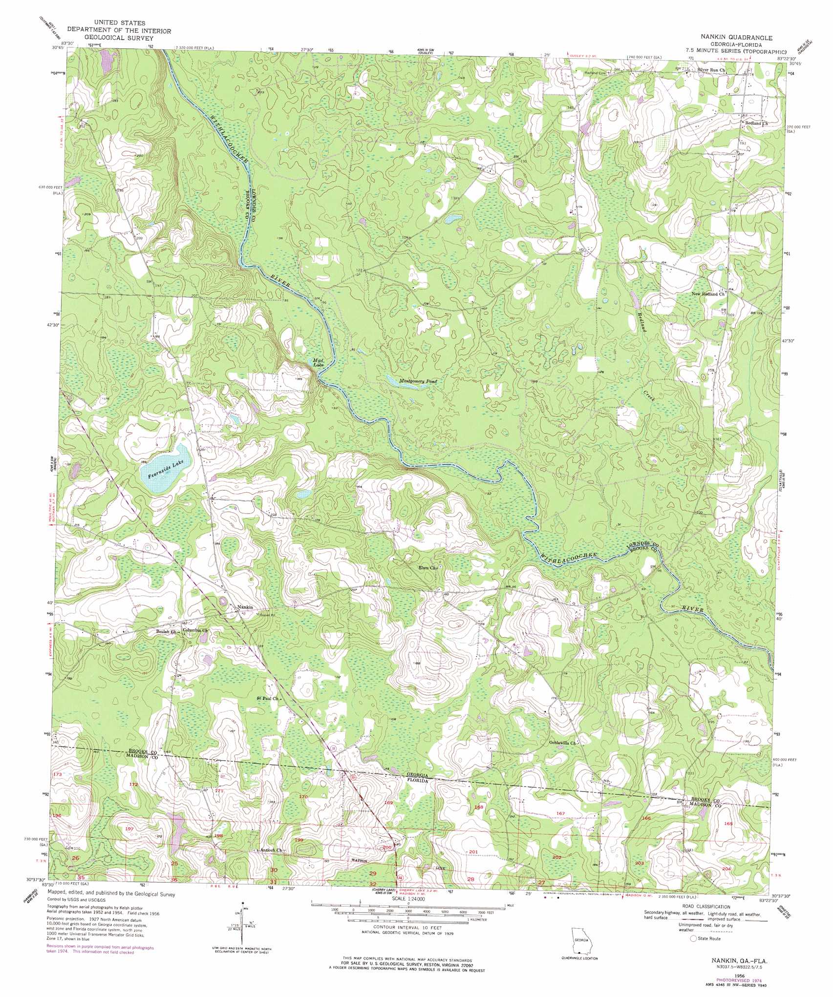
USGS Topo Quad 30083f4 - 1:24,000 scale
| Topo Map Name: | Nankin |
| USGS Topo Quad ID: | 30083f4 |
| Print Size: | ca. 21 1/4" wide x 27" high |
| Southeast Coordinates: | 30.625° N latitude / 83.375° W longitude |
| Map Center Coordinates: | 30.6875° N latitude / 83.4375° W longitude |
| U.S. States: | GA, FL |
| Filename: | o30083f4.jpg |
| Download Map JPG Image: | Nankin topo map 1:24,000 scale |
| Map Type: | Topographic |
| Topo Series: | 7.5´ |
| Map Scale: | 1:24,000 |
| Source of Map Images: | United States Geological Survey (USGS) |
| Alternate Map Versions: |
Nankin GA 1956, updated 1957 Download PDF Buy paper map Nankin GA 1956, updated 1977 Download PDF Buy paper map Nankin GA 1994, updated 1998 Download PDF Buy paper map Nankin GA 2011 Download PDF Buy paper map Nankin GA 2014 Download PDF Buy paper map |
1:24,000 Topo Quads surrounding Nankin
Pavo |
Pebble Hill |
Hahira West |
Hahira East |
Bemiss |
Dixie |
Quitman |
Ousley |
Valdosta |
Indianola |
Grooverville |
Baden |
Nankin |
Clyattville |
Lake Park |
Ashville |
Hamburg |
Cherry Lake |
Pinetta |
Octahatchee |
Greenville |
Greenville Ne |
Madison |
Lee |
Ellaville |
> Back to 30083e1 at 1:100,000 scale
> Back to 30082a1 at 1:250,000 scale
> Back to U.S. Topo Maps home
Nankin topo map: Gazetteer
Nankin: Bridges
Knight Bridge (historical) elevation 24m 78′Rocky Ford Bridge elevation 22m 72′
Nankin: Cliffs
Godwin Bluff elevation 30m 98′Nankin: Lakes
Fearnside Lake elevation 56m 183′Montgomery Pond elevation 27m 88′
Mud Lake elevation 26m 85′
Nankin: Populated Places
Nankin elevation 60m 196′Nankin: Streams
Redland Creek elevation 27m 88′Nankin: Swamps
Sims Lake elevation 27m 88′Nankin digital topo map on disk
Buy this Nankin topo map showing relief, roads, GPS coordinates and other geographical features, as a high-resolution digital map file on DVD: