Buhler Topo Map Louisiana
To zoom in, hover over the map of Buhler
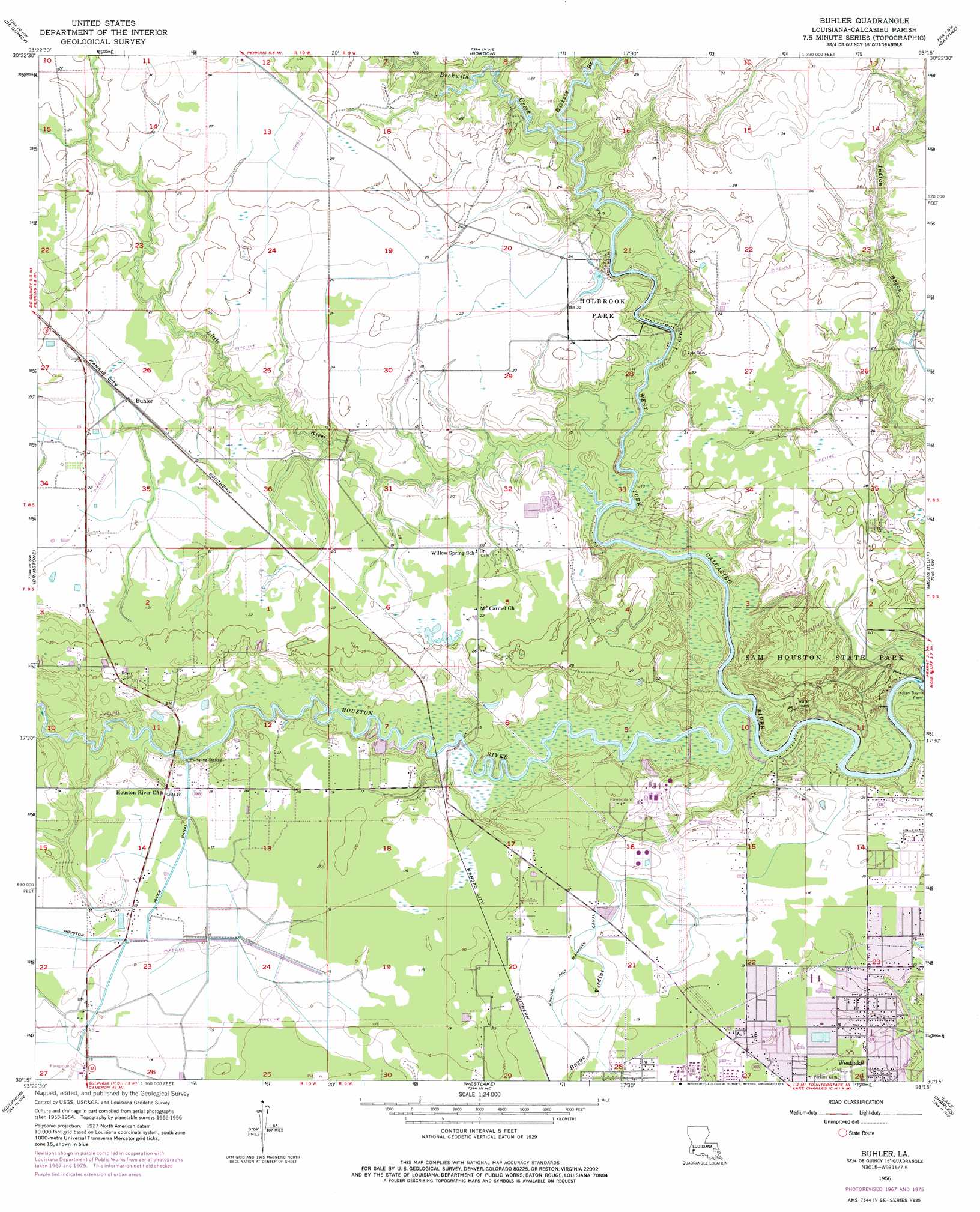
USGS Topo Quad 30093c3 - 1:24,000 scale
| Topo Map Name: | Buhler |
| USGS Topo Quad ID: | 30093c3 |
| Print Size: | ca. 21 1/4" wide x 27" high |
| Southeast Coordinates: | 30.25° N latitude / 93.25° W longitude |
| Map Center Coordinates: | 30.3125° N latitude / 93.3125° W longitude |
| U.S. State: | LA |
| Filename: | o30093c3.jpg |
| Download Map JPG Image: | Buhler topo map 1:24,000 scale |
| Map Type: | Topographic |
| Topo Series: | 7.5´ |
| Map Scale: | 1:24,000 |
| Source of Map Images: | United States Geological Survey (USGS) |
| Alternate Map Versions: |
Buhler LA 1956, updated 1957 Download PDF Buy paper map Buhler LA 1956, updated 1968 Download PDF Buy paper map Buhler LA 1956, updated 1976 Download PDF Buy paper map Buhler LA 1956, updated 1976 Download PDF Buy paper map Buhler LA 1998, updated 2002 Download PDF Buy paper map Buhler LA 2012 Download PDF Buy paper map Buhler LA 2015 Download PDF Buy paper map |
1:24,000 Topo Quads surrounding Buhler
Fields |
Oretta |
Kernan |
Longville |
Reeves |
Clark Hollow |
De Quincy |
Gordon |
Gaytine |
Topsy |
Lunita |
Brimstone |
Buhler |
Moss Bluff |
Hecker |
Vinton |
Sulphur |
Westlake |
Lake Charles |
Iowa |
Cameron Farms |
Black Lake |
Moss Lake |
Lake Charles Sw |
Lake Charles Se |
> Back to 30093a1 at 1:100,000 scale
> Back to 30092a1 at 1:250,000 scale
> Back to U.S. Topo Maps home
Buhler topo map: Gazetteer
Buhler: Airports
Reynolds Airport elevation 5m 16′Buhler: Canals
Krause and Managan Canal elevation 5m 16′Buhler: Dams
Holbrook Park Lake Dam elevation 4m 13′Lake View Dam elevation 4m 13′
Buhler: Oilfields
Beckwith Oil and Gas Field elevation 3m 9′Buhler: Parks
Holbrook Park elevation 7m 22′Pecanderosa Park elevation 4m 13′
Sam Houston State Park elevation 8m 26′
Buhler: Populated Places
Buhler elevation 6m 19′Buhler: Streams
Beckwith Creek elevation 2m 6′Hickory Branch elevation 0m 0′
Houston River elevation 0m 0′
Indian Bayou elevation 0m 0′
Little Indian Bayou elevation 2m 6′
Little River elevation 0m 0′
Buhler digital topo map on disk
Buy this Buhler topo map showing relief, roads, GPS coordinates and other geographical features, as a high-resolution digital map file on DVD: