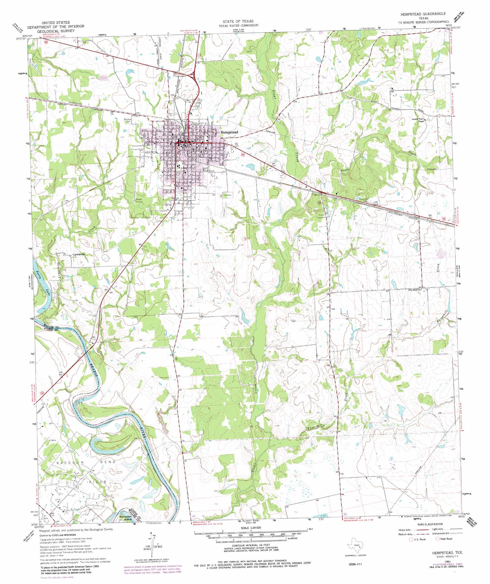
Hempstead Topo Map Texas
To zoom in, hover over the map of Hempstead
USGS Topo Quad 30096a1 - 1:24,000 scale
| Topo Map Name: | Hempstead |
| USGS Topo Quad ID: | 30096a1 |
| Print Size: | ca. 21 1/4" wide x 27" high |
| Southeast Coordinates: | 30° N latitude / 96° W longitude |
| Map Center Coordinates: | 30.0625° N latitude / 96.0625° W longitude |
| U.S. State: | TX |
| Filename: | o30096a1.jpg |
| Download Map JPG Image: | Hempstead topo map 1:24,000 scale |
| Map Type: | Topographic |
| Topo Series: | 7.5´ |
| Map Scale: | 1:24,000 |
| Source of Map Images: | United States Geological Survey (USGS) |
| Alternate Map Versions: |
Hempstead TX 1961, updated 1963 Download PDF Buy paper map Hempstead TX 1961, updated 1974 Download PDF Buy paper map Hempstead TX 1961, updated 1980 Download PDF Buy paper map Hempstead TX 1961, updated 1980 Download PDF Buy paper map Hempstead TX 2010 Download PDF Buy paper map Hempstead TX 2013 Download PDF Buy paper map Hempstead TX 2016 Download PDF Buy paper map |
1:24,000 Topo Quads surrounding Hempstead
Independence |
Washington |
Courtney |
Stoneham |
Plantersville |
Chappell Hill |
Daniels |
Howth |
Waller Nw |
Magnolia West |
Kenney |
Buckhorn |
Hempstead |
Waller |
Hockley |
Bellville |
Burleigh |
Sunny Side |
Hockley Mound |
Warren Lake |
Cat Spring |
Sealy |
San Felipe |
Brookshire |
Katy |
> Back to 30096a1 at 1:100,000 scale
> Back to 30096a1 at 1:250,000 scale
> Back to U.S. Topo Maps home
Hempstead topo map: Gazetteer
Hempstead: Airports
Hempstead Gliderport elevation 79m 259′Hempstead: Bends
Raccoon Bend elevation 37m 121′Hempstead: Lakes
Perry Lake elevation 42m 137′Hempstead: Oilfields
Raccoon Bend Oil Field elevation 45m 147′Hempstead: Populated Places
Hempstead elevation 74m 242′Lewisville elevation 52m 170′
Pine Island elevation 60m 196′
Hempstead: Streams
Lewisville Creek elevation 37m 121′Ponds Creek elevation 54m 177′
Threemile Creek elevation 43m 141′
Hempstead digital topo map on disk
Buy this Hempstead topo map showing relief, roads, GPS coordinates and other geographical features, as a high-resolution digital map file on DVD: