Soso Topo Map Mississippi
To zoom in, hover over the map of Soso
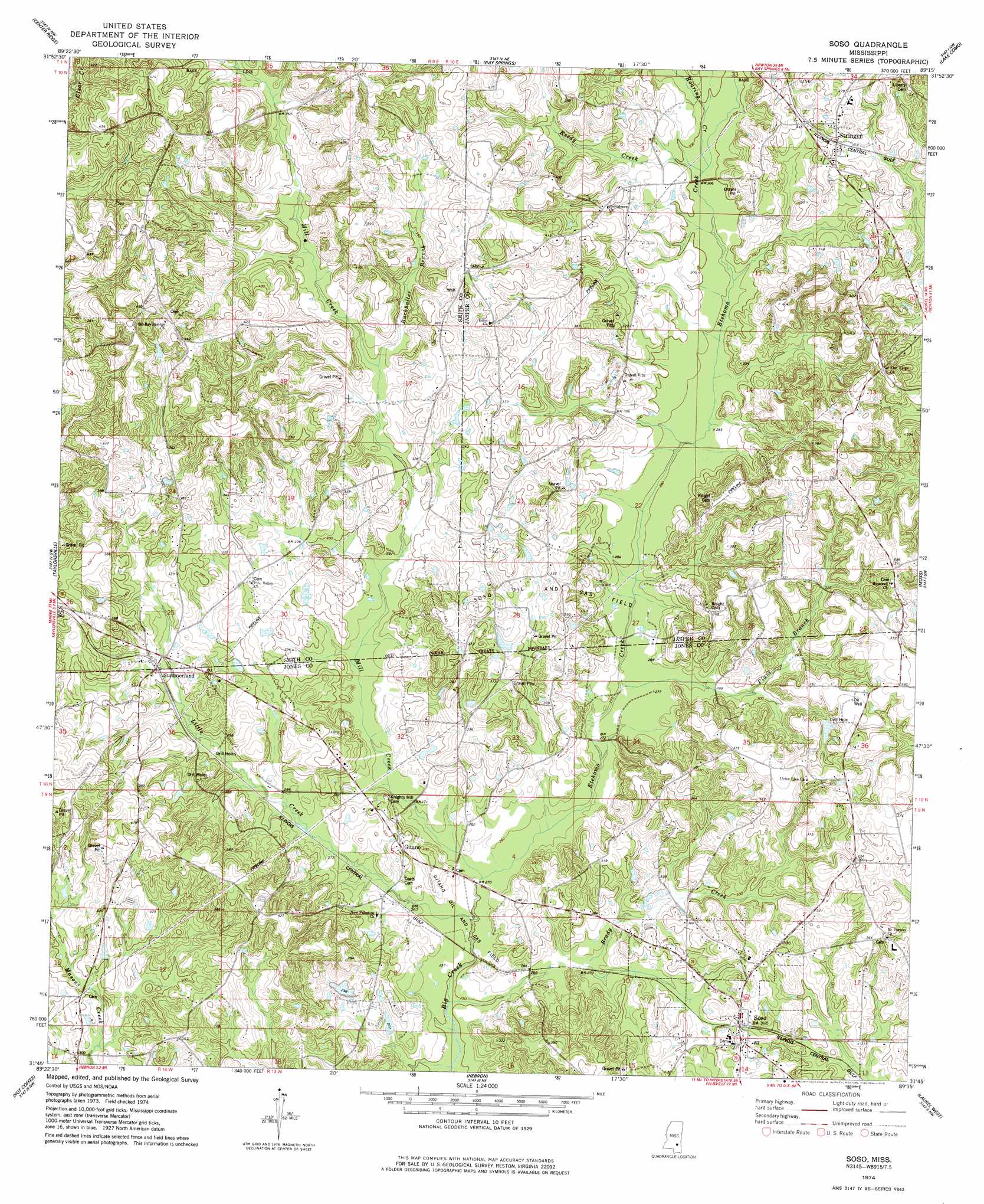
USGS Topo Quad 31089g3 - 1:24,000 scale
| Topo Map Name: | Soso |
| USGS Topo Quad ID: | 31089g3 |
| Print Size: | ca. 21 1/4" wide x 27" high |
| Southeast Coordinates: | 31.75° N latitude / 89.25° W longitude |
| Map Center Coordinates: | 31.8125° N latitude / 89.3125° W longitude |
| U.S. State: | MS |
| Filename: | o31089g3.jpg |
| Download Map JPG Image: | Soso topo map 1:24,000 scale |
| Map Type: | Topographic |
| Topo Series: | 7.5´ |
| Map Scale: | 1:24,000 |
| Source of Map Images: | United States Geological Survey (USGS) |
| Alternate Map Versions: |
Soso MS 1974, updated 1978 Download PDF Buy paper map Soso MS 2012 Download PDF Buy paper map Soso MS 2015 Download PDF Buy paper map |
1:24,000 Topo Quads surrounding Soso
Raleigh |
Louin Sw |
Louin |
Montrose South |
Paulding |
Cohay |
Center Ridge |
Bay Springs |
Lake Como |
Waldrup |
Mize |
Taylorsville |
Soso |
Moss |
Sandersville |
Collins |
Hot Coffee |
Hebron |
Laurel West |
Laurel East |
Williamsburg |
Seminary |
Moselle |
Ellisville |
Lanham |
> Back to 31089e1 at 1:100,000 scale
> Back to 31088a1 at 1:250,000 scale
> Back to U.S. Topo Maps home
Soso topo map: Gazetteer
Soso: Dams
Big Creek Structure 13 Dam elevation 90m 295′Big Creek Watershed 14 Dam elevation 104m 341′
Clarke Watkins Lake Dam elevation 95m 311′
James Hilbun Poultry Farm Pond Dam elevation 79m 259′
King Lake Dam elevation 113m 370′
Shellie Parker Lake Dam elevation 91m 298′
Soso: Lakes
Knights Mill Pond (historical) elevation 81m 265′Soso: Oilfields
Christmas Gas Pool elevation 105m 344′Gitano Oil and Gas Field elevation 78m 255′
Paluxy Oil Pool elevation 97m 318′
Rodessa Oil Pool elevation 107m 351′
Soso Oil and Gas Field elevation 97m 318′
Stanley Gas Pool elevation 100m 328′
Soso: Populated Places
Amy elevation 111m 364′Gitano elevation 93m 305′
Simpson elevation 108m 354′
Soso elevation 96m 314′
Stringer elevation 107m 351′
Summerland elevation 94m 308′
Soso: Post Offices
Stringer Post Office elevation 107m 351′Soso: Streams
Brady Creek elevation 76m 249′Buckhalter Branch elevation 96m 314′
Etehomo Creek elevation 78m 255′
Little Creek elevation 76m 249′
Mill Creek elevation 77m 252′
Plant Branch elevation 83m 272′
Reedy Creek elevation 89m 291′
Roaring Creek elevation 89m 291′
Soso digital topo map on disk
Buy this Soso topo map showing relief, roads, GPS coordinates and other geographical features, as a high-resolution digital map file on DVD:
Gulf Coast (LA, MS, AL, FL) & Southwestern Georgia
Buy digital topo maps: Gulf Coast (LA, MS, AL, FL) & Southwestern Georgia
 & Southwestern Georgia map DVD")