Dewey Lake Topo Map Texas
To zoom in, hover over the map of Dewey Lake
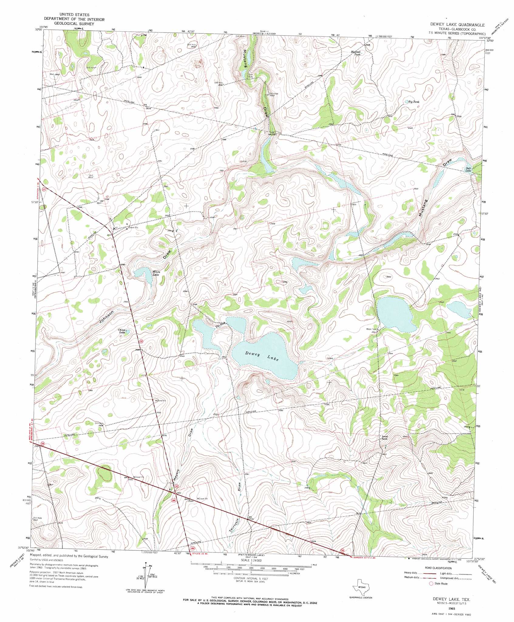
USGS Topo Quad 31101h6 - 1:24,000 scale
| Topo Map Name: | Dewey Lake |
| USGS Topo Quad ID: | 31101h6 |
| Print Size: | ca. 21 1/4" wide x 27" high |
| Southeast Coordinates: | 31.875° N latitude / 101.625° W longitude |
| Map Center Coordinates: | 31.9375° N latitude / 101.6875° W longitude |
| U.S. State: | TX |
| Filename: | o31101h6.jpg |
| Download Map JPG Image: | Dewey Lake topo map 1:24,000 scale |
| Map Type: | Topographic |
| Topo Series: | 7.5´ |
| Map Scale: | 1:24,000 |
| Source of Map Images: | United States Geological Survey (USGS) |
| Alternate Map Versions: |
Dewey Lake TX 1965, updated 1966 Download PDF Buy paper map Dewey Lake TX 2010 Download PDF Buy paper map Dewey Lake TX 2012 Download PDF Buy paper map Dewey Lake TX 2016 Download PDF Buy paper map |
1:24,000 Topo Quads surrounding Dewey Lake
Dickenson Ranch |
Stanton |
Natural Dam Lake |
Elbow |
Big Spring South |
Germania |
Stanton Se |
Houston Ranch |
Lucian Wells Ranch |
Lees |
Stephenson Lake |
Spraberry |
Dewey Lake |
Dewey Lake Ne |
Ballinger Ranch |
Salt Lake |
Pecks Lake |
Patterson Lake |
Dewey Lake Se |
Garden City |
Midkiff Nw |
Midkiff |
Bigby Corner |
Saint Lawrence |
Three Bluff Draw Nw |
> Back to 31101e1 at 1:100,000 scale
> Back to 31100a1 at 1:250,000 scale
> Back to U.S. Topo Maps home
Dewey Lake topo map: Gazetteer
Dewey Lake: Gaps
The Neck elevation 771m 2529′Dewey Lake: Lakes
China Lake elevation 781m 2562′Dewey Lake elevation 770m 2526′
Salt Lake elevation 763m 2503′
White Lake elevation 772m 2532′
Dewey Lake: Reservoirs
Big Tank elevation 783m 2568′Bluebell Tank elevation 799m 2621′
Dewey Lake: Valleys
Johnson Draw elevation 767m 2516′Meyers Draw elevation 773m 2536′
Thirtysix Draw elevation 772m 2532′
Dewey Lake digital topo map on disk
Buy this Dewey Lake topo map showing relief, roads, GPS coordinates and other geographical features, as a high-resolution digital map file on DVD: