Stuckey Boone Lake Topo Map Georgia
To zoom in, hover over the map of Stuckey Boone Lake
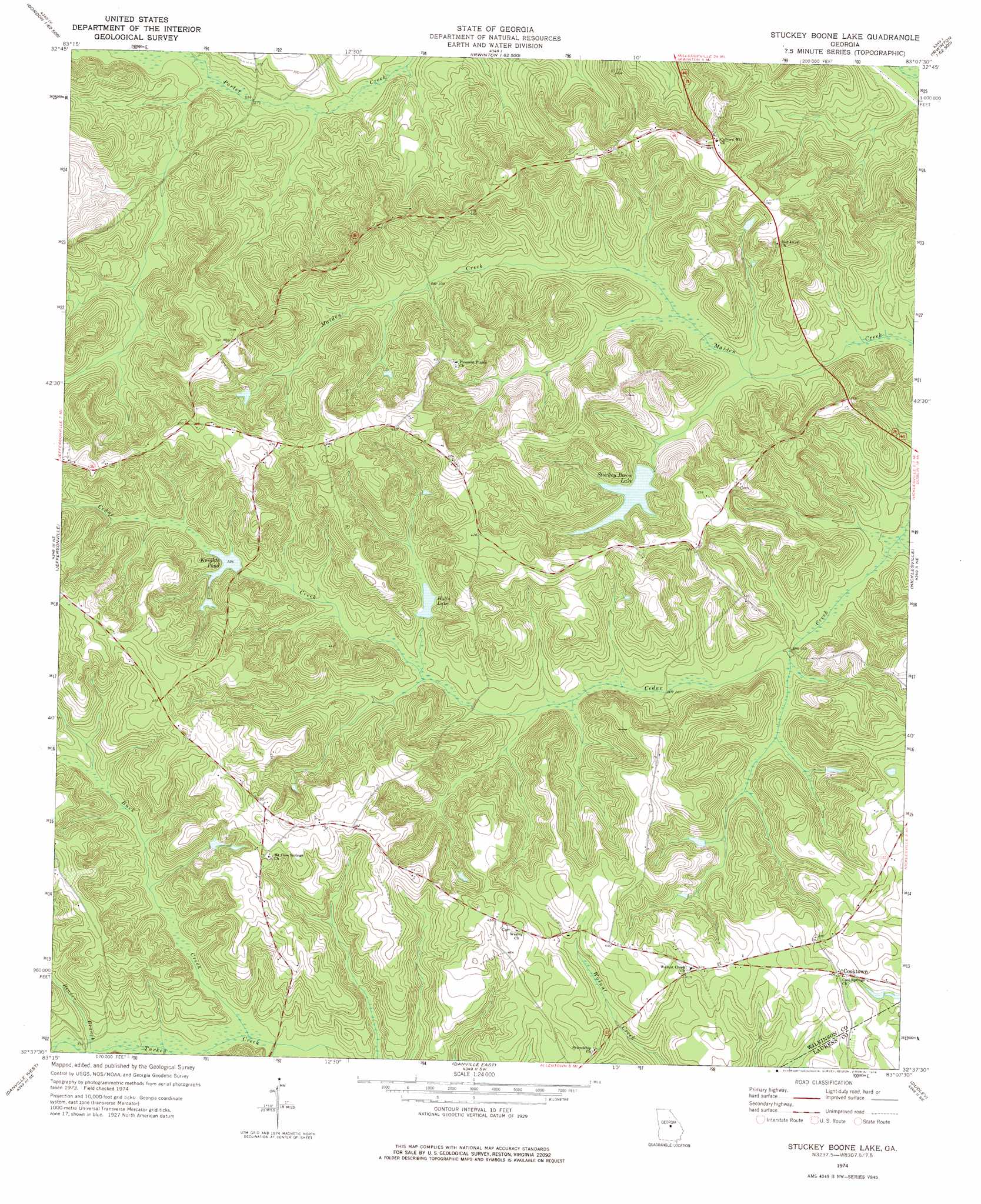
USGS Topo Quad 32083f2 - 1:24,000 scale
| Topo Map Name: | Stuckey Boone Lake |
| USGS Topo Quad ID: | 32083f2 |
| Print Size: | ca. 21 1/4" wide x 27" high |
| Southeast Coordinates: | 32.625° N latitude / 83.125° W longitude |
| Map Center Coordinates: | 32.6875° N latitude / 83.1875° W longitude |
| U.S. State: | GA |
| Filename: | o32083f2.jpg |
| Download Map JPG Image: | Stuckey Boone Lake topo map 1:24,000 scale |
| Map Type: | Topographic |
| Topo Series: | 7.5´ |
| Map Scale: | 1:24,000 |
| Source of Map Images: | United States Geological Survey (USGS) |
| Alternate Map Versions: |
Stuckey Boone Lake GA 1974, updated 1976 Download PDF Buy paper map Stuckey Boone Lake GA 2011 Download PDF Buy paper map Stuckey Boone Lake GA 2014 Download PDF Buy paper map |
1:24,000 Topo Quads surrounding Stuckey Boone Lake
James |
Gordon |
Napier Pond |
Gumm Pond |
Tabernacle |
Dry Branch |
Massey Hill |
Irwinton |
Toomsboro |
Oconee |
Marion |
Jeffersonville |
Stuckey Boone Lake |
Nicklesville |
Cow Hell Swamp |
Tarversville |
Danville West |
Danville East |
Dudley |
Dublin |
Westlake |
Cochran |
Chester |
Dexter |
Rentz |
> Back to 32083e1 at 1:100,000 scale
> Back to 32082a1 at 1:250,000 scale
> Back to U.S. Topo Maps home
Stuckey Boone Lake topo map: Gazetteer
Stuckey Boone Lake: Dams
Halls Lake Dam elevation 94m 308′Knights Pond Dam elevation 97m 318′
Stuckey Boone Lake Dam elevation 93m 305′
Stuckey Boone Lake: Populated Places
Cooktown elevation 120m 393′Stuckey Boone Lake: Reservoirs
Halls Lake elevation 94m 308′Knights Pond elevation 97m 318′
Stuckey Boone Lake elevation 93m 305′
Stuckey Boone Lake: Streams
Beaver Branch elevation 99m 324′Buck Creek elevation 96m 314′
Stuckey Boone Lake digital topo map on disk
Buy this Stuckey Boone Lake topo map showing relief, roads, GPS coordinates and other geographical features, as a high-resolution digital map file on DVD:
South Carolina, Western North Carolina & Northeastern Georgia
Buy digital topo maps: South Carolina, Western North Carolina & Northeastern Georgia