Danville East Topo Map Georgia
To zoom in, hover over the map of Danville East
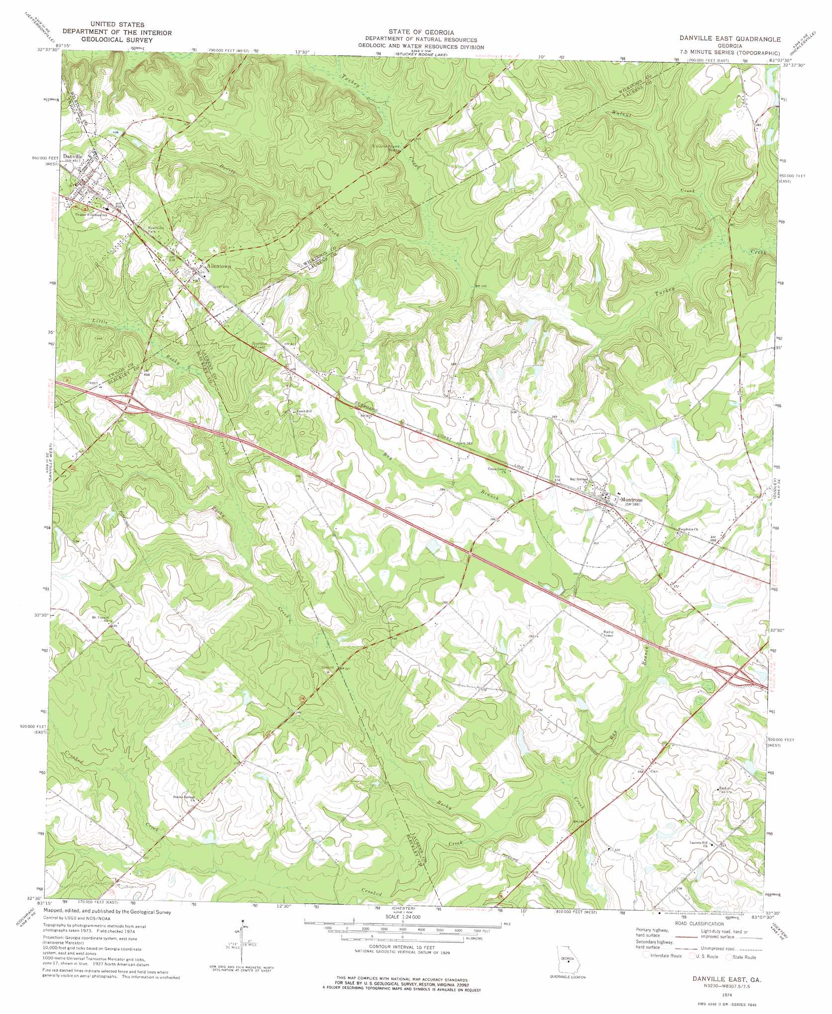
USGS Topo Quad 32083e2 - 1:24,000 scale
| Topo Map Name: | Danville East |
| USGS Topo Quad ID: | 32083e2 |
| Print Size: | ca. 21 1/4" wide x 27" high |
| Southeast Coordinates: | 32.5° N latitude / 83.125° W longitude |
| Map Center Coordinates: | 32.5625° N latitude / 83.1875° W longitude |
| U.S. State: | GA |
| Filename: | o32083e2.jpg |
| Download Map JPG Image: | Danville East topo map 1:24,000 scale |
| Map Type: | Topographic |
| Topo Series: | 7.5´ |
| Map Scale: | 1:24,000 |
| Source of Map Images: | United States Geological Survey (USGS) |
| Alternate Map Versions: |
Danville East GA 1974, updated 1976 Download PDF Buy paper map Danville East GA 2011 Download PDF Buy paper map Danville East GA 2014 Download PDF Buy paper map |
1:24,000 Topo Quads surrounding Danville East
Dry Branch |
Massey Hill |
Irwinton |
Toomsboro |
Oconee |
Marion |
Jeffersonville |
Stuckey Boone Lake |
Nicklesville |
Cow Hell Swamp |
Tarversville |
Danville West |
Danville East |
Dudley |
Dublin |
Westlake |
Cochran |
Chester |
Dexter |
Rentz |
Hawkinsville |
Empire |
Yonkers |
Cadwell |
Five Points |
> Back to 32083e1 at 1:100,000 scale
> Back to 32082a1 at 1:250,000 scale
> Back to U.S. Topo Maps home
Danville East topo map: Gazetteer
Danville East: Bridges
E Cuyler Adams Bridge elevation 91m 298′Danville East: Crossings
Exit 10 elevation 128m 419′Exit 11 elevation 116m 380′
Danville East: Dams
Harrison Lake Dam elevation 90m 295′Morris Lake Dam elevation 87m 285′
Danville East: Populated Places
Allentown elevation 131m 429′Danville elevation 137m 449′
Laurens Hill elevation 109m 357′
Montrose elevation 117m 383′
Danville East: Post Offices
Allentown Post Office elevation 131m 429′Danville Post Office elevation 137m 449′
Danville East: Reservoirs
Harrison Lake elevation 90m 295′Morris Lake elevation 87m 285′
Danville East: Streams
Bay Branch elevation 83m 272′Crooked Creek elevation 86m 282′
Devils Branch elevation 88m 288′
Little Rocky Creek elevation 98m 321′
Walnut Creek elevation 81m 265′
Danville East digital topo map on disk
Buy this Danville East topo map showing relief, roads, GPS coordinates and other geographical features, as a high-resolution digital map file on DVD:
South Carolina, Western North Carolina & Northeastern Georgia
Buy digital topo maps: South Carolina, Western North Carolina & Northeastern Georgia