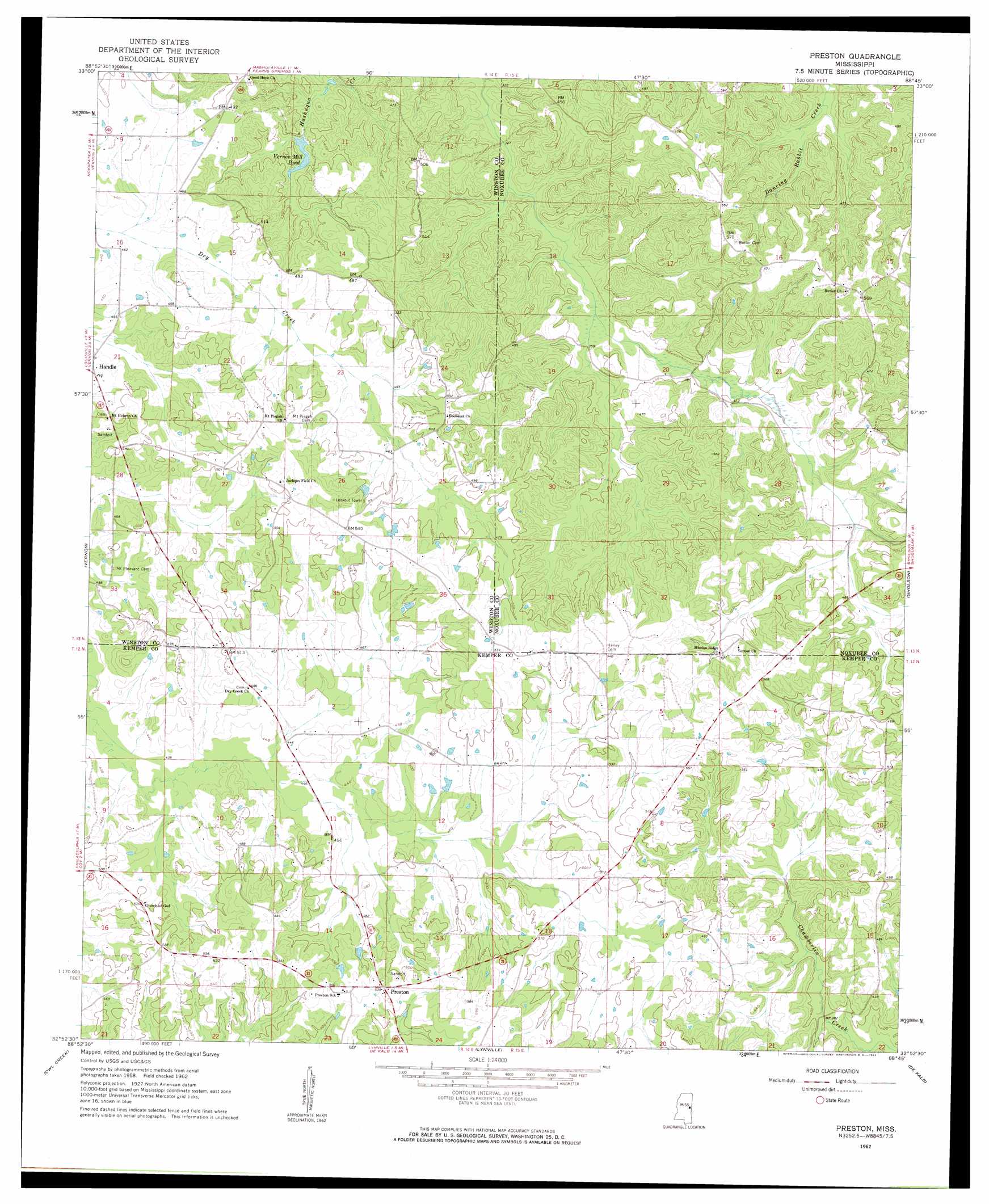
Preston Topo Map Mississippi
To zoom in, hover over the map of Preston
USGS Topo Quad 32088h7 - 1:24,000 scale
| Topo Map Name: | Preston |
| USGS Topo Quad ID: | 32088h7 |
| Print Size: | ca. 21 1/4" wide x 27" high |
| Southeast Coordinates: | 32.875° N latitude / 88.75° W longitude |
| Map Center Coordinates: | 32.9375° N latitude / 88.8125° W longitude |
| U.S. State: | MS |
| Filename: | o32088h7.jpg |
| Download Map JPG Image: | Preston topo map 1:24,000 scale |
| Map Type: | Topographic |
| Topo Series: | 7.5´ |
| Map Scale: | 1:24,000 |
| Source of Map Images: | United States Geological Survey (USGS) |
| Alternate Map Versions: |
Preston MS 1962, updated 1963 Download PDF Buy paper map Preston MS 1962, updated 1982 Download PDF Buy paper map Preston MS 2012 Download PDF Buy paper map Preston MS 2015 Download PDF Buy paper map |
1:24,000 Topo Quads surrounding Preston
Louisville North |
Betheden |
Barge Lake |
Lynn Creek |
Brooksville |
Louisville South |
Boon |
Fearns Springs |
Mashulaville |
Macon |
Noxapater |
Vernon |
Preston |
Gholson |
Shuqualak |
Philadelphia |
Owl Creek |
Lynville |
De Kalb |
Townsend |
Deemer |
House |
Moscow |
Lauderdale Nw |
Oak Grove |
> Back to 32088e1 at 1:100,000 scale
> Back to 32088a1 at 1:250,000 scale
> Back to U.S. Topo Maps home
Preston topo map: Gazetteer
Preston: Dams
Boys Ranch Lake Dam elevation 123m 403′Mill Lake Dam elevation 114m 374′
Preston: Lakes
Vernon Mill Pond elevation 114m 374′Preston: Populated Places
Handle elevation 142m 465′Hashuqua (historical) elevation 140m 459′
Preston elevation 164m 538′
Preston: Post Offices
Preston Post Office elevation 163m 534′Preston digital topo map on disk
Buy this Preston topo map showing relief, roads, GPS coordinates and other geographical features, as a high-resolution digital map file on DVD:
Gulf Coast (LA, MS, AL, FL) & Southwestern Georgia
Buy digital topo maps: Gulf Coast (LA, MS, AL, FL) & Southwestern Georgia
 & Southwestern Georgia map DVD")