Riverton Topo Map Louisiana
To zoom in, hover over the map of Riverton
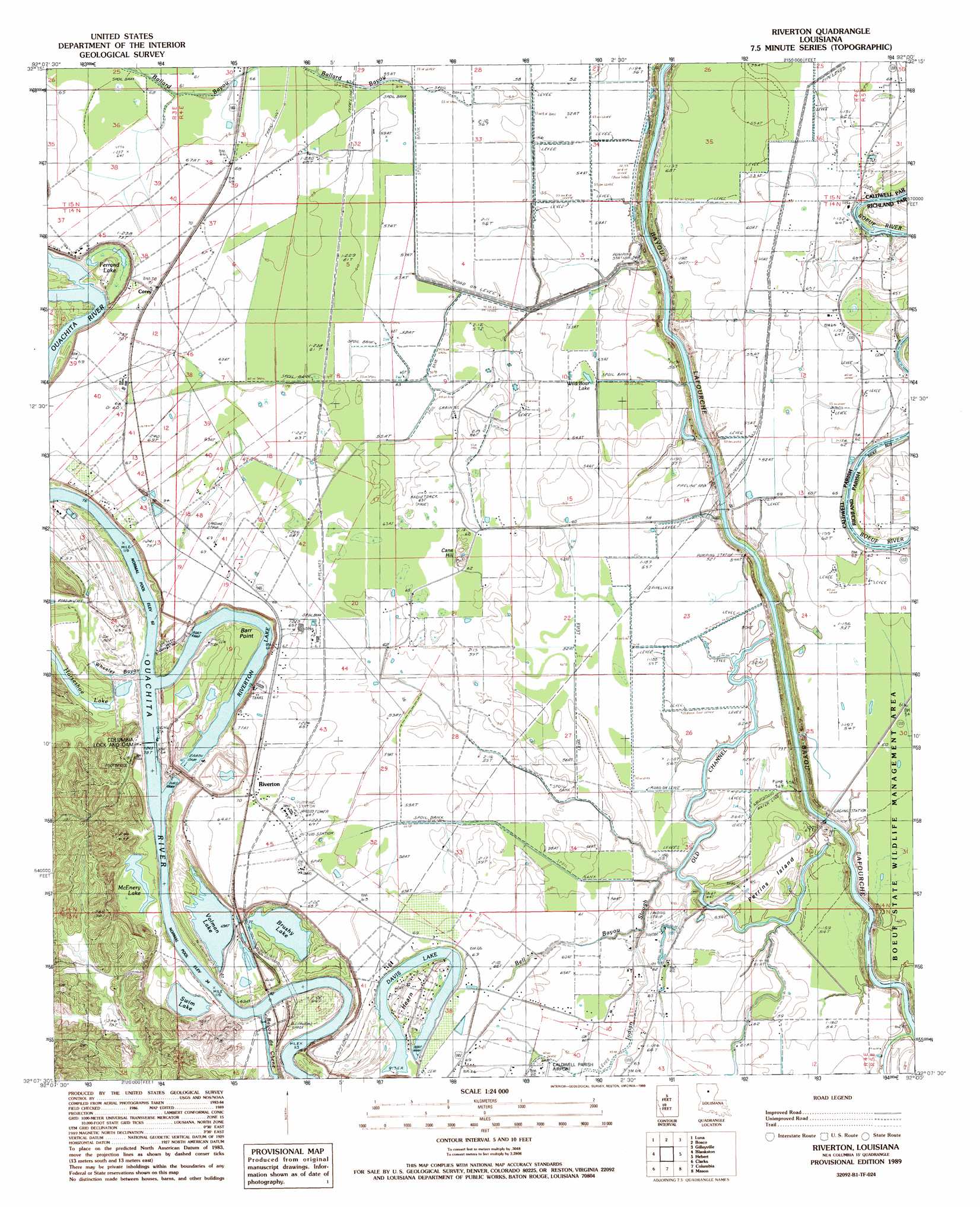
USGS Topo Quad 32092b1 - 1:24,000 scale
| Topo Map Name: | Riverton |
| USGS Topo Quad ID: | 32092b1 |
| Print Size: | ca. 21 1/4" wide x 27" high |
| Southeast Coordinates: | 32.125° N latitude / 92° W longitude |
| Map Center Coordinates: | 32.1875° N latitude / 92.0625° W longitude |
| U.S. State: | LA |
| Filename: | o32092b1.jpg |
| Download Map JPG Image: | Riverton topo map 1:24,000 scale |
| Map Type: | Topographic |
| Topo Series: | 7.5´ |
| Map Scale: | 1:24,000 |
| Source of Map Images: | United States Geological Survey (USGS) |
| Alternate Map Versions: |
Riverton LA 1989, updated 1989 Download PDF Buy paper map Riverton LA 2012 Download PDF Buy paper map Riverton LA 2015 Download PDF Buy paper map |
1:24,000 Topo Quads surrounding Riverton
Cadeville |
West Monroe South |
Monroe South |
Crew Lake |
Rayville |
Chatham Se |
Luna |
Bosco |
Gilleyville |
Mangham |
Vixen |
Blankston |
Riverton |
Hebert |
Liddieville |
Cotton Plant |
Clark |
Columbia |
Mason |
Fort Necessity |
Fords Creek |
Olla East |
Holum |
Enterprise |
Extension |
> Back to 32092a1 at 1:100,000 scale
> Back to 32092a1 at 1:250,000 scale
> Back to U.S. Topo Maps home
Riverton topo map: Gazetteer
Riverton: Airports
Kenneys Airstrip elevation 18m 59′Riverton: Capes
Barr Point elevation 16m 52′Riverton: Dams
Brushy Lake Dam elevation 14m 45′Columbia Closure Dam elevation 16m 52′
Columbia Lock and Dam elevation 39m 127′
Lock and Dam Number Three (historical) elevation 16m 52′
Riverton: Guts
Bell Bayou elevation 20m 65′Indian Slough elevation 16m 52′
Old Channel Bayou Lafourche elevation 15m 49′
Wheeler Bayou elevation 18m 59′
Riverton: Islands
Hearn Island elevation 21m 68′Perrins Island elevation 20m 65′
Riverton: Lakes
Brushy Lake elevation 14m 45′Davis Lake elevation 17m 55′
Eagle Lake (historical) elevation 18m 59′
Ferrand Lake elevation 17m 55′
Horseshoe Lake elevation 17m 55′
McEnery Lake elevation 18m 59′
Riverton Lake elevation 10m 32′
Swim Lake elevation 14m 45′
Volman Lake elevation 14m 45′
Wild Boar Lake elevation 16m 52′
Riverton: Oilfields
Cane Hill Gas Field elevation 18m 59′Riverton: Populated Places
Corey elevation 21m 68′Riverton elevation 21m 68′
Riverton: Streams
Ballard Bayou elevation 15m 49′Bayou deChene elevation 16m 52′
Riverton: Summits
Cane Hill elevation 20m 65′Riverton digital topo map on disk
Buy this Riverton topo map showing relief, roads, GPS coordinates and other geographical features, as a high-resolution digital map file on DVD: