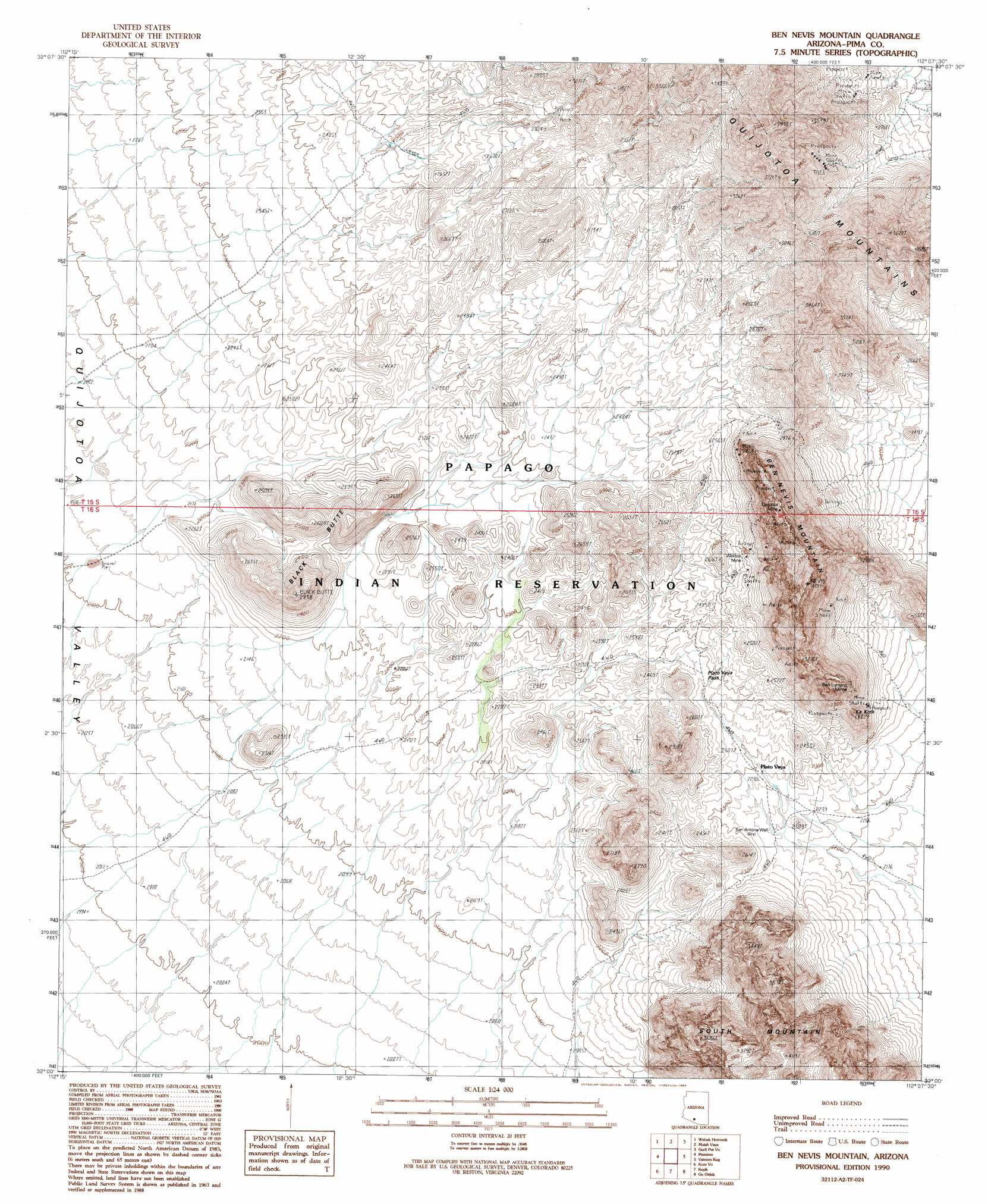
Ben Nevis Mountain Topo Map Arizona
To zoom in, hover over the map of Ben Nevis Mountain
USGS Topo Quad 32112a2 - 1:24,000 scale
| Topo Map Name: | Ben Nevis Mountain |
| USGS Topo Quad ID: | 32112a2 |
| Print Size: | ca. 21 1/4" wide x 27" high |
| Southeast Coordinates: | 32° N latitude / 112.125° W longitude |
| Map Center Coordinates: | 32.0625° N latitude / 112.1875° W longitude |
| U.S. State: | AZ |
| Filename: | o32112a2.jpg |
| Download Map JPG Image: | Ben Nevis Mountain topo map 1:24,000 scale |
| Map Type: | Topographic |
| Topo Series: | 7.5´ |
| Map Scale: | 1:24,000 |
| Source of Map Images: | United States Geological Survey (USGS) |
| Alternate Map Versions: |
Ben Nevis Mountain AZ 1990, updated 1990 Download PDF Buy paper map Ben Nevis Mountain AZ 1996, updated 2001 Download PDF Buy paper map Ben Nevis Mountain AZ 2011 Download PDF Buy paper map Ben Nevis Mountain AZ 2014 Download PDF Buy paper map |
1:24,000 Topo Quads surrounding Ben Nevis Mountain
Hickiwan |
Vaya Chin |
Window Mountain |
Gu Achi |
Santa Rosa Mountains Sw |
West Of Wahak Hotrontk |
Wahak Hotrontk |
Maish Vaya |
Gurli Put Vo |
Sand Wells |
West Of Pisinimo |
Pisinimo |
Ben Nevis Mountain |
Vainom Kug |
Ko Vaya |
Chupan Mountain |
Kom Vo |
Kupk |
Gu Oidak |
Sells West |
Bailey Peak |
Papago Farms |
Kots Kug Ranch |
Chukut Kuk |
Cowlic |
> Back to 32112a1 at 1:100,000 scale
> Back to 32112a1 at 1:250,000 scale
> Back to U.S. Topo Maps home
Ben Nevis Mountain topo map: Gazetteer
Ben Nevis Mountain: Gaps
Piato Vaya Pass elevation 730m 2395′Ben Nevis Mountain: Mines
Ben Lomond Mines elevation 902m 2959′Quijotoa Mine elevation 1163m 3815′
Weldon Mine elevation 802m 2631′
Ben Nevis Mountain: Populated Places
Piato Vaya elevation 730m 2395′Ben Nevis Mountain: Summits
Ben Nevis Mountain elevation 1046m 3431′Black Butte elevation 861m 2824′
Ka Kotk elevation 797m 2614′
Quijotoa Mountains elevation 1166m 3825′
Ben Nevis Mountain: Wells
San Antone Well elevation 0m 0′Ben Nevis Mountain digital topo map on disk
Buy this Ben Nevis Mountain topo map showing relief, roads, GPS coordinates and other geographical features, as a high-resolution digital map file on DVD: