Vainom Kug Topo Map Arizona
To zoom in, hover over the map of Vainom Kug
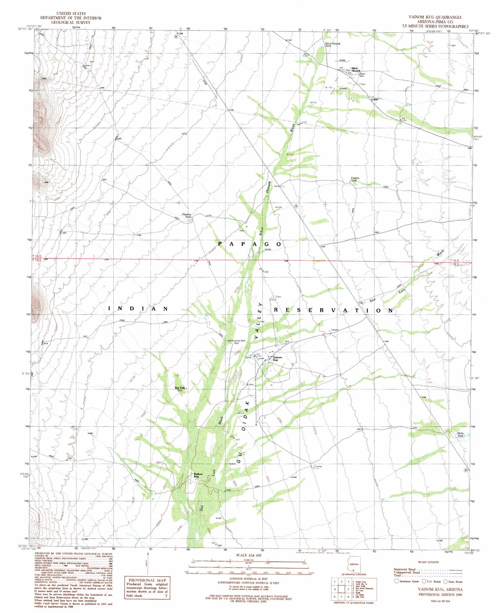
USGS Topo Quad 32112a1 - 1:24,000 scale
| Topo Map Name: | Vainom Kug |
| USGS Topo Quad ID: | 32112a1 |
| Print Size: | ca. 21 1/4" wide x 27" high |
| Southeast Coordinates: | 32° N latitude / 112° W longitude |
| Map Center Coordinates: | 32.0625° N latitude / 112.0625° W longitude |
| U.S. State: | AZ |
| Filename: | o32112a1.jpg |
| Download Map JPG Image: | Vainom Kug topo map 1:24,000 scale |
| Map Type: | Topographic |
| Topo Series: | 7.5´ |
| Map Scale: | 1:24,000 |
| Source of Map Images: | United States Geological Survey (USGS) |
| Alternate Map Versions: |
Vainom Kug AZ 1990, updated 1990 Download PDF Buy paper map Vainom Kug AZ 1996, updated 2002 Download PDF Buy paper map Vainom Kug AZ 2011 Download PDF Buy paper map Vainom Kug AZ 2014 Download PDF Buy paper map |
1:24,000 Topo Quads surrounding Vainom Kug
Vaya Chin |
Window Mountain |
Gu Achi |
Santa Rosa Mountains Sw |
Santa Rosa Mountains Se |
Wahak Hotrontk |
Maish Vaya |
Gurli Put Vo |
Sand Wells |
Sil Nakya |
Pisinimo |
Ben Nevis Mountain |
Vainom Kug |
Ko Vaya |
Comobabi |
Kom Vo |
Kupk |
Gu Oidak |
Sells West |
Sells East |
Papago Farms |
Kots Kug Ranch |
Chukut Kuk |
Cowlic |
Topawa |
> Back to 32112a1 at 1:100,000 scale
> Back to 32112a1 at 1:250,000 scale
> Back to U.S. Topo Maps home
Vainom Kug topo map: Gazetteer
Vainom Kug: Areas
Papagueria elevation 759m 2490′Pimeria Alta elevation 758m 2486′
Vainom Kug: Populated Places
Kaihon Kug elevation 610m 2001′Kui Tatk elevation 623m 2043′
Sikul Himatk elevation 0m 0′
Vainom Kug elevation 629m 2063′
Vainom Kug: Reservoirs
Francis Tank elevation 661m 2168′Havana Tank elevation 653m 2142′
Nolia Tank elevation 669m 2194′
Sikul Himatk Tank elevation 0m 0′
Vainom Kug: Streams
Sikul Himatk Wash elevation 0m 0′Vainom Kug: Wells
Old Quijotoa Well elevation 626m 2053′Vainom Kug digital topo map on disk
Buy this Vainom Kug topo map showing relief, roads, GPS coordinates and other geographical features, as a high-resolution digital map file on DVD: