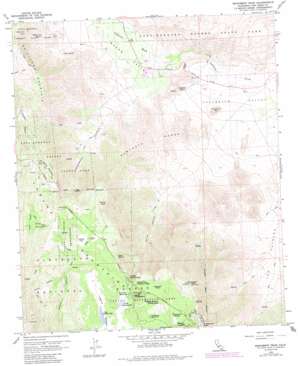
Monument Peak Topo Map California
To zoom in, hover over the map of Monument Peak
USGS Topo Quad 32116h4 - 1:24,000 scale
| Topo Map Name: | Monument Peak |
| USGS Topo Quad ID: | 32116h4 |
| Print Size: | ca. 21 1/4" wide x 27" high |
| Southeast Coordinates: | 32.875° N latitude / 116.375° W longitude |
| Map Center Coordinates: | 32.9375° N latitude / 116.4375° W longitude |
| U.S. State: | CA |
| Filename: | o32116h4.jpg |
| Download Map JPG Image: | Monument Peak topo map 1:24,000 scale |
| Map Type: | Topographic |
| Topo Series: | 7.5´ |
| Map Scale: | 1:24,000 |
| Source of Map Images: | United States Geological Survey (USGS) |
| Alternate Map Versions: |
Monument Peak CA 1959, updated 1961 Download PDF Buy paper map Monument Peak CA 1959, updated 1965 Download PDF Buy paper map Monument Peak CA 1959, updated 1980 Download PDF Buy paper map Monument Peak CA 1959, updated 1985 Download PDF Buy paper map Monument Peak CA 1959, updated 1988 Download PDF Buy paper map Monument Peak CA 1959, updated 1995 Download PDF Buy paper map Monument Peak CA 1997, updated 2000 Download PDF Buy paper map Monument Peak CA 2012 Download PDF Buy paper map Monument Peak CA 2015 Download PDF Buy paper map |
| FStopo: | US Forest Service topo Monument Peak is available: Download FStopo PDF Download FStopo TIF |
1:24,000 Topo Quads surrounding Monument Peak
> Back to 32116e1 at 1:100,000 scale
> Back to 32116a1 at 1:250,000 scale
> Back to U.S. Topo Maps home
Monument Peak topo map: Gazetteer
Monument Peak: Airports
Rancho Vallecito Airport elevation 517m 1696′Monument Peak: Flats
El Prado Meadow elevation 1678m 5505′Filaree Flat elevation 1618m 5308′
Flathead Flats elevation 1732m 5682′
Indian Potrero elevation 1705m 5593′
Laguna Meadow elevation 1666m 5465′
The Potrero elevation 673m 2208′
Monument Peak: Lakes
Big Laguna Lake elevation 1652m 5419′Little Laguna Lake elevation 1671m 5482′
Monument Peak: Mines
Noble Mine elevation 1455m 4773′Sundown Mine elevation 1624m 5328′
Monument Peak: Ranges
Sawtooth Range elevation 842m 2762′Monument Peak: Reservoirs
Chula Vista Reservoir elevation 1765m 5790′Los Huecos Reservoir elevation 1758m 5767′
Monument Peak: Ridges
Oriflamme Mountain elevation 1467m 4812′Monument Peak: Slopes
Campbell Grade elevation 590m 1935′Monument Peak: Springs
Oasis Spring elevation 1560m 5118′Pepper Tree Spring elevation 857m 2811′
Taylor Spring elevation 779m 2555′
Monument Peak: Streams
Lucas Creek elevation 1535m 5036′Salt Creek elevation 596m 1955′
Monument Peak: Summits
Garnet Mountain elevation 1731m 5679′Garnet Peak elevation 1705m 5593′
Monument Peak elevation 1904m 6246′
Pine Mountain elevation 1722m 5649′
Stephenson Peak elevation 1889m 6197′
Troutman Mountain elevation 609m 1998′
Monument Peak: Trails
Garnet Peak Trail elevation 1734m 5688′Witches Broom Trail elevation 1658m 5439′
Monument Peak: Valleys
Boiling Spring Ravine elevation 1662m 5452′Cottonwood Canyon elevation 674m 2211′
Mason Valley elevation 608m 1994′
Storm Canyon elevation 648m 2125′
Monument Peak digital topo map on disk
Buy this Monument Peak topo map showing relief, roads, GPS coordinates and other geographical features, as a high-resolution digital map file on DVD:


