Montgomery Topo Map Mississippi
To zoom in, hover over the map of Montgomery
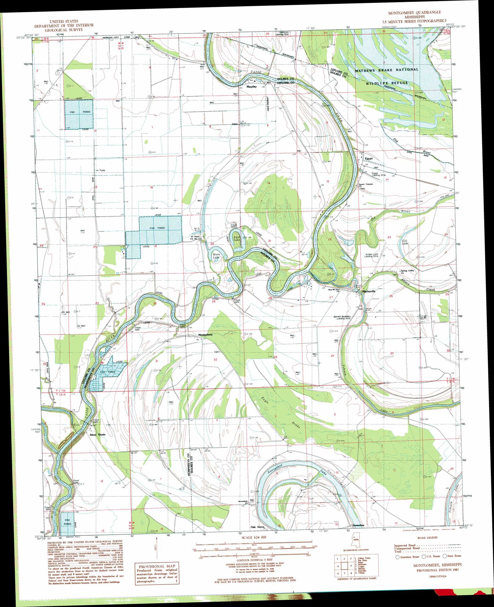
USGS Topo Quad 33090c3 - 1:24,000 scale
| Topo Map Name: | Montgomery |
| USGS Topo Quad ID: | 33090c3 |
| Print Size: | ca. 21 1/4" wide x 27" high |
| Southeast Coordinates: | 33.25° N latitude / 90.25° W longitude |
| Map Center Coordinates: | 33.3125° N latitude / 90.3125° W longitude |
| U.S. State: | MS |
| Filename: | o33090c3.jpg |
| Download Map JPG Image: | Montgomery topo map 1:24,000 scale |
| Map Type: | Topographic |
| Topo Series: | 7.5´ |
| Map Scale: | 1:24,000 |
| Source of Map Images: | United States Geological Survey (USGS) |
| Alternate Map Versions: |
Montgomery MS 1983, updated 1984 Download PDF Buy paper map Montgomery MS 2012 Download PDF Buy paper map Montgomery MS 2015 Download PDF Buy paper map |
1:24,000 Topo Quads surrounding Montgomery
Sunflower |
Bear Gut Bayou |
Shellmound |
Greenwood |
Browning |
Moorhead |
Colony Town |
Itta Bena |
Sidon |
Gravel Hill |
Inverness |
Swiftown |
Montgomery |
Cruger |
Black Hawk |
Bellewood |
Belzoni |
Marcella |
Tchula |
Lexington North |
Midnight |
Silver City |
Thornton |
Howard |
Lexington South |
> Back to 33090a1 at 1:100,000 scale
> Back to 33090a1 at 1:250,000 scale
> Back to U.S. Topo Maps home
Montgomery topo map: Gazetteer
Montgomery: Bends
Marksville B Cut-Off elevation 30m 98′Silent Shade Cut-Off elevation 32m 104′
Montgomery: Channels
Yazoo River Cutoff elevation 29m 95′Montgomery: Crossings
Markhams Ferry (historical) elevation 30m 98′McAffees Ferry (historical) elevation 33m 108′
Montgomery: Dams
Eldrin Fondren Ponds Dam elevation 33m 108′Joe Long Ponds Dam elevation 35m 114′
Montgomery: Lakes
Dent Lake elevation 33m 108′Eagle Lake (historical) elevation 35m 114′
East Lake elevation 33m 108′
Gill Lake elevation 37m 121′
Moon Lake elevation 33m 108′
Montgomery: Populated Places
Egypt elevation 36m 118′Horseshoe elevation 37m 121′
Marksville elevation 37m 121′
Mayday elevation 37m 121′
Montgomery elevation 35m 114′
Oak Grove elevation 37m 121′
Montgomery: Streams
Abiaca Creek elevation 35m 114′Old River elevation 32m 104′
Montgomery: Swamps
Eagle Brake elevation 35m 114′Montgomery digital topo map on disk
Buy this Montgomery topo map showing relief, roads, GPS coordinates and other geographical features, as a high-resolution digital map file on DVD: