Winchester Topo Map Arkansas
To zoom in, hover over the map of Winchester
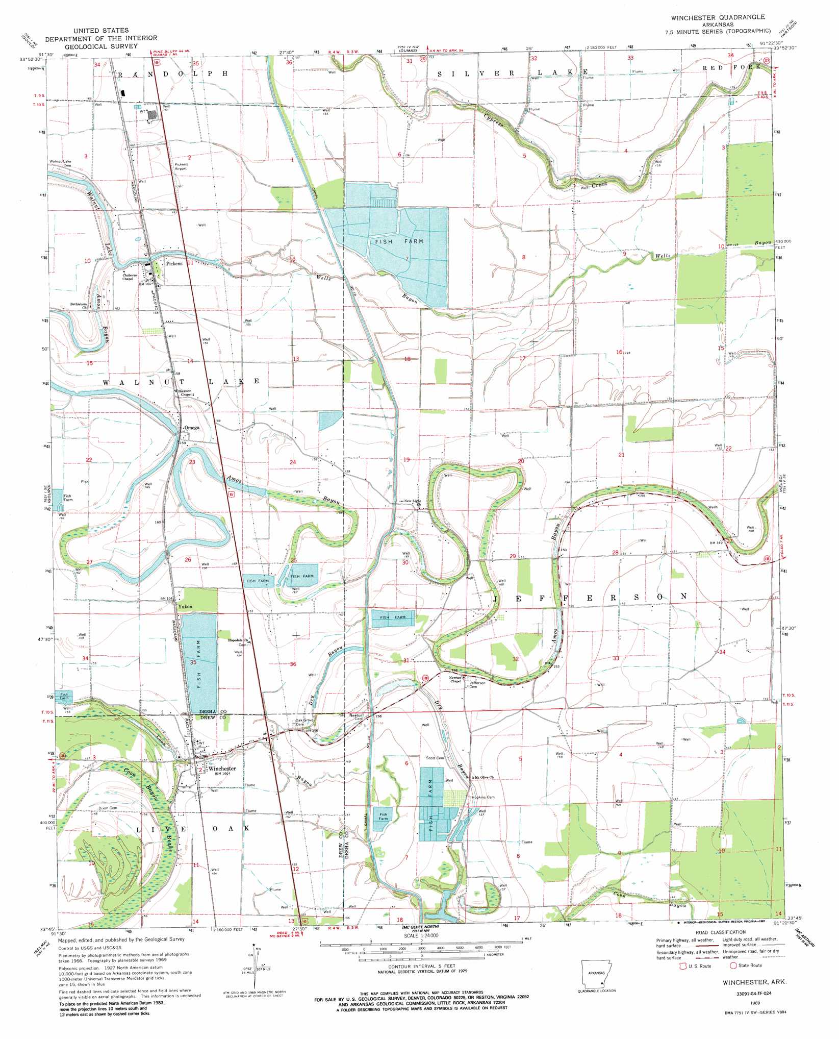
USGS Topo Quad 33091g4 - 1:24,000 scale
| Topo Map Name: | Winchester |
| USGS Topo Quad ID: | 33091g4 |
| Print Size: | ca. 21 1/4" wide x 27" high |
| Southeast Coordinates: | 33.75° N latitude / 91.375° W longitude |
| Map Center Coordinates: | 33.8125° N latitude / 91.4375° W longitude |
| U.S. State: | AR |
| Filename: | o33091g4.jpg |
| Download Map JPG Image: | Winchester topo map 1:24,000 scale |
| Map Type: | Topographic |
| Topo Series: | 7.5´ |
| Map Scale: | 1:24,000 |
| Source of Map Images: | United States Geological Survey (USGS) |
| Alternate Map Versions: |
Winchester AR 1969, updated 1971 Download PDF Buy paper map Winchester AR 1969, updated 1987 Download PDF Buy paper map Winchester AR 2011 Download PDF Buy paper map Winchester AR 2014 Download PDF Buy paper map |
1:24,000 Topo Quads surrounding Winchester
Grady |
Cades |
Gillett |
Arkansas Post |
Henrico Sw |
Avery |
Gould |
Dumas |
Watson |
Yancopin |
Tyro |
Gourd |
Winchester |
Kelso |
Lake Cheatham |
Collins Nw |
Selma |
Mcgehee North |
Mcarthur |
Catfish Point |
Cominto |
Collins |
Mcgehee South |
Halley |
Arkansas City |
> Back to 33091e1 at 1:100,000 scale
> Back to 33090a1 at 1:250,000 scale
> Back to U.S. Topo Maps home
Winchester topo map: Gazetteer
Winchester: Airports
Pickens Airport elevation 49m 160′Winchester: Canals
Canal Number 19 elevation 45m 147′Winchester: Dams
Walnut Lake Dam elevation 48m 157′Winchester: Guts
Amos Bayou elevation 49m 160′Coon Bayou elevation 43m 141′
Dry Bayou elevation 44m 144′
Winchester: Lakes
Walnut Lake elevation 48m 157′Winchester: Populated Places
Hopedale (historical) elevation 47m 154′Omega elevation 51m 167′
Pickens elevation 50m 164′
Winchester elevation 46m 150′
Yukon elevation 48m 157′
Winchester: Swamps
Coon Bayou Brake elevation 44m 144′Winchester digital topo map on disk
Buy this Winchester topo map showing relief, roads, GPS coordinates and other geographical features, as a high-resolution digital map file on DVD: