Collins Nw Topo Map Arkansas
To zoom in, hover over the map of Collins Nw
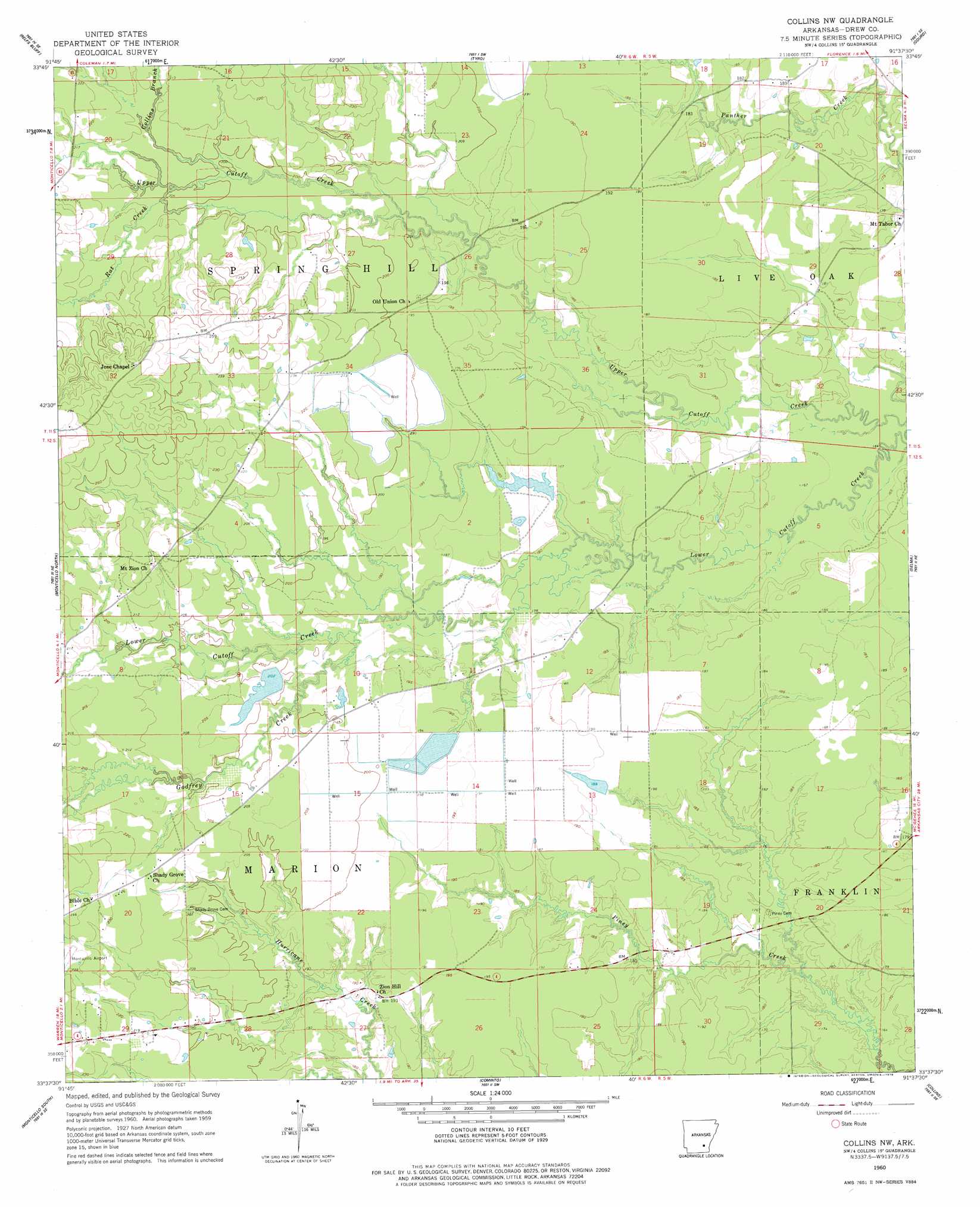
USGS Topo Quad 33091f6 - 1:24,000 scale
| Topo Map Name: | Collins Nw |
| USGS Topo Quad ID: | 33091f6 |
| Print Size: | ca. 21 1/4" wide x 27" high |
| Southeast Coordinates: | 33.625° N latitude / 91.625° W longitude |
| Map Center Coordinates: | 33.6875° N latitude / 91.6875° W longitude |
| U.S. State: | AR |
| Filename: | o33091f6.jpg |
| Download Map JPG Image: | Collins Nw topo map 1:24,000 scale |
| Map Type: | Topographic |
| Topo Series: | 7.5´ |
| Map Scale: | 1:24,000 |
| Source of Map Images: | United States Geological Survey (USGS) |
| Alternate Map Versions: |
Collins NW AR 1960, updated 1961 Download PDF Buy paper map Collins NW AR 1960, updated 1978 Download PDF Buy paper map Collins NW AR 2011 Download PDF Buy paper map Collins NW AR 2014 Download PDF Buy paper map |
1:24,000 Topo Quads surrounding Collins Nw
Glendale |
Star City |
Avery |
Gould |
Dumas |
Cornerville |
Relfs Bluff |
Tyro |
Gourd |
Winchester |
Wilmar North |
Monticello North |
Collins Nw |
Selma |
Mcgehee North |
Wilmar South |
Monticello South |
Cominto |
Collins |
Mcgehee South |
Longview |
Ladelle |
Mist Nw |
Line |
Jerome |
> Back to 33091e1 at 1:100,000 scale
> Back to 33090a1 at 1:250,000 scale
> Back to U.S. Topo Maps home
Collins Nw topo map: Gazetteer
Collins Nw: Areas
Brush Prairie elevation 61m 200′Cooper Prairie elevation 64m 209′
Tiffin Prairie elevation 59m 193′
Collins Nw: Dams
Byrd Lake Dam elevation 57m 187′Collins Nw: Populated Places
Old Piney (historical) elevation 54m 177′Old Union (historical) elevation 59m 193′
Collins Nw: Reservoirs
Byrd Lake elevation 57m 187′Collins Nw: Streams
Collins Branch elevation 61m 200′Godfrey Creek elevation 59m 193′
Rat Creek elevation 62m 203′
Collins Nw digital topo map on disk
Buy this Collins Nw topo map showing relief, roads, GPS coordinates and other geographical features, as a high-resolution digital map file on DVD: