Throckmorton Topo Map Texas
To zoom in, hover over the map of Throckmorton
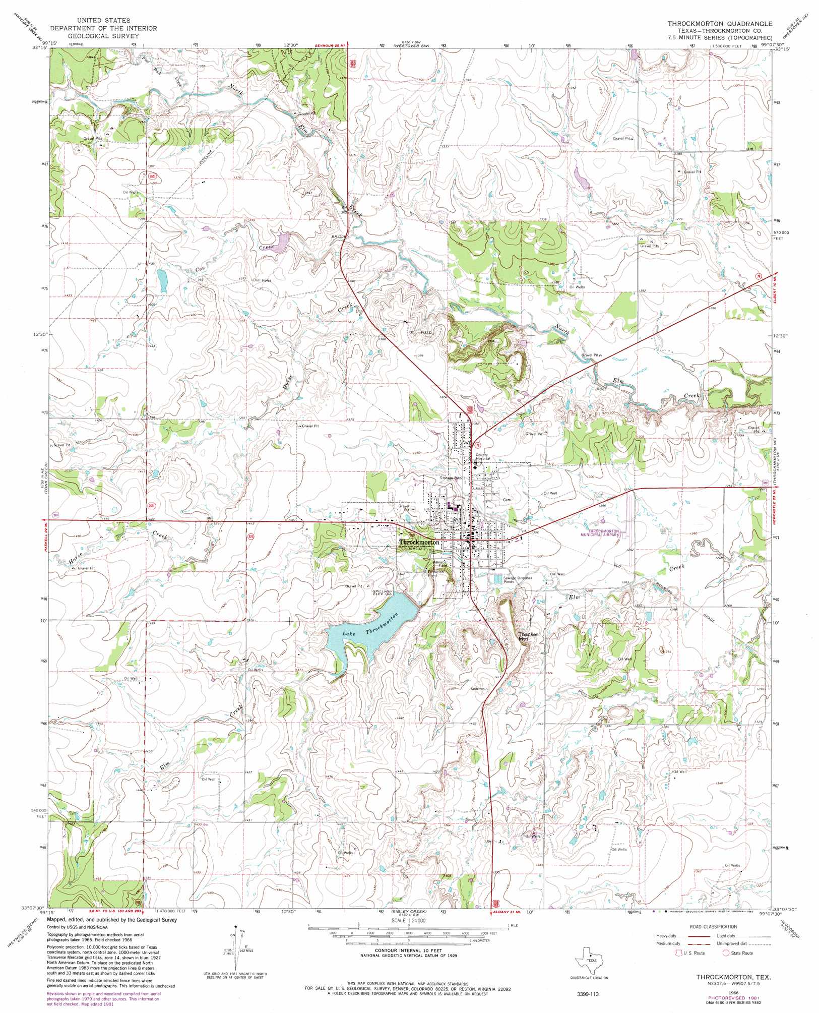
USGS Topo Quad 33099b2 - 1:24,000 scale
| Topo Map Name: | Throckmorton |
| USGS Topo Quad ID: | 33099b2 |
| Print Size: | ca. 21 1/4" wide x 27" high |
| Southeast Coordinates: | 33.125° N latitude / 99.125° W longitude |
| Map Center Coordinates: | 33.1875° N latitude / 99.1875° W longitude |
| U.S. State: | TX |
| Filename: | o33099b2.jpg |
| Download Map JPG Image: | Throckmorton topo map 1:24,000 scale |
| Map Type: | Topographic |
| Topo Series: | 7.5´ |
| Map Scale: | 1:24,000 |
| Source of Map Images: | United States Geological Survey (USGS) |
| Alternate Map Versions: |
Throckmorton TX 1966, updated 1969 Download PDF Buy paper map Throckmorton TX 1966, updated 1982 Download PDF Buy paper map Throckmorton TX 2010 Download PDF Buy paper map Throckmorton TX 2013 Download PDF Buy paper map Throckmorton TX 2016 Download PDF Buy paper map |
1:24,000 Topo Quads surrounding Throckmorton
Antelope Creek Nw |
Antelope Creek Ne |
Rock Canyon |
Westover |
Megargel |
Antelope Creek Sw |
Antelope Creek Se |
Westover Sw |
Westover Se |
Padgett |
Reynolds Bend Nw |
Tonk Creek |
Throckmorton |
Throckmorton Ne |
Proffitt Crossing |
Hoover Mountain |
Reynolds Bend |
Sibley Creek |
Woodson |
Murray |
Antelope Hills |
Collins Creek |
Fort Griffin |
Lusk |
Crystal Falls |
> Back to 33099a1 at 1:100,000 scale
> Back to 33098a1 at 1:250,000 scale
> Back to U.S. Topo Maps home
Throckmorton topo map: Gazetteer
Throckmorton: Airports
Throckmorton Municipal Airport elevation 389m 1276′Throckmorton: Dams
Brown Lake Dam elevation 412m 1351′Lake Throckmorton Dam elevation 401m 1315′
Patterson Lake Number 1 Dam elevation 402m 1318′
Patterson Lake Number 2 Dam elevation 407m 1335′
Throckmorton: Populated Places
Throckmorton elevation 402m 1318′Throckmorton: Reservoirs
Brown Lake elevation 412m 1351′Lake Throckmorton elevation 410m 1345′
Patterson Lake Number 1 elevation 402m 1318′
Patterson Lake Number 2 elevation 407m 1335′
Throckmorton: Streams
Cow Creek elevation 393m 1289′Flat Rock Creek elevation 403m 1322′
Horse Creek elevation 390m 1279′
Throckmorton: Summits
Thacker Mountain elevation 425m 1394′Throckmorton digital topo map on disk
Buy this Throckmorton topo map showing relief, roads, GPS coordinates and other geographical features, as a high-resolution digital map file on DVD: