A B C Creek Topo Map Texas
To zoom in, hover over the map of A B C Creek
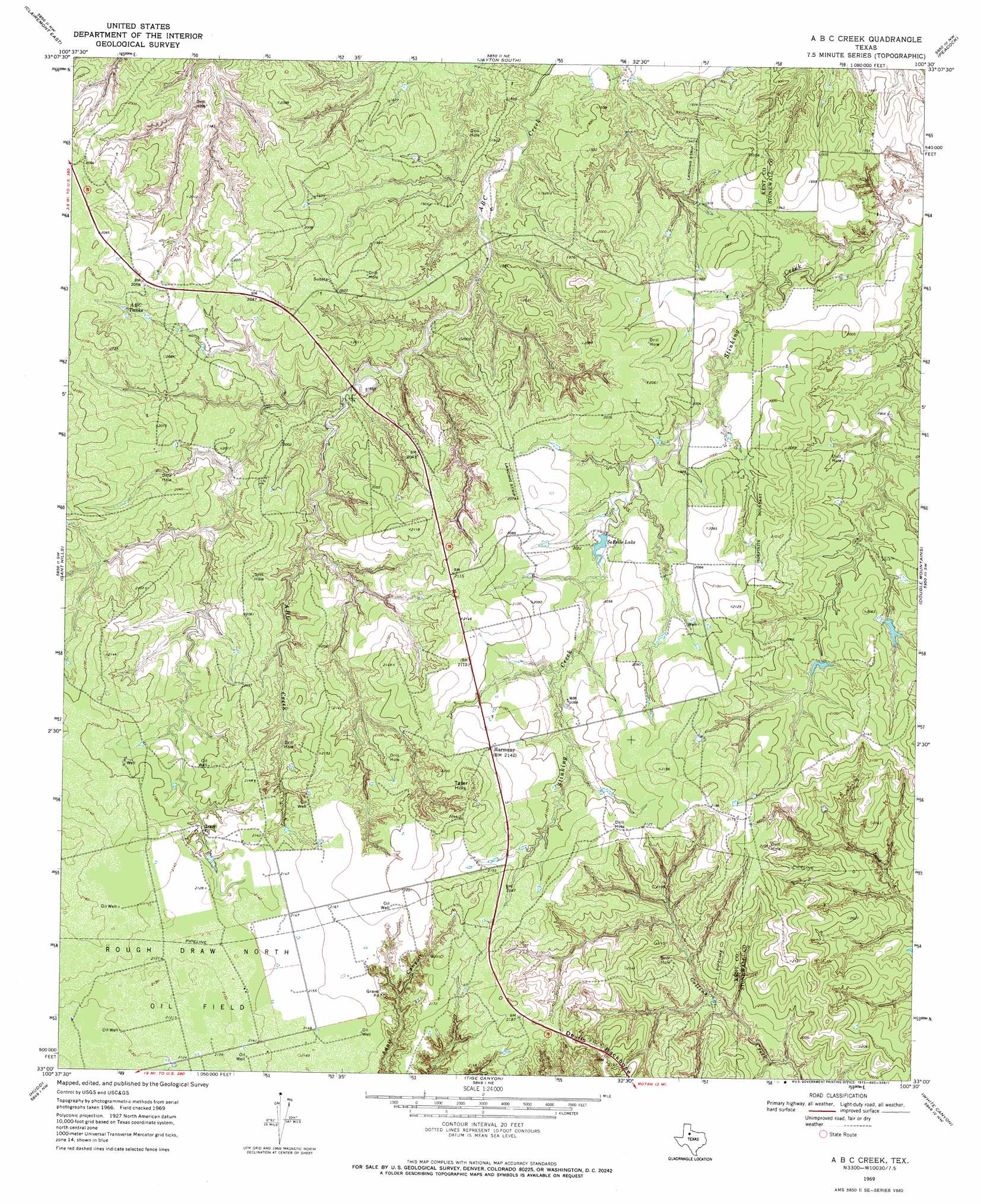
USGS Topo Quad 33100a5 - 1:24,000 scale
| Topo Map Name: | A B C Creek |
| USGS Topo Quad ID: | 33100a5 |
| Print Size: | ca. 21 1/4" wide x 27" high |
| Southeast Coordinates: | 33° N latitude / 100.5° W longitude |
| Map Center Coordinates: | 33.0625° N latitude / 100.5625° W longitude |
| U.S. State: | TX |
| Filename: | o33100a5.jpg |
| Download Map JPG Image: | A B C Creek topo map 1:24,000 scale |
| Map Type: | Topographic |
| Topo Series: | 7.5´ |
| Map Scale: | 1:24,000 |
| Source of Map Images: | United States Geological Survey (USGS) |
| Alternate Map Versions: |
A B C Creek TX 1969, updated 1972 Download PDF Buy paper map A B C Creek TX 2010 Download PDF Buy paper map A B C Creek TX 2012 Download PDF Buy paper map A B C Creek TX 2016 Download PDF Buy paper map |
1:24,000 Topo Quads surrounding A B C Creek
White Camp |
Girard |
Jayton North |
Seven Diamond L Canyon |
Lovers Resort |
Clairemont West |
Clairemont East |
Jayton South |
Peacock |
Swenson |
Cooper Mountain |
Gant Hills |
A B C Creek |
Double Mountains |
Coon Hollow |
Maverick Creek |
Hudd |
Tige Canyon |
White Canyon |
Poke Mountain |
Lloyd Mountain |
Camp Springs |
Hobbs |
Rotan |
Royston |
> Back to 33100a1 at 1:100,000 scale
> Back to 33100a1 at 1:250,000 scale
> Back to U.S. Topo Maps home
A B C Creek topo map: Gazetteer
A B C Creek: Dams
So Relle Lake Dam elevation 614m 2014′A B C Creek: Oilfields
Rough Draw North Oil Field elevation 649m 2129′A B C Creek: Populated Places
Harmony elevation 652m 2139′A B C Creek: Reservoirs
ABC Tanks elevation 622m 2040′So Relle Lake elevation 614m 2014′
SoRelle Lake elevation 616m 2020′
A B C Creek: Ridges
Devils Backbone elevation 644m 2112′A B C Creek: Summits
Tater Hills elevation 682m 2237′A B C Creek digital topo map on disk
Buy this A B C Creek topo map showing relief, roads, GPS coordinates and other geographical features, as a high-resolution digital map file on DVD: