Gila Butte Se Topo Map Arizona
To zoom in, hover over the map of Gila Butte Se
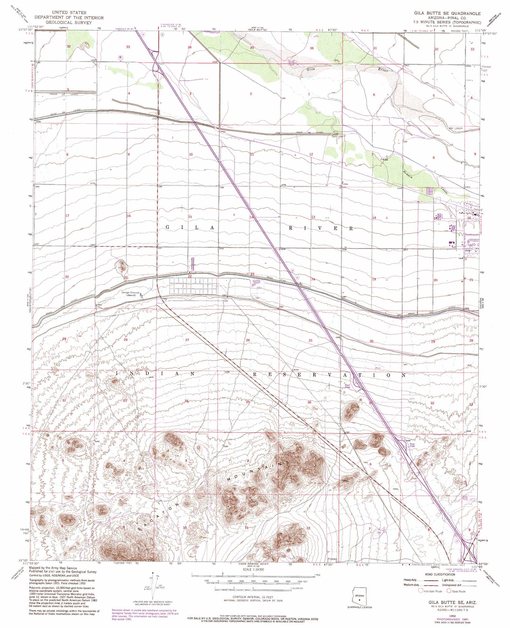
USGS Topo Quad 33111a7 - 1:24,000 scale
| Topo Map Name: | Gila Butte Se |
| USGS Topo Quad ID: | 33111a7 |
| Print Size: | ca. 21 1/4" wide x 27" high |
| Southeast Coordinates: | 33° N latitude / 111.75° W longitude |
| Map Center Coordinates: | 33.0625° N latitude / 111.8125° W longitude |
| U.S. State: | AZ |
| Filename: | o33111a7.jpg |
| Download Map JPG Image: | Gila Butte Se topo map 1:24,000 scale |
| Map Type: | Topographic |
| Topo Series: | 7.5´ |
| Map Scale: | 1:24,000 |
| Source of Map Images: | United States Geological Survey (USGS) |
| Alternate Map Versions: |
Gila Butte SE AZ 1952, updated 1957 Download PDF Buy paper map Gila Butte SE AZ 1952, updated 1968 Download PDF Buy paper map Gila Butte SE AZ 1952, updated 1982 Download PDF Buy paper map Gila Butte SE AZ 1971, updated 1972 Download PDF Buy paper map Gila Butte SE AZ 2011 Download PDF Buy paper map Gila Butte SE AZ 2014 Download PDF Buy paper map |
1:24,000 Topo Quads surrounding Gila Butte Se
Lone Butte |
Guadalupe |
Chandler |
Higley |
Desert Well |
Pima Butte |
Gila Butte Nw |
Gila Butte |
Chandler Heights |
Sacaton Ne |
Maricopa |
Sacaton Butte |
Gila Butte Se |
Sacaton |
Blackwater |
Antelope Peak Ne |
Stanfield |
Casa Grande West |
Casa Crande East |
Coolidge |
Indian Butte |
Double Peak |
Chuichu |
Casa Grande Mountains |
Eloy North |
> Back to 33111a1 at 1:100,000 scale
> Back to 33110a1 at 1:250,000 scale
> Back to U.S. Topo Maps home
Gila Butte Se topo map: Gazetteer
Gila Butte Se: Crossings
Casa Blanca Interchange elevation 373m 1223′Interchange 175 elevation 372m 1220′
Gila Butte Se: Populated Places
Burns elevation 481m 1578′Gila Butte Se: Summits
Sacaton Mountains elevation 569m 1866′Gila Butte Se digital topo map on disk
Buy this Gila Butte Se topo map showing relief, roads, GPS coordinates and other geographical features, as a high-resolution digital map file on DVD: