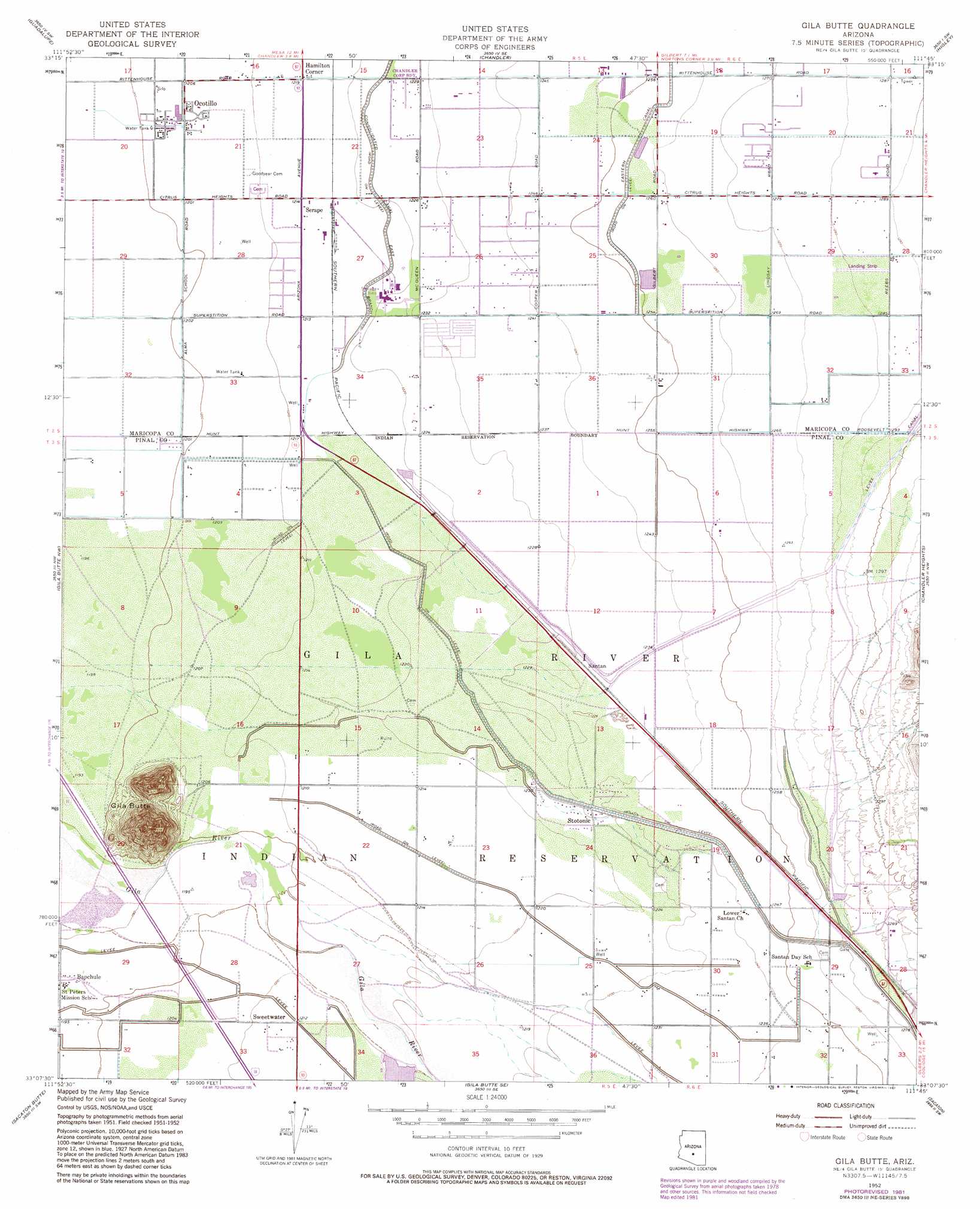
Gila Butte Topo Map Arizona
To zoom in, hover over the map of Gila Butte
USGS Topo Quad 33111b7 - 1:24,000 scale
| Topo Map Name: | Gila Butte |
| USGS Topo Quad ID: | 33111b7 |
| Print Size: | ca. 21 1/4" wide x 27" high |
| Southeast Coordinates: | 33.125° N latitude / 111.75° W longitude |
| Map Center Coordinates: | 33.1875° N latitude / 111.8125° W longitude |
| U.S. State: | AZ |
| Filename: | o33111b7.jpg |
| Download Map JPG Image: | Gila Butte topo map 1:24,000 scale |
| Map Type: | Topographic |
| Topo Series: | 7.5´ |
| Map Scale: | 1:24,000 |
| Source of Map Images: | United States Geological Survey (USGS) |
| Alternate Map Versions: |
Gila Butte AZ 1952, updated 1957 Download PDF Buy paper map Gila Butte AZ 1952, updated 1962 Download PDF Buy paper map Gila Butte AZ 1952, updated 1968 Download PDF Buy paper map Gila Butte AZ 1971, updated 1972 Download PDF Buy paper map Gila Butte AZ 2011 Download PDF Buy paper map Gila Butte AZ 2014 Download PDF Buy paper map |
1:24,000 Topo Quads surrounding Gila Butte
Phoenix |
Tempe |
Mesa |
Buckhorn |
Apache Junction |
Lone Butte |
Guadalupe |
Chandler |
Higley |
Desert Well |
Pima Butte |
Gila Butte Nw |
Gila Butte |
Chandler Heights |
Sacaton Ne |
Maricopa |
Sacaton Butte |
Gila Butte Se |
Sacaton |
Blackwater |
Antelope Peak Ne |
Stanfield |
Casa Grande West |
Casa Crande East |
Coolidge |
> Back to 33111a1 at 1:100,000 scale
> Back to 33110a1 at 1:250,000 scale
> Back to U.S. Topo Maps home
Gila Butte topo map: Gazetteer
Gila Butte: Airports
Jeppesen Ranch Heliport elevation 367m 1204′Gila Butte: Populated Places
Bapchule elevation 365m 1197′Hamilton Corner elevation 371m 1217′
Ocotillo elevation 368m 1207′
Santan elevation 376m 1233′
Serape elevation 371m 1217′
Stotonic elevation 375m 1230′
Sweetwater elevation 369m 1210′
Gila Butte: Summits
Gila Butte elevation 490m 1607′Gila Butte digital topo map on disk
Buy this Gila Butte topo map showing relief, roads, GPS coordinates and other geographical features, as a high-resolution digital map file on DVD: