Poyen Topo Map Arkansas
To zoom in, hover over the map of Poyen
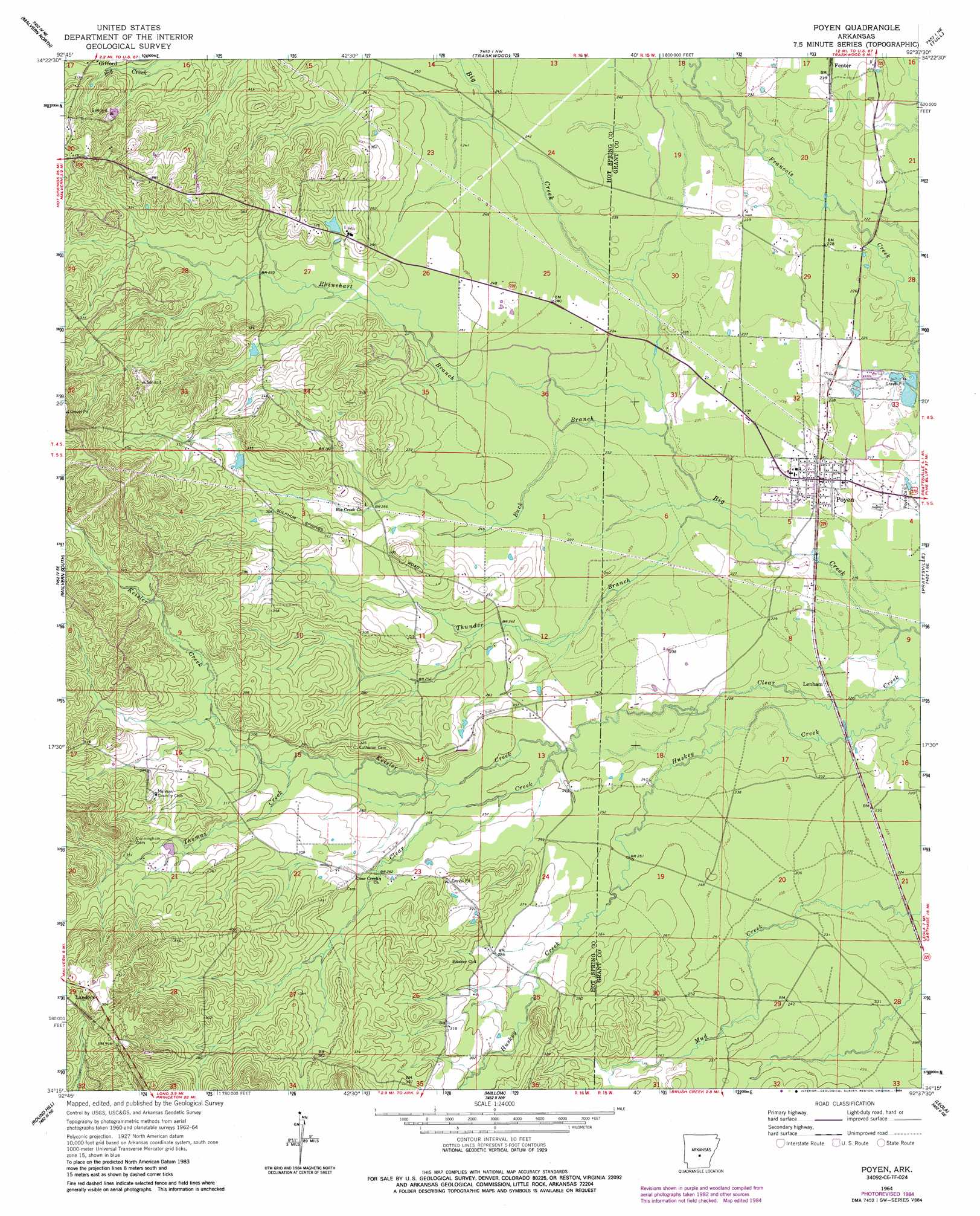
USGS Topo Quad 34092c6 - 1:24,000 scale
| Topo Map Name: | Poyen |
| USGS Topo Quad ID: | 34092c6 |
| Print Size: | ca. 21 1/4" wide x 27" high |
| Southeast Coordinates: | 34.25° N latitude / 92.625° W longitude |
| Map Center Coordinates: | 34.3125° N latitude / 92.6875° W longitude |
| U.S. State: | AR |
| Filename: | o34092c6.jpg |
| Download Map JPG Image: | Poyen topo map 1:24,000 scale |
| Map Type: | Topographic |
| Topo Series: | 7.5´ |
| Map Scale: | 1:24,000 |
| Source of Map Images: | United States Geological Survey (USGS) |
| Alternate Map Versions: |
Poyen AR 1964, updated 1964 Download PDF Buy paper map Poyen AR 1964, updated 1983 Download PDF Buy paper map Poyen AR 1964, updated 1984 Download PDF Buy paper map Poyen AR 2011 Download PDF Buy paper map Poyen AR 2014 Download PDF Buy paper map |
1:24,000 Topo Quads surrounding Poyen
Fountain Lake |
Lonsdale |
Haskell |
Benton |
Bryant |
Lake Catherine |
Malvern North |
Traskwood |
Tull |
Belfast |
Social Hill |
Malvern South |
Poyen |
Prattsville |
Sheridan |
Donaldson |
Round Hill |
Willow |
Leola |
Millerville |
Dalark |
Manning |
Tulip |
Carthage |
Bunn |
> Back to 34092a1 at 1:100,000 scale
> Back to 34092a1 at 1:250,000 scale
> Back to U.S. Topo Maps home
Poyen topo map: Gazetteer
Poyen: Dams
Arkansas Noname 27 Dam elevation 88m 288′Poyen: Populated Places
Lenham elevation 69m 226′McLean (historical) elevation 70m 229′
Poyen elevation 72m 236′
Poyen: Streams
Buck Branch elevation 69m 226′Clear Creek elevation 66m 216′
Keisler Creek elevation 75m 246′
Rhinehart Branch elevation 70m 229′
Thomas Creek elevation 89m 291′
Thunder Branch elevation 67m 219′
Poyen digital topo map on disk
Buy this Poyen topo map showing relief, roads, GPS coordinates and other geographical features, as a high-resolution digital map file on DVD: