Manitou Topo Map Oklahoma
To zoom in, hover over the map of Manitou
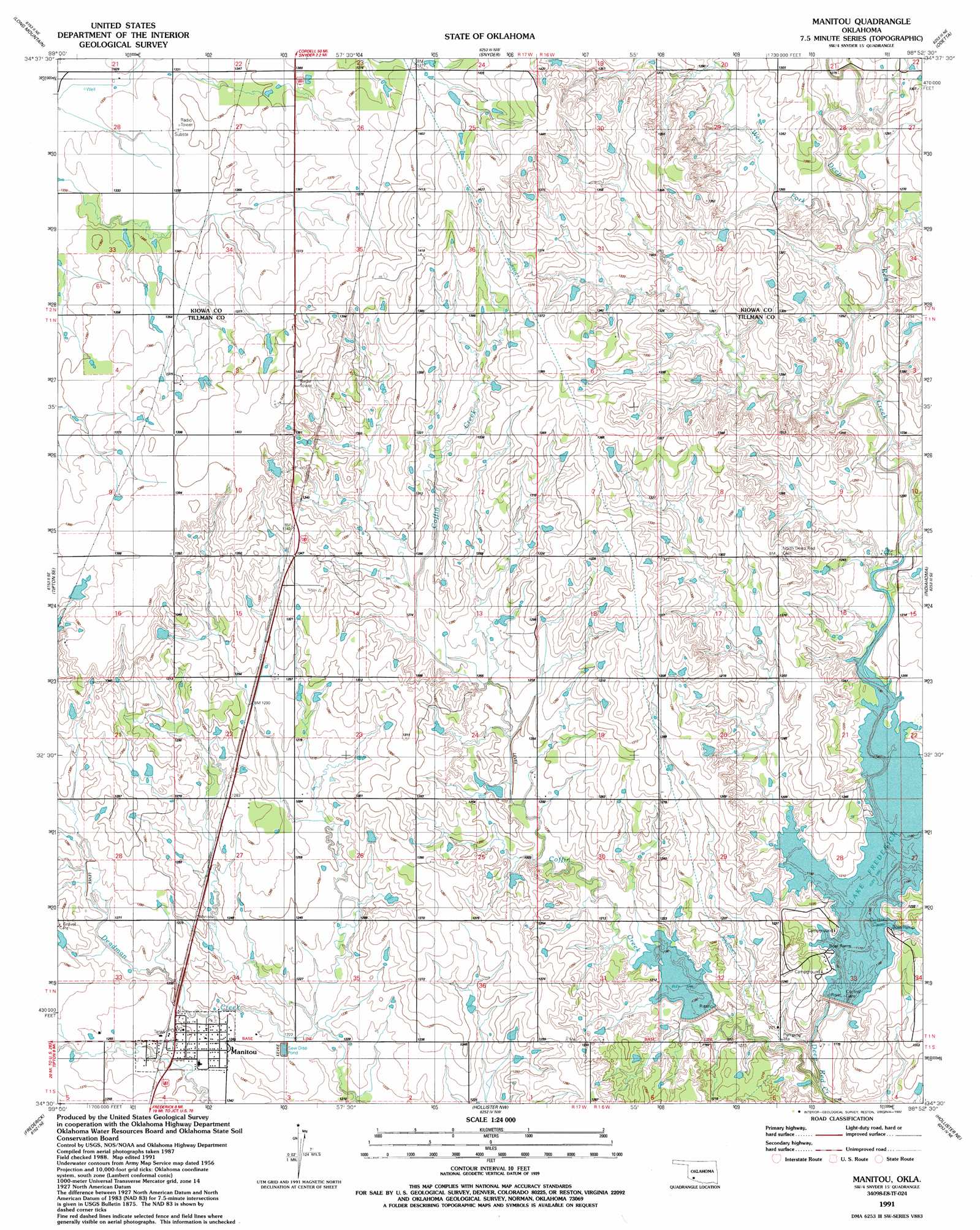
USGS Topo Quad 34098e8 - 1:24,000 scale
| Topo Map Name: | Manitou |
| USGS Topo Quad ID: | 34098e8 |
| Print Size: | ca. 21 1/4" wide x 27" high |
| Southeast Coordinates: | 34.5° N latitude / 98.875° W longitude |
| Map Center Coordinates: | 34.5625° N latitude / 98.9375° W longitude |
| U.S. State: | OK |
| Filename: | o34098e8.jpg |
| Download Map JPG Image: | Manitou topo map 1:24,000 scale |
| Map Type: | Topographic |
| Topo Series: | 7.5´ |
| Map Scale: | 1:24,000 |
| Source of Map Images: | United States Geological Survey (USGS) |
| Alternate Map Versions: |
Manitou OK 1956, updated 1959 Download PDF Buy paper map Manitou OK 1991, updated 1992 Download PDF Buy paper map Manitou OK 2010 Download PDF Buy paper map Manitou OK 2012 Download PDF Buy paper map Manitou OK 2016 Download PDF Buy paper map |
1:24,000 Topo Quads surrounding Manitou
Warren |
Roosevelt |
Glen Mountains |
Cooperton |
Saddle Mountain |
Headrick |
Long Mountain |
Snyder |
Odetta |
Quanah Mountain |
Tipton |
Tipton Se |
Manitou |
Indiahoma |
Post Oak Creek |
Frederick Nw |
Frederick |
Hollister Nw |
Hollister Ne |
Chattanooga |
Frederick Sw |
Frederick Se |
Hackberry Flat |
Hollister |
Chattanooga Sw |
> Back to 34098e1 at 1:100,000 scale
> Back to 34098a1 at 1:250,000 scale
> Back to U.S. Topo Maps home
Manitou topo map: Gazetteer
Manitou: Bays
Curtis Cove elevation 370m 1213′Manitou: Dams
Deep Red Run-Coffin Creek Site 1 Dam elevation 367m 1204′Deep Red Run-Coffin Creek Site 2 Dam elevation 358m 1174′
Oknoname 075012 Dam elevation 410m 1345′
Oknoname 141004 Dam elevation 415m 1361′
Oknoname 141005 Dam elevation 409m 1341′
Oknoname 141007 Dam elevation 393m 1289′
Oknoname 141019 Dam elevation 374m 1227′
Manitou: Populated Places
Manitou elevation 382m 1253′Manitou: Reservoirs
Deep Red Run-Coffin Creek Site 1 Reservoir elevation 367m 1204′Deep Red Run-Coffin Creek Site 2 Reservoir elevation 358m 1174′
Lake Frederick elevation 366m 1200′
Oknoname 075012 Reservoir elevation 410m 1345′
Oknoname 141004 Reservoir elevation 415m 1361′
Oknoname 141005 Reservoir elevation 409m 1341′
Oknoname 141007 Reservoir elevation 393m 1289′
Oknoname 141019 Reservoir elevation 374m 1227′
Manitou: Streams
Coffin Creek elevation 351m 1151′West Fork Deep Red Creek elevation 377m 1236′
Manitou digital topo map on disk
Buy this Manitou topo map showing relief, roads, GPS coordinates and other geographical features, as a high-resolution digital map file on DVD: