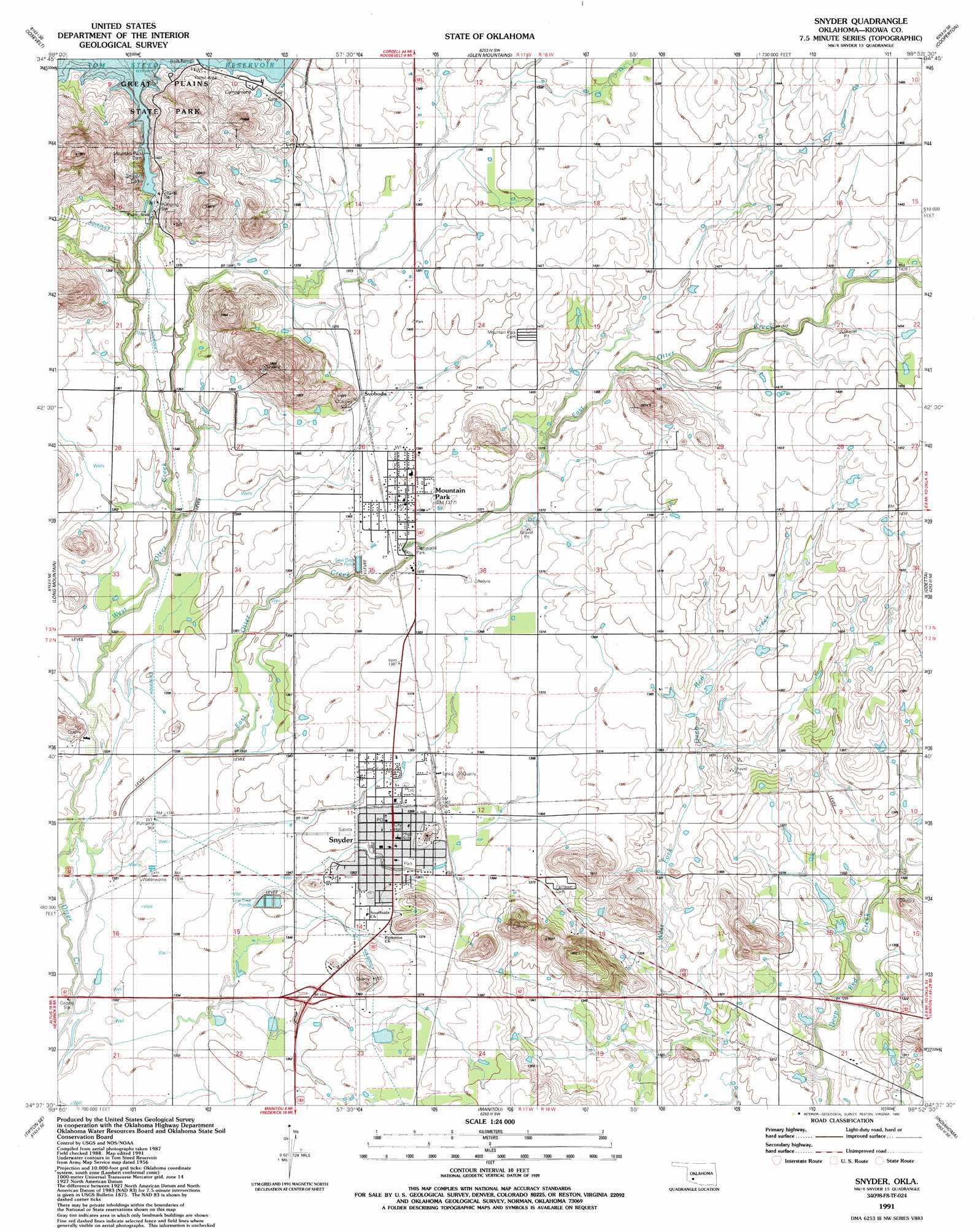
Snyder Topo Map Oklahoma
To zoom in, hover over the map of Snyder
USGS Topo Quad 34098f8 - 1:24,000 scale
| Topo Map Name: | Snyder |
| USGS Topo Quad ID: | 34098f8 |
| Print Size: | ca. 21 1/4" wide x 27" high |
| Southeast Coordinates: | 34.625° N latitude / 98.875° W longitude |
| Map Center Coordinates: | 34.6875° N latitude / 98.9375° W longitude |
| U.S. State: | OK |
| Filename: | o34098f8.jpg |
| Download Map JPG Image: | Snyder topo map 1:24,000 scale |
| Map Type: | Topographic |
| Topo Series: | 7.5´ |
| Map Scale: | 1:24,000 |
| Source of Map Images: | United States Geological Survey (USGS) |
| Alternate Map Versions: |
Snyder OK 1956, updated 1959 Download PDF Buy paper map Snyder OK 1956, updated 1983 Download PDF Buy paper map Snyder OK 1991, updated 1992 Download PDF Buy paper map Snyder OK 2010 Download PDF Buy paper map Snyder OK 2012 Download PDF Buy paper map Snyder OK 2016 Download PDF Buy paper map |
1:24,000 Topo Quads surrounding Snyder
Lone Wolf |
Babbs |
Rainy Mountain Creek |
Unap Mountain |
Bally Mountain |
Warren |
Roosevelt |
Glen Mountains |
Cooperton |
Saddle Mountain |
Headrick |
Long Mountain |
Snyder |
Odetta |
Quanah Mountain |
Tipton |
Tipton Se |
Manitou |
Indiahoma |
Post Oak Creek |
Frederick Nw |
Frederick |
Hollister Nw |
Hollister Ne |
Chattanooga |
> Back to 34098e1 at 1:100,000 scale
> Back to 34098a1 at 1:250,000 scale
> Back to U.S. Topo Maps home
Snyder topo map: Gazetteer
Snyder: Dams
Mountain Park Dam elevation 418m 1371′Oknoname 075015 Dam elevation 397m 1302′
Snyder: Lakes
Snyder Lake elevation 423m 1387′Snyder: Parks
Glenwood Park elevation 415m 1361′Snyder: Populated Places
Mountain Park elevation 418m 1371′Snyder elevation 413m 1354′
Svoboda elevation 421m 1381′
Snyder: Reservoirs
Oknoname 075015 Reservoir elevation 397m 1302′Tom Steed Reservoir elevation 418m 1371′
Snyder: Streams
East Otter Creek elevation 402m 1318′West Otter Creek elevation 403m 1322′
Snyder digital topo map on disk
Buy this Snyder topo map showing relief, roads, GPS coordinates and other geographical features, as a high-resolution digital map file on DVD: