Farwell Topo Map New Mexico
To zoom in, hover over the map of Farwell
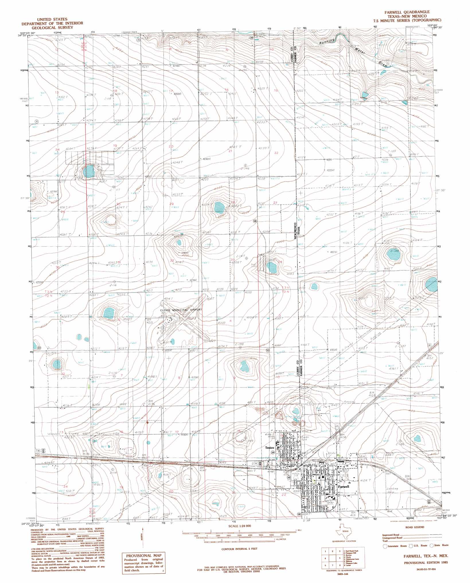
USGS Topo Quad 34103d1 - 1:24,000 scale
| Topo Map Name: | Farwell |
| USGS Topo Quad ID: | 34103d1 |
| Print Size: | ca. 21 1/4" wide x 27" high |
| Southeast Coordinates: | 34.375° N latitude / 103° W longitude |
| Map Center Coordinates: | 34.4375° N latitude / 103.0625° W longitude |
| U.S. States: | NM, TX |
| Filename: | o34103d1.jpg |
| Download Map JPG Image: | Farwell topo map 1:24,000 scale |
| Map Type: | Topographic |
| Topo Series: | 7.5´ |
| Map Scale: | 1:24,000 |
| Source of Map Images: | United States Geological Survey (USGS) |
| Alternate Map Versions: |
Farwell TX 1985, updated 1985 Download PDF Buy paper map Farwell TX 2010 Download PDF Buy paper map Farwell TX 2012 Download PDF Buy paper map Farwell TX 2016 Download PDF Buy paper map |
1:24,000 Topo Quads surrounding Farwell
Smith Ranch |
Pleasant Hill Nw |
Pleasant Hill Ne |
Rhea |
Twin Lakes |
Garrett Ranch |
Ned Houk Park |
Pleasant Hill |
Bovina |
Parmerton |
Portair |
Clovis |
Farwell |
Oklahoma Lane |
Lariat Ne |
Oasis State Park |
Midway |
Pleasure Lake |
Lariat |
Progress |
Portales |
Arch Nw |
Arch Ne |
Birdwell Ranch |
Baileyboro Ne |
> Back to 34103a1 at 1:100,000 scale
> Back to 34102a1 at 1:250,000 scale
> Back to U.S. Topo Maps home
Farwell topo map: Gazetteer
Farwell: Airports
Clovis Municipal Airport elevation 1281m 4202′Farwell Spraying Service, Incorporated Airport elevation 1255m 4117′
Farwell: Populated Places
Farwell elevation 1263m 4143′Texico elevation 1264m 4146′
Farwell: Post Offices
Texico Post Office elevation 1264m 4146′Farwell digital topo map on disk
Buy this Farwell topo map showing relief, roads, GPS coordinates and other geographical features, as a high-resolution digital map file on DVD: