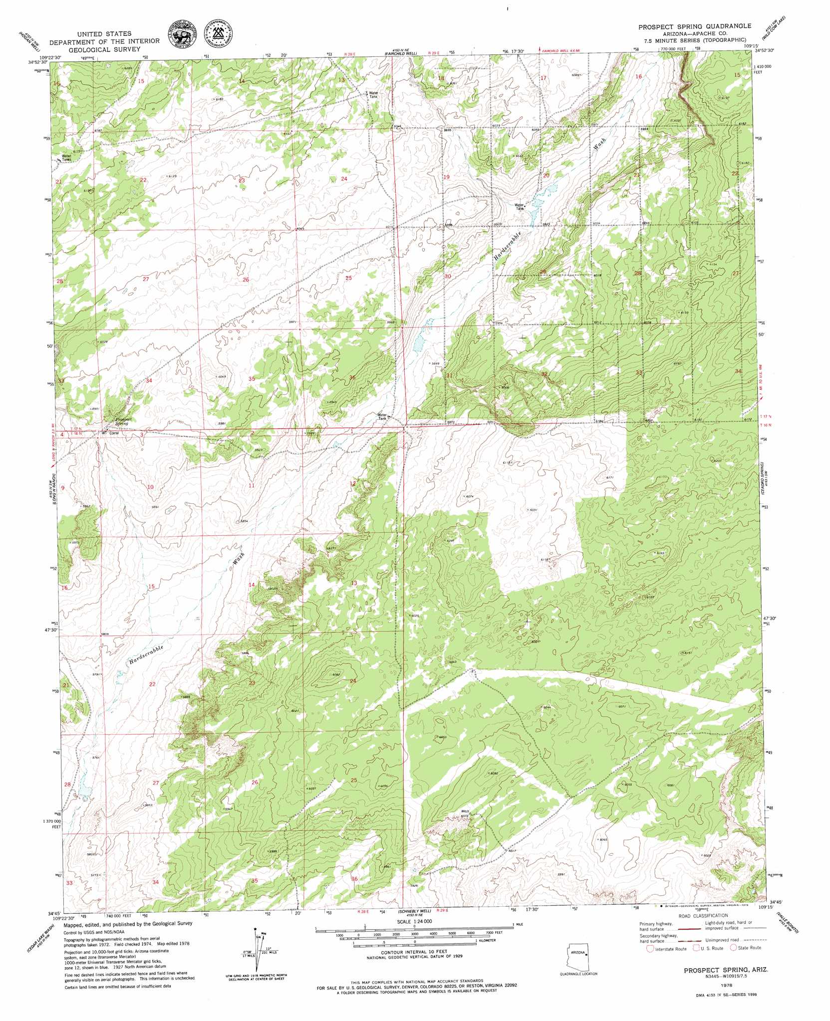
Prospect Spring Topo Map Arizona
To zoom in, hover over the map of Prospect Spring
USGS Topo Quad 34109g3 - 1:24,000 scale
| Topo Map Name: | Prospect Spring |
| USGS Topo Quad ID: | 34109g3 |
| Print Size: | ca. 21 1/4" wide x 27" high |
| Southeast Coordinates: | 34.75° N latitude / 109.25° W longitude |
| Map Center Coordinates: | 34.8125° N latitude / 109.3125° W longitude |
| U.S. State: | AZ |
| Filename: | o34109g3.jpg |
| Download Map JPG Image: | Prospect Spring topo map 1:24,000 scale |
| Map Type: | Topographic |
| Topo Series: | 7.5´ |
| Map Scale: | 1:24,000 |
| Source of Map Images: | United States Geological Survey (USGS) |
| Alternate Map Versions: |
Prospect Spring AZ 1978, updated 1979 Download PDF Buy paper map Prospect Spring AZ 2011 Download PDF Buy paper map Prospect Spring AZ 2014 Download PDF Buy paper map |
1:24,000 Topo Quads surrounding Prospect Spring
Navajo South |
Navajo Springs |
Beacon Well |
Deep Lake |
High Lonesome Well |
Ninemile Seep |
Hogan Well |
Fairchild Well |
Wild Cow Lake |
Barth Well |
Seven Springs |
Long H Ranch |
Prospect Spring |
Ceadro Spring |
Ceadro Spring Se |
Stinking Springs Mountain |
Cedar Lake Wash |
Schnebly Well |
Valle Bonito |
Valle Bonito Ne |
Stinking Springs |
Zion Reservoir |
Saint Johns North |
Kearn Lake |
Carrisito Spring |
> Back to 34109e1 at 1:100,000 scale
> Back to 34108a1 at 1:250,000 scale
> Back to U.S. Topo Maps home
Prospect Spring digital topo map on disk
Buy this Prospect Spring topo map showing relief, roads, GPS coordinates and other geographical features, as a high-resolution digital map file on DVD: