Carrisito Spring Topo Map Arizona
To zoom in, hover over the map of Carrisito Spring
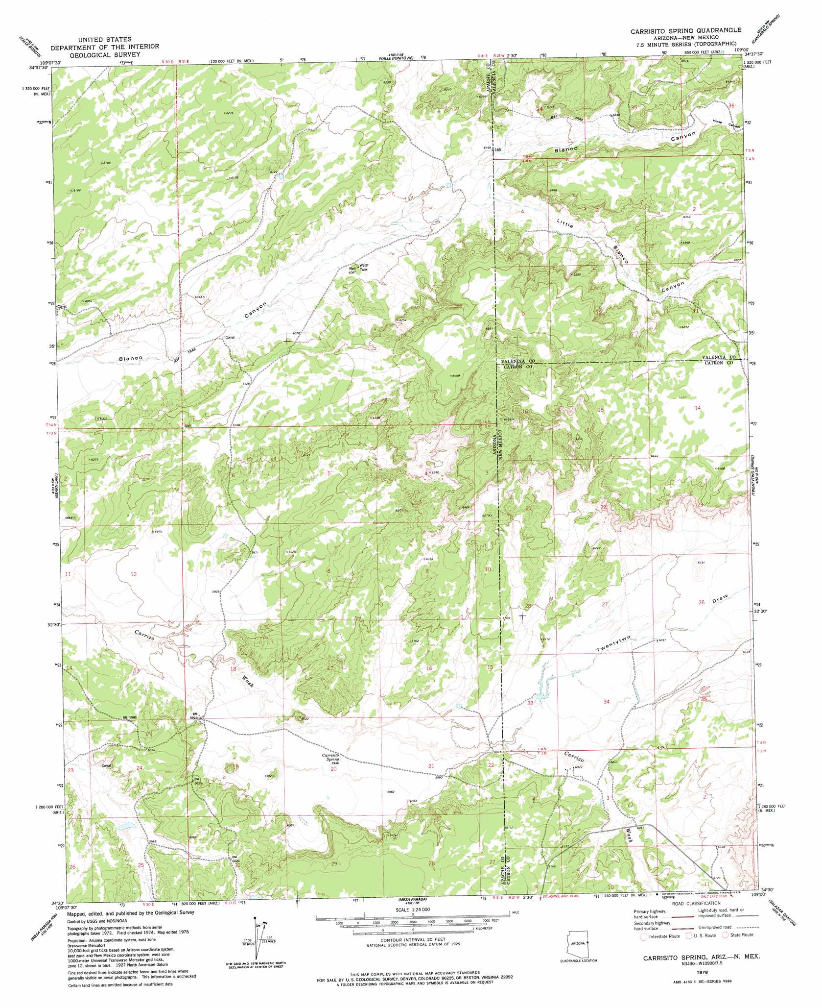
USGS Topo Quad 34109e1 - 1:24,000 scale
| Topo Map Name: | Carrisito Spring |
| USGS Topo Quad ID: | 34109e1 |
| Print Size: | ca. 21 1/4" wide x 27" high |
| Southeast Coordinates: | 34.5° N latitude / 109° W longitude |
| Map Center Coordinates: | 34.5625° N latitude / 109.0625° W longitude |
| U.S. States: | AZ, NM |
| Filename: | o34109e1.jpg |
| Download Map JPG Image: | Carrisito Spring topo map 1:24,000 scale |
| Map Type: | Topographic |
| Topo Series: | 7.5´ |
| Map Scale: | 1:24,000 |
| Source of Map Images: | United States Geological Survey (USGS) |
| Alternate Map Versions: |
Carrisito Spring AZ 1978, updated 1978 Download PDF Buy paper map Carrisito Spring AZ 2011 Download PDF Buy paper map Carrisito Spring AZ 2011 Download PDF Buy paper map Carrisito Spring AZ 2014 Download PDF Buy paper map |
1:24,000 Topo Quads surrounding Carrisito Spring
Prospect Spring |
Ceadro Spring |
Ceadro Spring Se |
Venadito Camp |
Atarque Lake |
Schnebly Well |
Valle Bonito |
Valle Bonito Ne |
Cantaralo Spring |
Rincon Hondo |
Saint Johns North |
Kearn Lake |
Carrisito Spring |
Twentytwo Spring |
Moreno Hill |
Saint Johns South |
Mesa Parada Nw |
Mesa Parada |
Salazar Canyon |
Zuni Salt Lake |
Lyman Lake |
Voigt Ranch |
The Rincon |
Goat Spring |
Blaines Lake |
> Back to 34109e1 at 1:100,000 scale
> Back to 34108a1 at 1:250,000 scale
> Back to U.S. Topo Maps home
Carrisito Spring topo map: Gazetteer
Carrisito Spring: Springs
Carrisito Spring elevation 1816m 5958′Carrisito Spring: Valleys
Horse Canyon elevation 1920m 6299′Little Blanco Canyon elevation 1870m 6135′
Twentytwo Draw elevation 1830m 6003′
Carrisito Spring: Wells
Blanco Water Well elevation 1901m 6236′Carrisito Spring digital topo map on disk
Buy this Carrisito Spring topo map showing relief, roads, GPS coordinates and other geographical features, as a high-resolution digital map file on DVD: