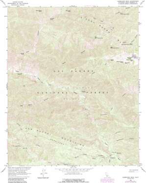
Hurricane Deck Topo Map California
To zoom in, hover over the map of Hurricane Deck
USGS Topo Quad 34119g7 - 1:24,000 scale
| Topo Map Name: | Hurricane Deck |
| USGS Topo Quad ID: | 34119g7 |
| Print Size: | ca. 21 1/4" wide x 27" high |
| Southeast Coordinates: | 34.75° N latitude / 119.75° W longitude |
| Map Center Coordinates: | 34.8125° N latitude / 119.8125° W longitude |
| U.S. State: | CA |
| Filename: | o34119g7.jpg |
| Download Map JPG Image: | Hurricane Deck topo map 1:24,000 scale |
| Map Type: | Topographic |
| Topo Series: | 7.5´ |
| Map Scale: | 1:24,000 |
| Source of Map Images: | United States Geological Survey (USGS) |
| Alternate Map Versions: |
Hurricane Deck CA 1964, updated 1965 Download PDF Buy paper map Hurricane Deck CA 1964, updated 1974 Download PDF Buy paper map Hurricane Deck CA 1964, updated 1983 Download PDF Buy paper map Hurricane Deck CA 1964, updated 1989 Download PDF Buy paper map Hurricane Deck CA 1995, updated 2000 Download PDF Buy paper map Hurricane Deck CA 2012 Download PDF Buy paper map Hurricane Deck CA 2015 Download PDF Buy paper map |
| FStopo: | US Forest Service topo Hurricane Deck is available: Download FStopo PDF Download FStopo TIF |
1:24,000 Topo Quads surrounding Hurricane Deck
> Back to 34119e1 at 1:100,000 scale
> Back to 34118a1 at 1:250,000 scale
> Back to U.S. Topo Maps home
Hurricane Deck topo map: Gazetteer
Hurricane Deck: Benches
Hurricane Deck elevation 1182m 3877′Hurricane Deck: Flats
Montgomery Potrero elevation 1398m 4586′Hurricane Deck: Springs
Abel Canyon Spring elevation 1190m 3904′Black Willow Spring elevation 1366m 4481′
East Mine Canyon Spring elevation 1131m 3710′
Ernest Blanco Spring elevation 1004m 3293′
Jackson Spring elevation 1382m 4534′
Live Oak Spring elevation 618m 2027′
Lost Knife Spring elevation 939m 3080′
Montgomery Number Three Spring elevation 1361m 4465′
Montgomery Number Two Spring elevation 1360m 4461′
Montgomery Spring elevation 1423m 4668′
North Mine Canyon Spring elevation 1114m 3654′
Upper Branch Canyon Spring elevation 1216m 3989′
Upper Trough Canyon Spring elevation 1156m 3792′
Hurricane Deck: Streams
South Fork Sisquoc River elevation 756m 2480′Hurricane Deck: Trails
Hurricane Deck Trail elevation 1130m 3707′Jackson Trail elevation 1277m 4189′
Manzana Trail elevation 972m 3188′
Hurricane Deck: Valleys
Abel Canyon elevation 524m 1719′Big Bend Canyon elevation 559m 1833′
Foresters Leap Canyon elevation 685m 2247′
Mine Canyon elevation 551m 1807′
Sweetwater Canyon elevation 722m 2368′
White Ledge Canyon elevation 803m 2634′
Hurricane Deck digital topo map on disk
Buy this Hurricane Deck topo map showing relief, roads, GPS coordinates and other geographical features, as a high-resolution digital map file on DVD:


