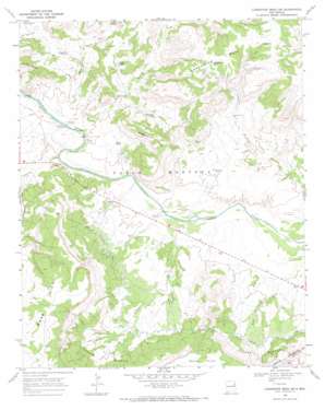
Carpenter Mesa Sw Topo Map New Mexico
To zoom in, hover over the map of Carpenter Mesa Sw
USGS Topo Quad 35103c8 - 1:24,000 scale
| Topo Map Name: | Carpenter Mesa Sw |
| USGS Topo Quad ID: | 35103c8 |
| Print Size: | ca. 21 1/4" wide x 27" high |
| Southeast Coordinates: | 35.25° N latitude / 103.875° W longitude |
| Map Center Coordinates: | 35.3125° N latitude / 103.9375° W longitude |
| U.S. State: | NM |
| Filename: | o35103c8.jpg |
| Download Map JPG Image: | Carpenter Mesa Sw topo map 1:24,000 scale |
| Map Type: | Topographic |
| Topo Series: | 7.5´ |
| Map Scale: | 1:24,000 |
| Source of Map Images: | United States Geological Survey (USGS) |
| Alternate Map Versions: |
Carpenter Mesa SW NM 1968, updated 1971 Download PDF Buy paper map Carpenter Mesa SW NM 2010 Download PDF Buy paper map Carpenter Mesa SW NM 2013 Download PDF Buy paper map Carpenter Mesa SW NM 2017 Download PDF Buy paper map |
1:24,000 Topo Quads surrounding Carpenter Mesa Sw
> Back to 35103a1 at 1:100,000 scale
> Back to 35102a1 at 1:250,000 scale
> Back to U.S. Topo Maps home
Carpenter Mesa Sw topo map: Gazetteer
Carpenter Mesa Sw: Areas
Johnson Rincon elevation 1281m 4202′Road Rincon elevation 1271m 4169′
Carpenter Mesa Sw: Canals
Conchas Canal elevation 1264m 4146′Carpenter Mesa Sw: Reservoirs
Bollschweiler Tank elevation 1375m 4511′Carpenter Tank elevation 1226m 4022′
McCavley Tank elevation 1250m 4101′
Quail Tank elevation 1239m 4064′
Toni Tank elevation 1258m 4127′
Carpenter Mesa Sw: Streams
Alamosa Creek elevation 1199m 3933′Johnson Creek elevation 1189m 3900′
Saint Patrick Creek elevation 1199m 3933′
Watrous Creek elevation 1198m 3930′
Carpenter Mesa Sw: Summits
Manhead Mesa elevation 1379m 4524′Carpenter Mesa Sw: Tunnels
Tunnel Number 3 elevation 1454m 4770′Tunnel Number 4 elevation 1359m 4458′
Carpenter Mesa Sw: Valleys
Alamosa Canyon elevation 1252m 4107′Carpenter Mesa Sw digital topo map on disk
Buy this Carpenter Mesa Sw topo map showing relief, roads, GPS coordinates and other geographical features, as a high-resolution digital map file on DVD:


