Tucker Mesa Ne Topo Map Arizona
To zoom in, hover over the map of Tucker Mesa Ne
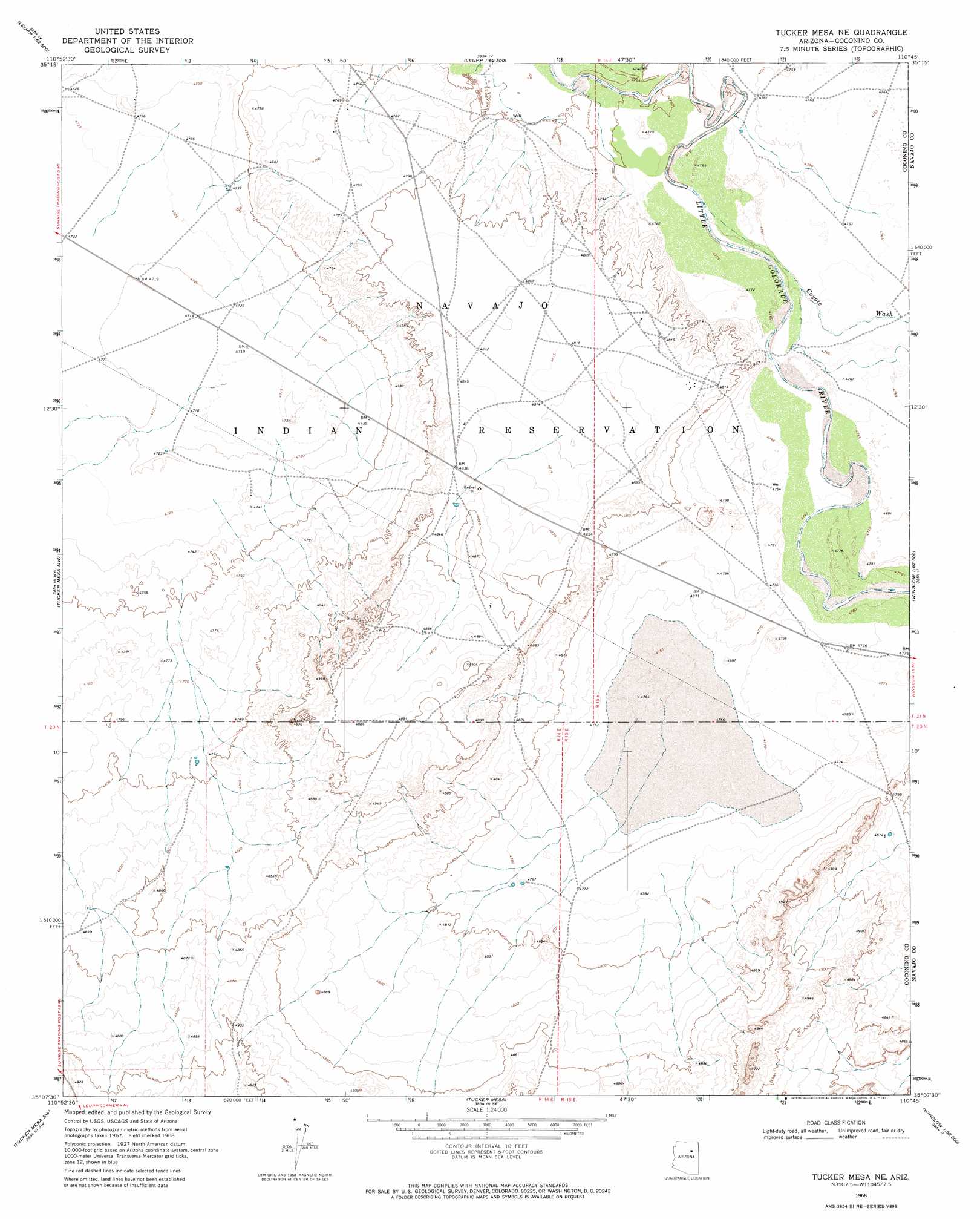
USGS Topo Quad 35110b7 - 1:24,000 scale
| Topo Map Name: | Tucker Mesa Ne |
| USGS Topo Quad ID: | 35110b7 |
| Print Size: | ca. 21 1/4" wide x 27" high |
| Southeast Coordinates: | 35.125° N latitude / 110.75° W longitude |
| Map Center Coordinates: | 35.1875° N latitude / 110.8125° W longitude |
| U.S. State: | AZ |
| Filename: | o35110b7.jpg |
| Download Map JPG Image: | Tucker Mesa Ne topo map 1:24,000 scale |
| Map Type: | Topographic |
| Topo Series: | 7.5´ |
| Map Scale: | 1:24,000 |
| Source of Map Images: | United States Geological Survey (USGS) |
| Alternate Map Versions: |
Tucker Mesa NE AZ 1968, updated 1971 Download PDF Buy paper map Tucker Mesa NE AZ 2011 Download PDF Buy paper map Tucker Mesa NE AZ 2014 Download PDF Buy paper map |
1:24,000 Topo Quads surrounding Tucker Mesa Ne
Grand Falls Ne |
Newberry Mesa |
Tolani Lake |
Montezumas Chair Nw |
Montezumas Chair |
Grand Falls Se |
Old Leupp |
East Of Old Leupp |
Bird Springs Wash |
Elephant Butte |
Canyon Diablo |
Tucker Mesa Nw |
Tucker Mesa Ne |
Winslow Nw |
Winslow Ne |
Meteor Crater |
Tucker Mesa Sw |
Tucker Mesa |
Winslow |
Rincon Ranch |
Chavez Mountain Ne |
West Sunset Mountain |
Rock Station |
Clear Creek Reservoir |
Hibbard |
> Back to 35110a1 at 1:100,000 scale
> Back to 35110a1 at 1:250,000 scale
> Back to U.S. Topo Maps home
Tucker Mesa Ne digital topo map on disk
Buy this Tucker Mesa Ne topo map showing relief, roads, GPS coordinates and other geographical features, as a high-resolution digital map file on DVD: