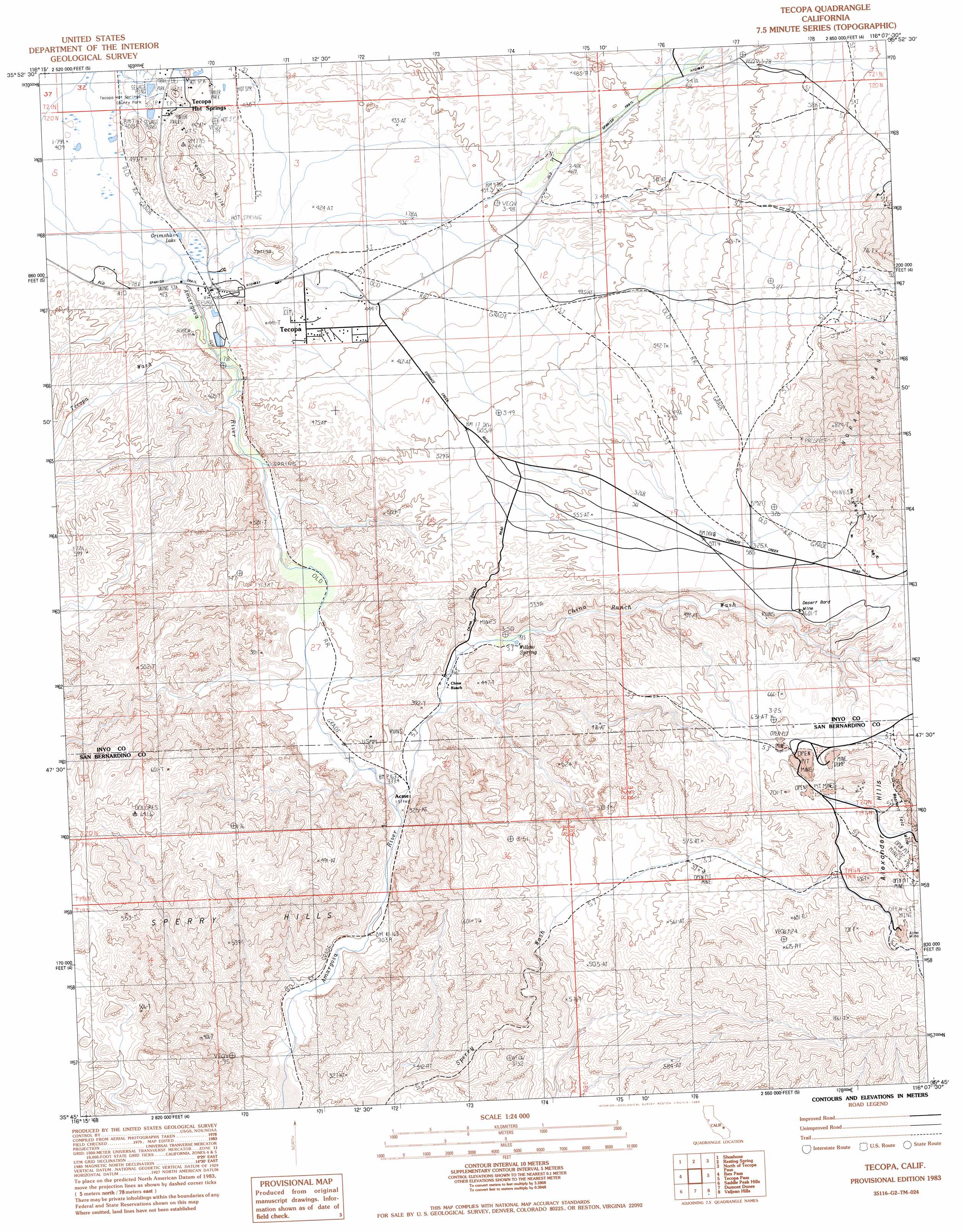
Tecopa Topo Map California
To zoom in, hover over the map of Tecopa
USGS Topo Quad 35116g2 - 1:24,000 scale
| Topo Map Name: | Tecopa |
| USGS Topo Quad ID: | 35116g2 |
| Print Size: | ca. 21 1/4" wide x 27" high |
| Southeast Coordinates: | 35.75° N latitude / 116.125° W longitude |
| Map Center Coordinates: | 35.8125° N latitude / 116.1875° W longitude |
| U.S. State: | CA |
| Filename: | o35116g2.jpg |
| Download Map JPG Image: | Tecopa topo map 1:24,000 scale |
| Map Type: | Topographic |
| Topo Series: | 7.5´ |
| Map Scale: | 1:24,000 |
| Source of Map Images: | United States Geological Survey (USGS) |
| Alternate Map Versions: |
Tecopa CA 1983, updated 1983 Download PDF Buy paper map Tecopa CA 2012 Download PDF Buy paper map Tecopa CA 2015 Download PDF Buy paper map |
1:24,000 Topo Quads surrounding Tecopa
Deadman Pass |
East Of Deadman Pass |
Twelve Mile Spring |
Nopah Peak |
Mound Spring |
Salsberry Peak |
Shoshone |
Resting Spring |
North Of Tecopa Pass |
Calvada Springs |
Ibex Spring |
Ibex Pass |
Tecopa |
Tecopa Pass |
Horse Thief Springs |
Old Ibex Pass |
Saddle Peak Hills |
Dumont Dunes |
Valjean Hills |
Kingston Peak |
Avawatz Pass |
Sheep Creek Spring |
Silurian Lake |
Silurian Hills |
Kingston Spring |
> Back to 35116e1 at 1:100,000 scale
> Back to 35116a1 at 1:250,000 scale
> Back to U.S. Topo Maps home
Tecopa topo map: Gazetteer
Tecopa: Basins
The Bowl elevation 355m 1164′Tecopa: Bridges
Sperry Trestle (historical) elevation 423m 1387′Tecopa: Cliffs
The Palisades elevation 343m 1125′Tecopa: Crossings
Dumont Crossing elevation 271m 889′Tecopa: Flats
The Meadows elevation 348m 1141′Tecopa: Gaps
The Narrows elevation 296m 971′Tecopa: Lakes
Grimshaw Lake elevation 409m 1341′Tecopa: Mines
Acme Mine elevation 771m 2529′Desert Bard Mine elevation 601m 1971′
Gunsight Mine elevation 800m 2624′
Western Talc Mine elevation 741m 2431′
Tecopa: Parks
Amargosa Canyon Natural Area ACEC elevation 628m 2060′Tecopa Hot Springs County Park elevation 413m 1354′
Tecopa: Populated Places
Acme (historical) elevation 325m 1066′Tecopa elevation 408m 1338′
Tecopa: Ranges
Tecopa Hills elevation 523m 1715′Tecopa: Springs
Tecopa Hot Springs elevation 428m 1404′Willow Spring elevation 421m 1381′
Tecopa: Streams
Tecopa Wash elevation 383m 1256′Tecopa: Valleys
Chicago Valley elevation 618m 2027′Long Valley elevation 364m 1194′
Tecopa digital topo map on disk
Buy this Tecopa topo map showing relief, roads, GPS coordinates and other geographical features, as a high-resolution digital map file on DVD:
Southern Sierra Nevada, California & Southern Nevada
Buy digital topo maps: Southern Sierra Nevada, California & Southern Nevada