Oil Center Topo Map California
To zoom in, hover over the map of Oil Center
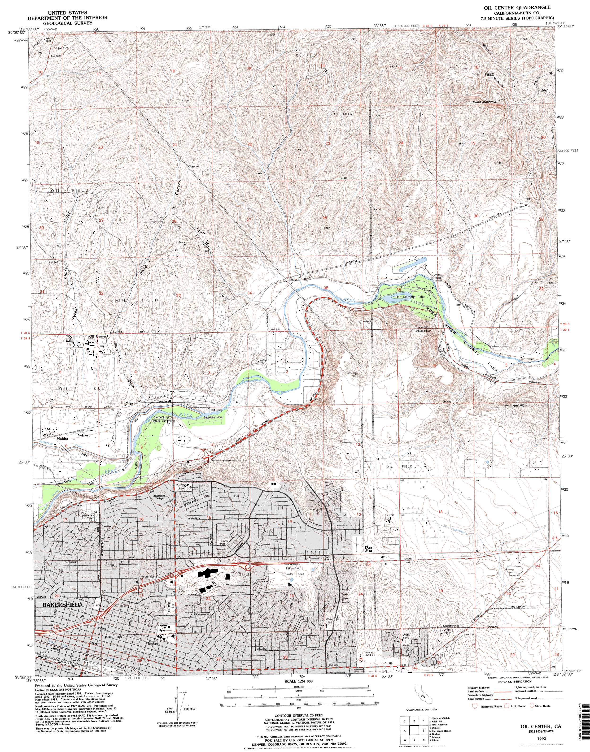
USGS Topo Quad 35118d8 - 1:24,000 scale
| Topo Map Name: | Oil Center |
| USGS Topo Quad ID: | 35118d8 |
| Print Size: | ca. 21 1/4" wide x 27" high |
| Southeast Coordinates: | 35.375° N latitude / 118.875° W longitude |
| Map Center Coordinates: | 35.4375° N latitude / 118.9375° W longitude |
| U.S. State: | CA |
| Filename: | o35118d8.jpg |
| Download Map JPG Image: | Oil Center topo map 1:24,000 scale |
| Map Type: | Topographic |
| Topo Series: | 7.5´ |
| Map Scale: | 1:24,000 |
| Source of Map Images: | United States Geological Survey (USGS) |
| Alternate Map Versions: |
Oil Center CA 1950 Download PDF Buy paper map Oil Center CA 1954, updated 1966 Download PDF Buy paper map Oil Center CA 1954, updated 1970 Download PDF Buy paper map Oil Center CA 1954, updated 1976 Download PDF Buy paper map Oil Center CA 1978, updated 1981 Download PDF Buy paper map Oil Center CA 1992, updated 1995 Download PDF Buy paper map Oil Center CA 2012 Download PDF Buy paper map Oil Center CA 2015 Download PDF Buy paper map |
1:24,000 Topo Quads surrounding Oil Center
Mcfarland |
Deepwell Ranch |
Sand Canyon |
Woody |
Glennville |
Famoso |
North Of Oildale |
Knob Hill |
Pine Mountain |
Democrat Hot Springs |
Rosedale |
Oildale |
Oil Center |
Rio Bravo Ranch |
Mount Adelaide |
Stevens |
Gosford |
Lamont |
Edison |
Bena |
Millux |
Conner |
Weed Patch |
Arvin |
Bear Mountain |
> Back to 35118a1 at 1:100,000 scale
> Back to 35118a1 at 1:250,000 scale
> Back to U.S. Topo Maps home
Oil Center topo map: Gazetteer
Oil Center: Airports
Kern Medical Center Heliport elevation 153m 501′Oil Center: Dams
Beardsley Weir elevation 135m 442′Oil Center: Oilfields
Kern Bluff Oil Field elevation 234m 767′Kern River Oil Field elevation 224m 734′
Round Mountain Oil Field elevation 351m 1151′
Sharktooth Oil Field elevation 298m 977′
Oil Center: Parks
College Park elevation 227m 744′Hart Memorial Unit elevation 148m 485′
Heritage Park elevation 167m 547′
Jefferson Park elevation 150m 492′
Kern River State Park elevation 147m 482′
Memorial Stadium elevation 210m 688′
Panorama Park elevation 190m 623′
Siemon Park elevation 227m 744′
University Park elevation 247m 810′
Oil Center: Populated Places
East Bakersfield elevation 151m 495′Kern elevation 137m 449′
Maltha elevation 138m 452′
Oil City elevation 137m 449′
Oil Center: Reservoirs
Hart Park Lake elevation 147m 482′Oil Center: Summits
Ant Hill elevation 288m 944′Round Mountain elevation 483m 1584′
Oil Center: Valleys
Sacramento Gulch elevation 137m 449′West Shore Gulch elevation 158m 518′
Oil Center digital topo map on disk
Buy this Oil Center topo map showing relief, roads, GPS coordinates and other geographical features, as a high-resolution digital map file on DVD:
Southern Sierra Nevada, California & Southern Nevada
Buy digital topo maps: Southern Sierra Nevada, California & Southern Nevada