Tanner Well Topo Map Arizona
To zoom in, hover over the map of Tanner Well
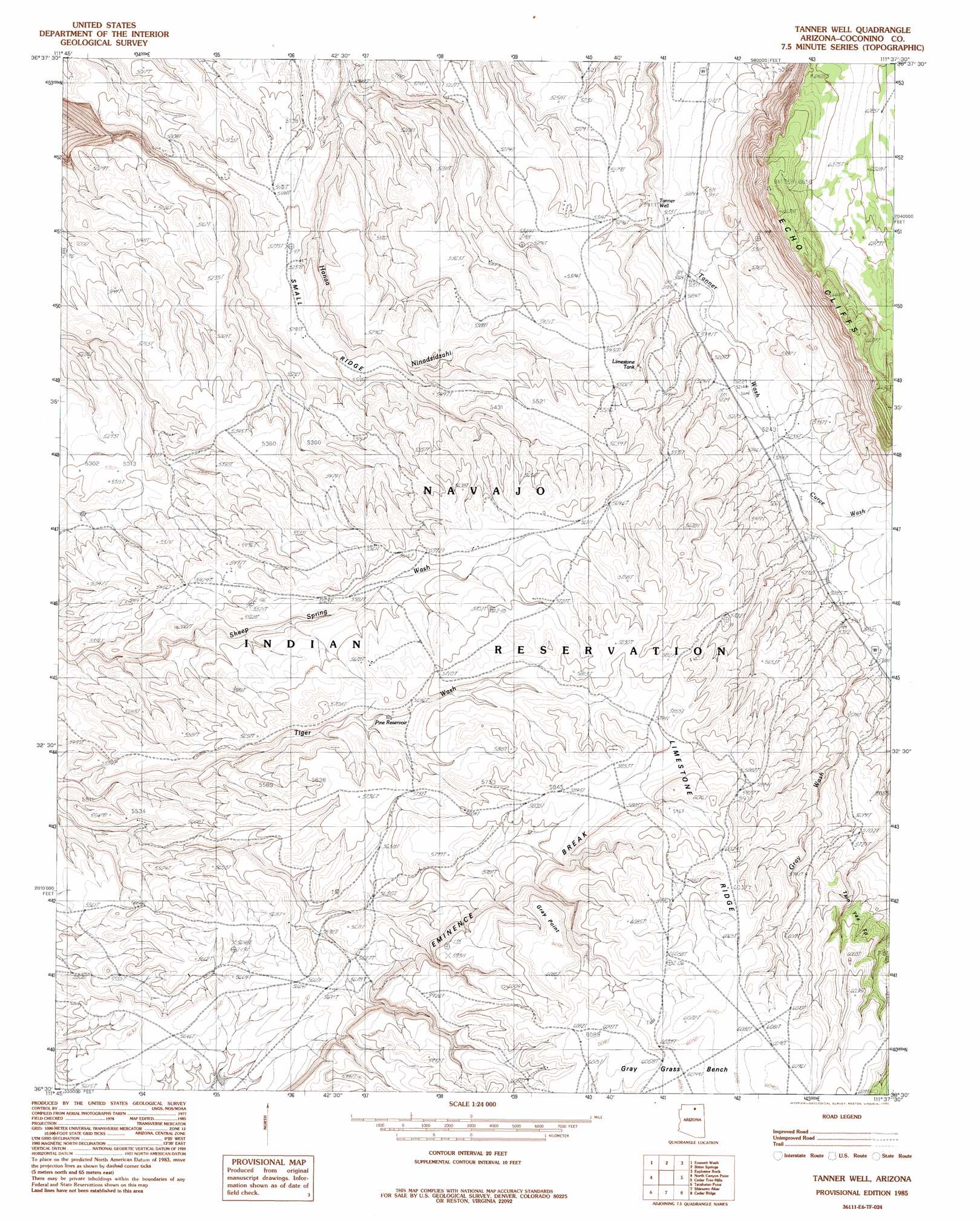
USGS Topo Quad 36111e6 - 1:24,000 scale
| Topo Map Name: | Tanner Well |
| USGS Topo Quad ID: | 36111e6 |
| Print Size: | ca. 21 1/4" wide x 27" high |
| Southeast Coordinates: | 36.5° N latitude / 111.625° W longitude |
| Map Center Coordinates: | 36.5625° N latitude / 111.6875° W longitude |
| U.S. State: | AZ |
| Filename: | o36111e6.jpg |
| Download Map JPG Image: | Tanner Well topo map 1:24,000 scale |
| Map Type: | Topographic |
| Topo Series: | 7.5´ |
| Map Scale: | 1:24,000 |
| Source of Map Images: | United States Geological Survey (USGS) |
| Alternate Map Versions: |
Tanner Well AZ 1985, updated 1985 Download PDF Buy paper map Tanner Well AZ 2011 Download PDF Buy paper map Tanner Well AZ 2014 Download PDF Buy paper map |
1:24,000 Topo Quads surrounding Tanner Well
One Toe Ridge |
The Big Knoll |
Navajo Bridge |
Lees Ferry |
White Dome |
Emmett Hill |
Emmett Wash |
Bitter Springs |
Explosive Rock |
Dead Monkey Ridge |
Buffalo Tanks |
North Canyon Point |
Tanner Well |
Cedar Tree Hills |
Dove Spring |
Buffalo Ranch |
Tatahatso Point |
Shinumo Altar |
Cedar Ridge |
Toh Bih Nosteny |
Point Imperial |
Nankoweap Mesa |
Blue Moon Reservoir |
Bodaway Mesa |
The Gap |
> Back to 36111e1 at 1:100,000 scale
> Back to 36110a1 at 1:250,000 scale
> Back to U.S. Topo Maps home
Tanner Well topo map: Gazetteer
Tanner Well: Benches
Gray Grass Bench elevation 1845m 6053′Tanner Well: Cliffs
Gray Point elevation 1850m 6069′Tanner Well: Reservoirs
Limestone Tank elevation 1639m 5377′Pine Reservoir elevation 1713m 5620′
Tanner Well: Streams
Curve Wash elevation 1606m 5269′Gray Wash elevation 1643m 5390′
Gray Wash elevation 1649m 5410′
Tanner Well: Summits
Cinyon Otah elevation 1850m 6069′Tanner Well: Wells
Tanner Well elevation 1567m 5141′Tanner Well digital topo map on disk
Buy this Tanner Well topo map showing relief, roads, GPS coordinates and other geographical features, as a high-resolution digital map file on DVD: