Grotto Canyon Topo Map California
To zoom in, hover over the map of Grotto Canyon
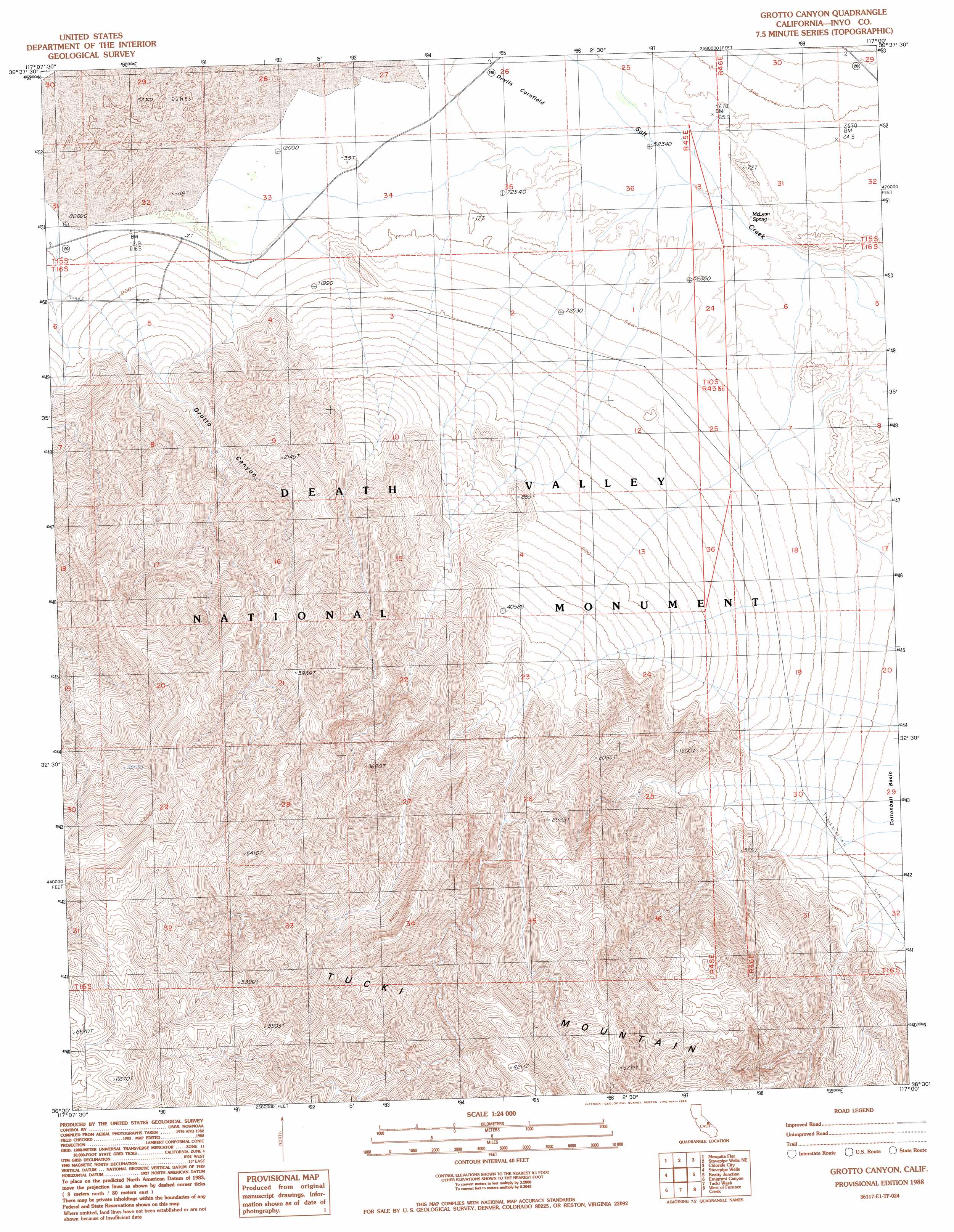
USGS Topo Quad 36117e1 - 1:24,000 scale
| Topo Map Name: | Grotto Canyon |
| USGS Topo Quad ID: | 36117e1 |
| Print Size: | ca. 21 1/4" wide x 27" high |
| Southeast Coordinates: | 36.5° N latitude / 117° W longitude |
| Map Center Coordinates: | 36.5625° N latitude / 117.0625° W longitude |
| U.S. State: | CA |
| Filename: | o36117e1.jpg |
| Download Map JPG Image: | Grotto Canyon topo map 1:24,000 scale |
| Map Type: | Topographic |
| Topo Series: | 7.5´ |
| Map Scale: | 1:24,000 |
| Source of Map Images: | United States Geological Survey (USGS) |
| Alternate Map Versions: |
Grotto Canyon CA 1988, updated 1988 Download PDF Buy paper map Grotto Canyon CA 2012 Download PDF Buy paper map Grotto Canyon CA 2015 Download PDF Buy paper map |
1:24,000 Topo Quads surrounding Grotto Canyon
Dry Bone Canyon |
Fall Canyon |
Thimble Peak |
Daylight Pass |
Gold Center |
East Of Sand Flat |
Mesquite Flat |
Stovepipe Wells |
Chloride City |
East Of Chloride City |
Cottonwood Canyon |
Stovepipe Wells Village |
Grotto Canyon |
Beatty Junction |
Nevares Peak |
Panamint Butte |
Emigrant Canyon |
Tucki Wash |
East Of Furnace Creek |
Furnace Creek |
Nova Canyon |
Emigrant Pass |
Wildrose Peak |
Devils Speedway |
Devils Golf Course |
> Back to 36117e1 at 1:100,000 scale
> Back to 36116a1 at 1:250,000 scale
> Back to U.S. Topo Maps home
Grotto Canyon topo map: Gazetteer
Grotto Canyon: Flats
Devils Cornfield elevation -26m -86′Grotto Canyon: Springs
McLean Spring elevation -27m -89′Grotto Canyon: Valleys
Grotto Canyon elevation 20m 65′Grotto Canyon digital topo map on disk
Buy this Grotto Canyon topo map showing relief, roads, GPS coordinates and other geographical features, as a high-resolution digital map file on DVD:
Southern Sierra Nevada, California & Southern Nevada
Buy digital topo maps: Southern Sierra Nevada, California & Southern Nevada