Cliquot Topo Map Missouri
To zoom in, hover over the map of Cliquot
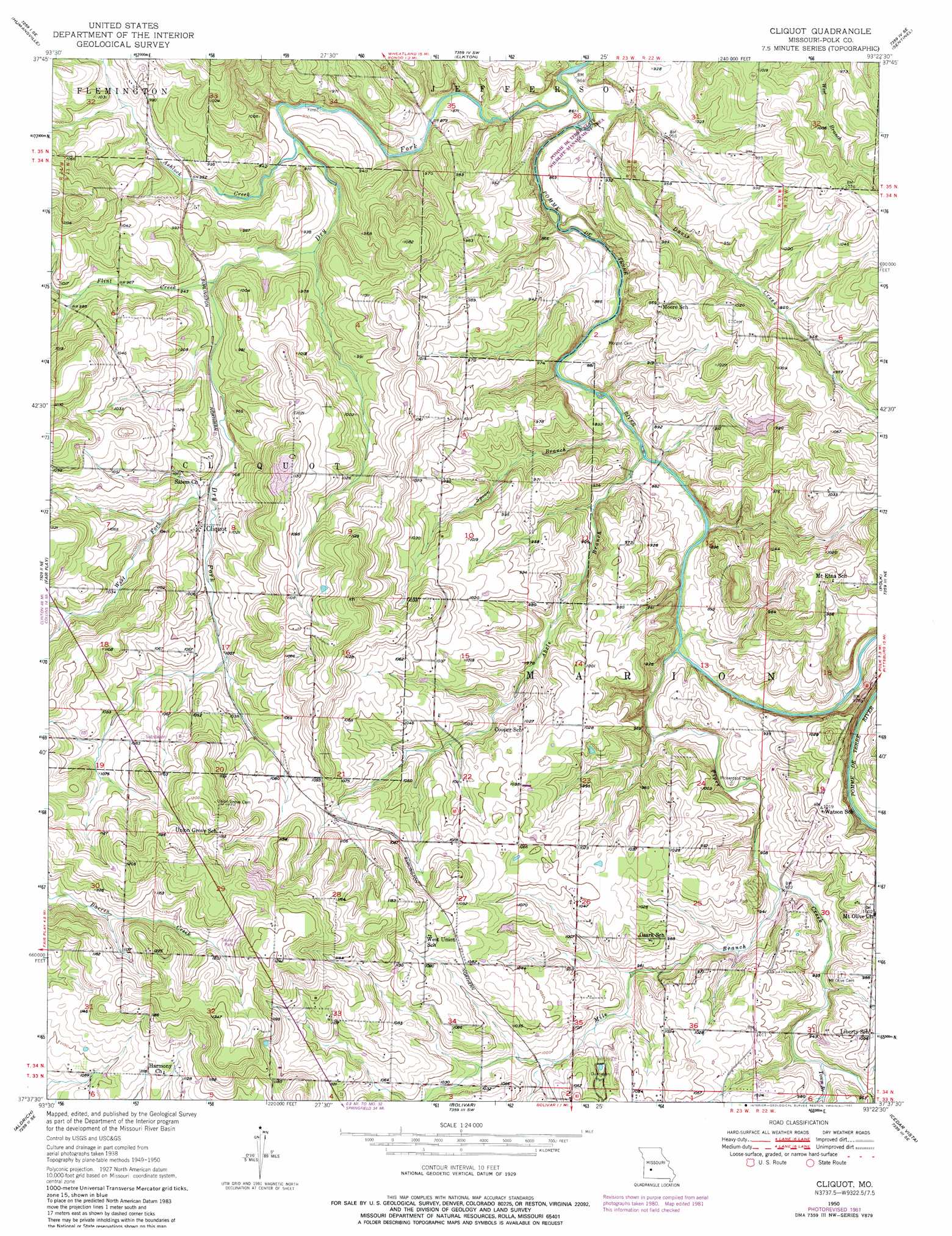
USGS Topo Quad 37093f4 - 1:24,000 scale
| Topo Map Name: | Cliquot |
| USGS Topo Quad ID: | 37093f4 |
| Print Size: | ca. 21 1/4" wide x 27" high |
| Southeast Coordinates: | 37.625° N latitude / 93.375° W longitude |
| Map Center Coordinates: | 37.6875° N latitude / 93.4375° W longitude |
| U.S. State: | MO |
| Filename: | o37093f4.jpg |
| Download Map JPG Image: | Cliquot topo map 1:24,000 scale |
| Map Type: | Topographic |
| Topo Series: | 7.5´ |
| Map Scale: | 1:24,000 |
| Source of Map Images: | United States Geological Survey (USGS) |
| Alternate Map Versions: |
Cliquot MO 1950, updated 1975 Download PDF Buy paper map Cliquot MO 1950, updated 1982 Download PDF Buy paper map Cliquot MO 1951 Download PDF Buy paper map Cliquot MO 2011 Download PDF Buy paper map Cliquot MO 2015 Download PDF Buy paper map |
1:24,000 Topo Quads surrounding Cliquot
Vista |
Weaubleau |
Wheatland |
Hermitage |
Preston |
Arnica |
Humansville |
Elkton |
Sentinel |
Urbana |
Bearcreek |
Fair Play |
Cliquot |
Polk |
Buffalo Nw |
Bona |
Aldrich |
Bolivar |
Cedar Vista |
Half Way |
Dadeville |
Walnut Grove |
Morrisville |
Pleasant Hope |
Fair Grove |
> Back to 37093e1 at 1:100,000 scale
> Back to 37092a1 at 1:250,000 scale
> Back to U.S. Topo Maps home
Cliquot topo map: Gazetteer
Cliquot: Dams
Woods Lake Dam elevation 286m 938′Cliquot: Parks
Dunnegan Park elevation 305m 1000′Cliquot: Populated Places
Cliquot elevation 306m 1003′Cliquot: Streams
Abels Branch elevation 262m 859′Ashlock Creek elevation 271m 889′
Davis Creek elevation 259m 849′
Dry Fork elevation 259m 849′
Flint Creek elevation 284m 931′
Mile Branch elevation 317m 1040′
Piper Creek elevation 264m 866′
Spoon Branch elevation 262m 859′
Town Branch elevation 286m 938′
West Fork Dry Fork elevation 295m 967′
Cliquot digital topo map on disk
Buy this Cliquot topo map showing relief, roads, GPS coordinates and other geographical features, as a high-resolution digital map file on DVD: