Fair Play Topo Map Missouri
To zoom in, hover over the map of Fair Play
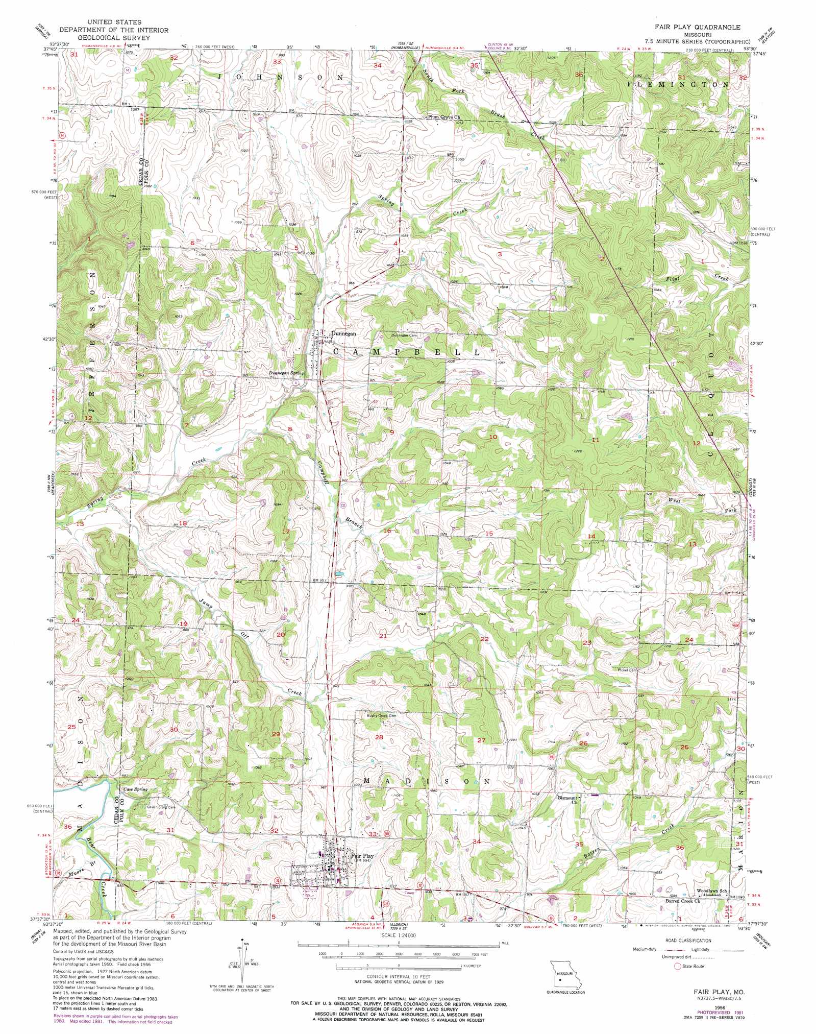
USGS Topo Quad 37093f5 - 1:24,000 scale
| Topo Map Name: | Fair Play |
| USGS Topo Quad ID: | 37093f5 |
| Print Size: | ca. 21 1/4" wide x 27" high |
| Southeast Coordinates: | 37.625° N latitude / 93.5° W longitude |
| Map Center Coordinates: | 37.6875° N latitude / 93.5625° W longitude |
| U.S. State: | MO |
| Filename: | o37093f5.jpg |
| Download Map JPG Image: | Fair Play topo map 1:24,000 scale |
| Map Type: | Topographic |
| Topo Series: | 7.5´ |
| Map Scale: | 1:24,000 |
| Source of Map Images: | United States Geological Survey (USGS) |
| Alternate Map Versions: |
Fair Play MO 1956, updated 1957 Download PDF Buy paper map Fair Play MO 1956, updated 1982 Download PDF Buy paper map Fair Play MO 2011 Download PDF Buy paper map Fair Play MO 2015 Download PDF Buy paper map |
1:24,000 Topo Quads surrounding Fair Play
Roscoe |
Vista |
Weaubleau |
Wheatland |
Hermitage |
Caplinger Mills |
Arnica |
Humansville |
Elkton |
Sentinel |
Stockton |
Bearcreek |
Fair Play |
Cliquot |
Polk |
Crisp |
Bona |
Aldrich |
Bolivar |
Cedar Vista |
Greenfield |
Dadeville |
Walnut Grove |
Morrisville |
Pleasant Hope |
> Back to 37093e1 at 1:100,000 scale
> Back to 37092a1 at 1:250,000 scale
> Back to U.S. Topo Maps home
Fair Play topo map: Gazetteer
Fair Play: Populated Places
Dunnegan elevation 285m 935′Fair Play elevation 299m 980′
Fair Play: Springs
Cave Spring elevation 272m 892′Dunnegan Spring elevation 277m 908′
Fair Play: Streams
Campbell Branch elevation 268m 879′Jump Off Creek elevation 258m 846′
Moore Branch elevation 266m 872′
Fair Play digital topo map on disk
Buy this Fair Play topo map showing relief, roads, GPS coordinates and other geographical features, as a high-resolution digital map file on DVD: