Sun City Ne Topo Map Kansas
To zoom in, hover over the map of Sun City Ne
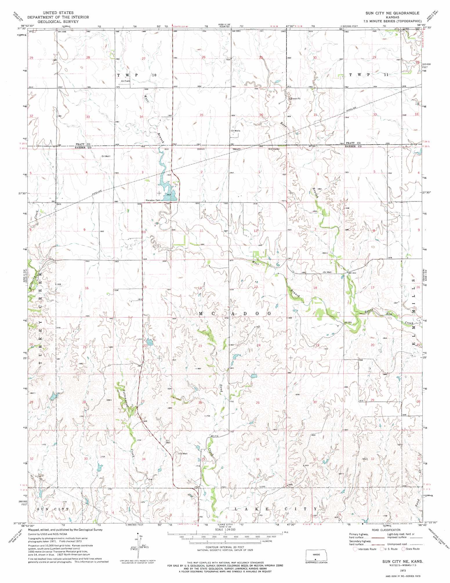
USGS Topo Quad 37098d7 - 1:24,000 scale
| Topo Map Name: | Sun City Ne |
| USGS Topo Quad ID: | 37098d7 |
| Print Size: | ca. 21 1/4" wide x 27" high |
| Southeast Coordinates: | 37.375° N latitude / 98.75° W longitude |
| Map Center Coordinates: | 37.4375° N latitude / 98.8125° W longitude |
| U.S. State: | KS |
| Filename: | o37098d7.jpg |
| Download Map JPG Image: | Sun City Ne topo map 1:24,000 scale |
| Map Type: | Topographic |
| Topo Series: | 7.5´ |
| Map Scale: | 1:24,000 |
| Source of Map Images: | United States Geological Survey (USGS) |
| Alternate Map Versions: |
Sun City NE KS 1973, updated 1975 Download PDF Buy paper map Sun City NE KS 2009 Download PDF Buy paper map Sun City NE KS 2012 Download PDF Buy paper map Sun City NE KS 2016 Download PDF Buy paper map |
1:24,000 Topo Quads surrounding Sun City Ne
Haviland Ne |
Cullison |
Coats Ne |
Pratt |
Cairo |
Haviland |
Croft |
Coats |
Pratt Sw |
Pratt Se |
Belvidere |
Sun City |
Sun City Ne |
Sawyer |
Isabel |
Wilmore Se |
Sun City Sw |
Lake City |
Medicine Lodge Sw |
Medicine Lodge |
Indian Creek |
Deerhead |
Pump Creek |
Hardtner Nw |
Gerlane |
> Back to 37098a1 at 1:100,000 scale
> Back to 37098a1 at 1:250,000 scale
> Back to U.S. Topo Maps home
Sun City Ne topo map: Gazetteer
Sun City Ne: Dams
MacAdoo Dam elevation 583m 1912′Sun City Ne: Streams
East Branch South Elm Creek elevation 549m 1801′West Branch South Elm Creek elevation 552m 1811′
Sun City Ne digital topo map on disk
Buy this Sun City Ne topo map showing relief, roads, GPS coordinates and other geographical features, as a high-resolution digital map file on DVD: