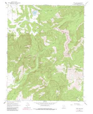
Pine Lake Topo Map Utah
To zoom in, hover over the map of Pine Lake
USGS Topo Quad 37111f8 - 1:24,000 scale
| Topo Map Name: | Pine Lake |
| USGS Topo Quad ID: | 37111f8 |
| Print Size: | ca. 21 1/4" wide x 27" high |
| Southeast Coordinates: | 37.625° N latitude / 111.875° W longitude |
| Map Center Coordinates: | 37.6875° N latitude / 111.9375° W longitude |
| U.S. State: | UT |
| Filename: | o37111f8.jpg |
| Download Map JPG Image: | Pine Lake topo map 1:24,000 scale |
| Map Type: | Topographic |
| Topo Series: | 7.5´ |
| Map Scale: | 1:24,000 |
| Source of Map Images: | United States Geological Survey (USGS) |
| Alternate Map Versions: |
Pine Lake UT 1964, updated 1966 Download PDF Buy paper map Pine Lake UT 1964, updated 1980 Download PDF Buy paper map Pine Lake UT 2002, updated 2005 Download PDF Buy paper map Pine Lake UT 2011 Download PDF Buy paper map Pine Lake UT 2014 Download PDF Buy paper map |
| FStopo: | US Forest Service topo Pine Lake is available: Download FStopo PDF Download FStopo TIF |
1:24,000 Topo Quads surrounding Pine Lake
> Back to 37111e1 at 1:100,000 scale
> Back to 37110a1 at 1:250,000 scale
> Back to U.S. Topo Maps home
Pine Lake topo map: Gazetteer
Pine Lake: Canals
Lossee Canal elevation 2486m 8156′Pine Lake: Capes
Powell Point elevation 3083m 10114′Pine Lake: Cliffs
Table Cliff elevation 2842m 9324′Pine Lake: Dams
Pine Creek Dam elevation 2498m 8195′Pine Lake: Mines
Shakespeare Mine elevation 2083m 6833′Pine Lake: Plains
Table Cliff Plateau elevation 3135m 10285′Pine Lake: Reservoirs
Pine Lake elevation 2498m 8195′Pine Lake: Springs
Burro Spring elevation 2585m 8480′Paradise Spring elevation 2308m 7572′
Stump Spring elevation 2522m 8274′
Pine Lake: Valleys
Burro Canyon elevation 2270m 7447′Pasture Canyon elevation 2043m 6702′
Pine Canyon elevation 2561m 8402′
Pole Canyon elevation 2438m 7998′
Pine Lake digital topo map on disk
Buy this Pine Lake topo map showing relief, roads, GPS coordinates and other geographical features, as a high-resolution digital map file on DVD:


