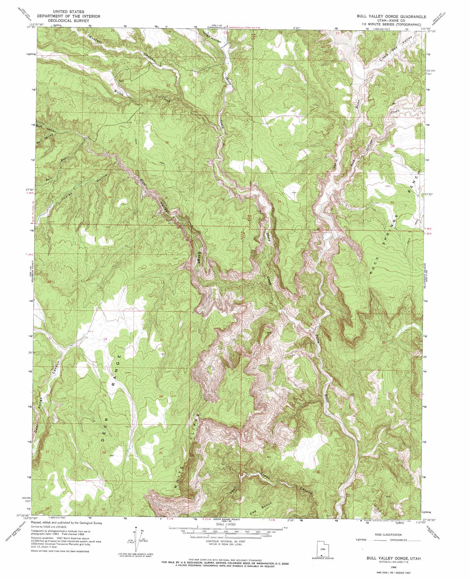
Bull Valley Gorge Topo Map Utah
To zoom in, hover over the map of Bull Valley Gorge
USGS Topo Quad 37112d1 - 1:24,000 scale
| Topo Map Name: | Bull Valley Gorge |
| USGS Topo Quad ID: | 37112d1 |
| Print Size: | ca. 21 1/4" wide x 27" high |
| Southeast Coordinates: | 37.375° N latitude / 112° W longitude |
| Map Center Coordinates: | 37.4375° N latitude / 112.0625° W longitude |
| U.S. State: | UT |
| Filename: | o37112d1.jpg |
| Download Map JPG Image: | Bull Valley Gorge topo map 1:24,000 scale |
| Map Type: | Topographic |
| Topo Series: | 7.5´ |
| Map Scale: | 1:24,000 |
| Source of Map Images: | United States Geological Survey (USGS) |
| Alternate Map Versions: |
Bull Valley Gorge UT 1966, updated 1968 Download PDF Buy paper map Bull Valley Gorge UT 1966, updated 1968 Download PDF Buy paper map Bull Valley Gorge UT 2010 Download PDF Buy paper map Bull Valley Gorge UT 2014 Download PDF Buy paper map |
1:24,000 Topo Quads surrounding Bull Valley Gorge
Wilson Peak |
Bryce Canyon |
Tropic Canyon |
Pine Lake |
Upper Valley |
Tropic Reservoir |
Bryce Point |
Cannonville |
Henrieville |
Canaan Peak |
Podunk Creek |
Rainbow Point |
Bull Valley Gorge |
Slickrock Bench |
Butler Valley |
Skutumpah Creek |
Deer Spring Point |
Deer Range Point |
Calico Peak |
Horse Flat |
Pine Point |
Nephi Point |
Eightmile Pass |
Fivemile Valley |
Lower Coyote Spring |
> Back to 37112a1 at 1:100,000 scale
> Back to 37112a1 at 1:250,000 scale
> Back to U.S. Topo Maps home
Bull Valley Gorge topo map: Gazetteer
Bull Valley Gorge: Ranges
Deer Range elevation 2154m 7066′Bull Valley Gorge: Streams
Bull Run elevation 1854m 6082′Rock Springs Creek elevation 1652m 5419′
Sheep Creek elevation 1613m 5291′
Willis Creek elevation 1740m 5708′
Bull Valley Gorge: Valleys
Averett Canyon elevation 1806m 5925′Bull Valley elevation 1854m 6082′
Bull Valley Gorge elevation 1666m 5465′
Indian Hollow elevation 1793m 5882′
Indian Hollow elevation 1843m 6046′
Little Bull Valley elevation 1847m 6059′
Little Dry Valley elevation 1677m 5501′
Bull Valley Gorge digital topo map on disk
Buy this Bull Valley Gorge topo map showing relief, roads, GPS coordinates and other geographical features, as a high-resolution digital map file on DVD: