Alamo Se Topo Map Nevada
To zoom in, hover over the map of Alamo Se
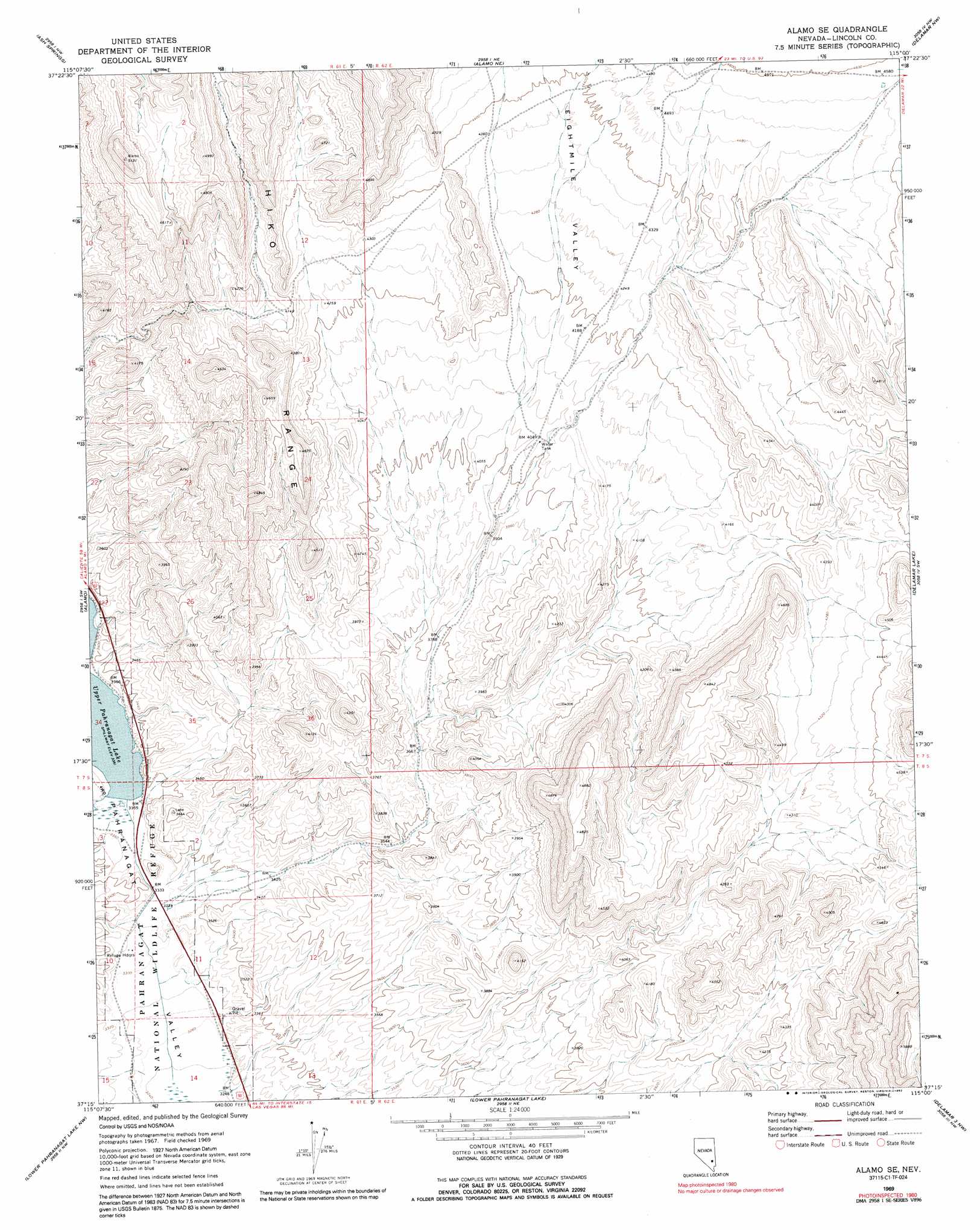
USGS Topo Quad 37115c1 - 1:24,000 scale
| Topo Map Name: | Alamo Se |
| USGS Topo Quad ID: | 37115c1 |
| Print Size: | ca. 21 1/4" wide x 27" high |
| Southeast Coordinates: | 37.25° N latitude / 115° W longitude |
| Map Center Coordinates: | 37.3125° N latitude / 115.0625° W longitude |
| U.S. State: | NV |
| Filename: | o37115c1.jpg |
| Download Map JPG Image: | Alamo Se topo map 1:24,000 scale |
| Map Type: | Topographic |
| Topo Series: | 7.5´ |
| Map Scale: | 1:24,000 |
| Source of Map Images: | United States Geological Survey (USGS) |
| Alternate Map Versions: |
Alamo SE NV 1969, updated 1972 Download PDF Buy paper map Alamo SE NV 1980, updated 1992 Download PDF Buy paper map Alamo SE NV 2012 Download PDF Buy paper map Alamo SE NV 2015 Download PDF Buy paper map |
1:24,000 Topo Quads surrounding Alamo Se
Mount Irish Se |
Hiko |
Hiko Se |
Pahroc Summit Pass |
Pahroc Spring Se |
Hancock Summit |
Ash Springs |
Alamo Ne |
Delamar Nw |
Delamar |
Badger Spring |
Alamo |
Alamo Se |
Delamar Lake |
Gregerson Basin |
Desert Hills Ne |
Lower Pahranagat Lake Nw |
Lower Pahranagat Lake |
Delamar 3 Nw |
Delamar 3 Ne |
Desert Hills Se |
Lower Pahranagat Lake Sw |
Lower Pahranagat Lake Se |
Delamar 3 Sw |
Delamar 3 Se |
> Back to 37115a1 at 1:100,000 scale
> Back to 37114a1 at 1:250,000 scale
> Back to U.S. Topo Maps home
Alamo Se topo map: Gazetteer
Alamo Se: Dams
Upper Pahranagat Dam elevation 1022m 3353′Alamo Se: Reservoirs
Upper Pahranagat Lake elevation 1022m 3353′Alamo Se: Valleys
Eightmile Valley elevation 1189m 3900′Alamo Se digital topo map on disk
Buy this Alamo Se topo map showing relief, roads, GPS coordinates and other geographical features, as a high-resolution digital map file on DVD: