Alamo Ne Topo Map Nevada
To zoom in, hover over the map of Alamo Ne
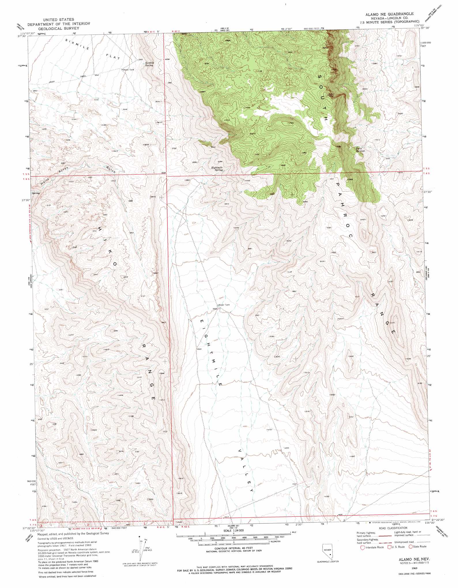
USGS Topo Quad 37115d1 - 1:24,000 scale
| Topo Map Name: | Alamo Ne |
| USGS Topo Quad ID: | 37115d1 |
| Print Size: | ca. 21 1/4" wide x 27" high |
| Southeast Coordinates: | 37.375° N latitude / 115° W longitude |
| Map Center Coordinates: | 37.4375° N latitude / 115.0625° W longitude |
| U.S. State: | NV |
| Filename: | o37115d1.jpg |
| Download Map JPG Image: | Alamo Ne topo map 1:24,000 scale |
| Map Type: | Topographic |
| Topo Series: | 7.5´ |
| Map Scale: | 1:24,000 |
| Source of Map Images: | United States Geological Survey (USGS) |
| Alternate Map Versions: |
Alamo NE NV 1969, updated 1973 Download PDF Buy paper map Alamo NE NV 1969, updated 1980 Download PDF Buy paper map Alamo NE NV 2012 Download PDF Buy paper map Alamo NE NV 2014 Download PDF Buy paper map |
1:24,000 Topo Quads surrounding Alamo Ne
Mail Summit |
Fossil Peak |
Hiko Ne |
Pahroc Spring |
Pahroc Spring Ne |
Mount Irish Se |
Hiko |
Hiko Se |
Pahroc Summit Pass |
Pahroc Spring Se |
Hancock Summit |
Ash Springs |
Alamo Ne |
Delamar Nw |
Delamar |
Badger Spring |
Alamo |
Alamo Se |
Delamar Lake |
Gregerson Basin |
Desert Hills Ne |
Lower Pahranagat Lake Nw |
Lower Pahranagat Lake |
Delamar 3 Nw |
Delamar 3 Ne |
> Back to 37115a1 at 1:100,000 scale
> Back to 37114a1 at 1:250,000 scale
> Back to U.S. Topo Maps home
Alamo Ne topo map: Gazetteer
Alamo Ne: Ranges
South Pahroc Range elevation 2393m 7851′Alamo Ne: Reservoirs
Twin Spring Reservoir elevation 1889m 6197′Alamo Ne: Springs
Boulder Spring elevation 1972m 6469′Eightmile Spring elevation 1851m 6072′
Rye Patch Spring elevation 1961m 6433′
Sixmile Spring elevation 1636m 5367′
Twin Springs elevation 1912m 6272′
Alamo Ne digital topo map on disk
Buy this Alamo Ne topo map showing relief, roads, GPS coordinates and other geographical features, as a high-resolution digital map file on DVD: