Mud Lake South Topo Map Nevada
To zoom in, hover over the map of Mud Lake South
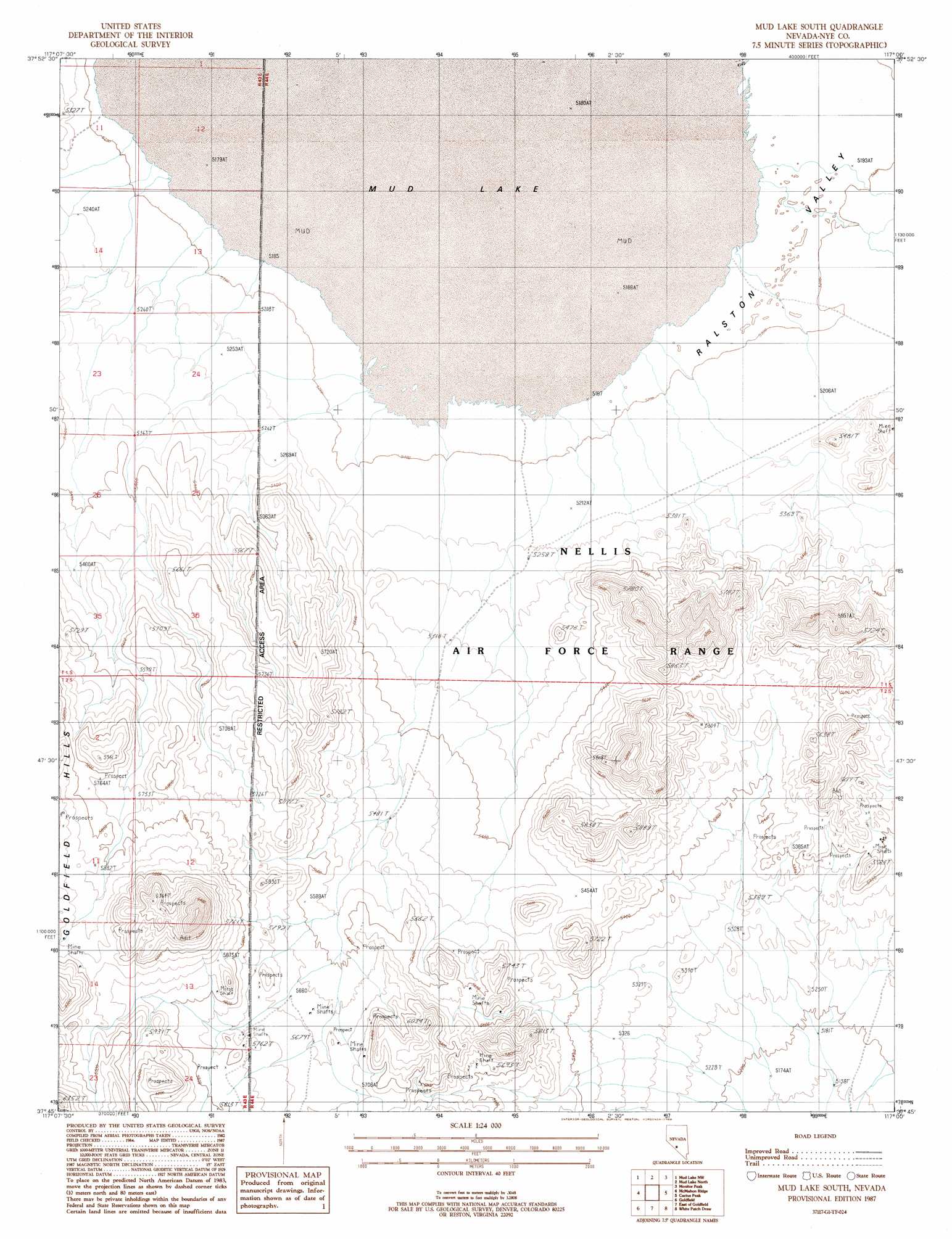
USGS Topo Quad 37117g1 - 1:24,000 scale
| Topo Map Name: | Mud Lake South |
| USGS Topo Quad ID: | 37117g1 |
| Print Size: | ca. 21 1/4" wide x 27" high |
| Southeast Coordinates: | 37.75° N latitude / 117° W longitude |
| Map Center Coordinates: | 37.8125° N latitude / 117.0625° W longitude |
| U.S. State: | NV |
| Filename: | o37117g1.jpg |
| Download Map JPG Image: | Mud Lake South topo map 1:24,000 scale |
| Map Type: | Topographic |
| Topo Series: | 7.5´ |
| Map Scale: | 1:24,000 |
| Source of Map Images: | United States Geological Survey (USGS) |
| Alternate Map Versions: |
Mud Lake South NV 1987, updated 1988 Download PDF Buy paper map |
1:24,000 Topo Quads surrounding Mud Lake South
Mount Butte |
Tonopah |
East Of Tonopah |
Mckinney Tanks |
Yellow Cone |
Klondike |
Mud Lake Nw |
Mud Lake North |
Monitor Peak |
Reeds Ranch |
Alkali |
Mcmahon Ridge |
Mud Lake South |
Cactus Peak |
East Of Cactus Peak |
Montezuma Peak |
Goldfield |
East Of Goldfield |
White Patch Draw |
Cactus Spring |
Montezuma Peak Se |
Ralston |
Stonewall Spring |
Pack Rat Canyon |
Civet Cat Cave |
> Back to 37117e1 at 1:100,000 scale
> Back to 37116a1 at 1:250,000 scale
> Back to U.S. Topo Maps home
Mud Lake South topo map: Gazetteer
Mud Lake South: Lakes
Mud Lake elevation 1582m 5190′Mud Lake South: Plains
Ralston Desert elevation 1615m 5298′Mud Lake South: Reservoirs
Iron Tank (historical) elevation 1582m 5190′Mud Lake South digital topo map on disk
Buy this Mud Lake South topo map showing relief, roads, GPS coordinates and other geographical features, as a high-resolution digital map file on DVD: