Goblin Valley Topo Map Utah
To zoom in, hover over the map of Goblin Valley
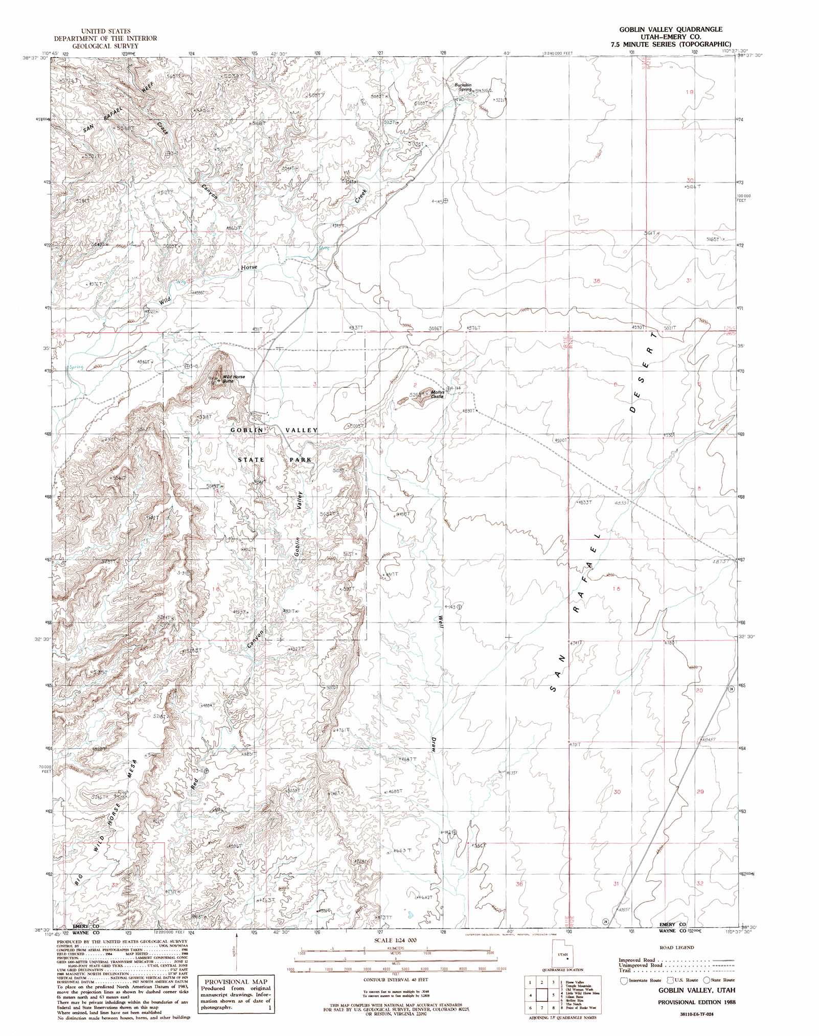
USGS Topo Quad 38110e6 - 1:24,000 scale
| Topo Map Name: | Goblin Valley |
| USGS Topo Quad ID: | 38110e6 |
| Print Size: | ca. 21 1/4" wide x 27" high |
| Southeast Coordinates: | 38.5° N latitude / 110.625° W longitude |
| Map Center Coordinates: | 38.5625° N latitude / 110.6875° W longitude |
| U.S. State: | UT |
| Filename: | o38110e6.jpg |
| Download Map JPG Image: | Goblin Valley topo map 1:24,000 scale |
| Map Type: | Topographic |
| Topo Series: | 7.5´ |
| Map Scale: | 1:24,000 |
| Source of Map Images: | United States Geological Survey (USGS) |
| Alternate Map Versions: |
Stinking Springs Creek 4 SW UT 1954 Download PDF Buy paper map Goblin Valley UT 1988, updated 1988 Download PDF Buy paper map Goblin Valley UT 1988, updated 1988 Download PDF Buy paper map Goblin Valley UT 1996, updated 2002 Download PDF Buy paper map Goblin Valley UT 2010 Download PDF Buy paper map Goblin Valley UT 2014 Download PDF Buy paper map |
1:24,000 Topo Quads surrounding Goblin Valley
Copper Globe |
San Rafael Knob |
Twin Knolls |
Arsons Garden |
Greasewood Draw |
Tomsich Butte |
Horse Valley |
Temple Mountain |
Old Woman Wash |
Crows Nest Spring |
Hunt Draw |
Little Wild Horse Mesa |
Goblin Valley |
Gilson Butte |
The Flat Tops |
Factory Butte |
Skyline Rim |
The Notch |
Point Of Rocks West |
Point Of Rocks East |
Town Point |
Steamboat Point |
Hanksville |
Angel Cove |
Angel Point |
> Back to 38110e1 at 1:100,000 scale
> Back to 38110a1 at 1:250,000 scale
> Back to U.S. Topo Maps home
Goblin Valley topo map: Gazetteer
Goblin Valley: Parks
Goblin Valley State Park elevation 1517m 4977′Goblin Valley State Park elevation 1516m 4973′
Goblin Valley: Springs
Buckskin Spring elevation 1580m 5183′Goblin Valley: Summits
Mollys Castle elevation 1500m 4921′Wild Horse Butte elevation 1644m 5393′
Goblin Valley: Valleys
Chute Canyon elevation 1451m 4760′Crack Canyon elevation 1481m 4858′
Goblin Valley elevation 1476m 4842′
Goblin Valley digital topo map on disk
Buy this Goblin Valley topo map showing relief, roads, GPS coordinates and other geographical features, as a high-resolution digital map file on DVD: