Black Point Topo Map Utah
To zoom in, hover over the map of Black Point
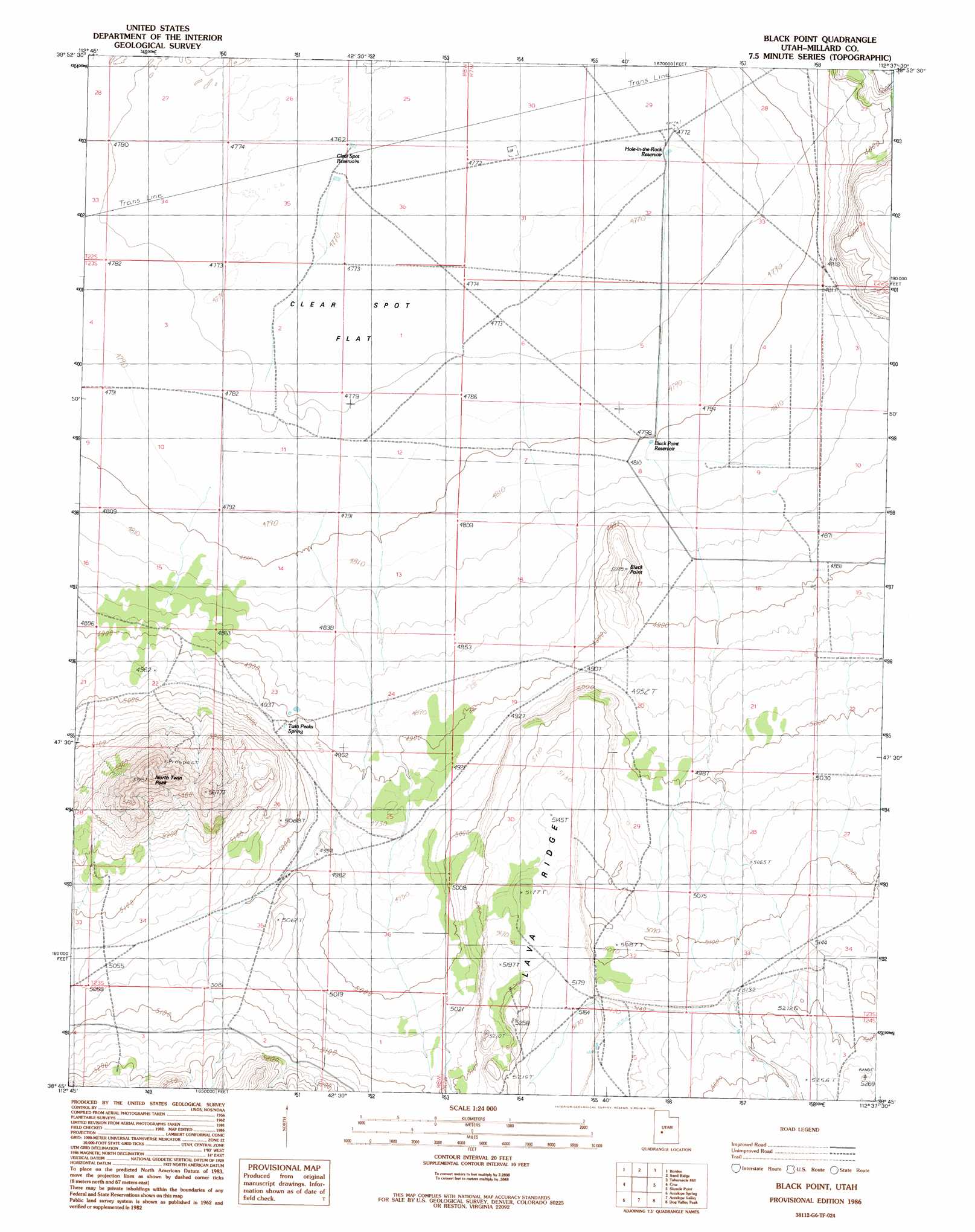
USGS Topo Quad 38112g6 - 1:24,000 scale
| Topo Map Name: | Black Point |
| USGS Topo Quad ID: | 38112g6 |
| Print Size: | ca. 21 1/4" wide x 27" high |
| Southeast Coordinates: | 38.75° N latitude / 112.625° W longitude |
| Map Center Coordinates: | 38.8125° N latitude / 112.6875° W longitude |
| U.S. State: | UT |
| Filename: | o38112g6.jpg |
| Download Map JPG Image: | Black Point topo map 1:24,000 scale |
| Map Type: | Topographic |
| Topo Series: | 7.5´ |
| Map Scale: | 1:24,000 |
| Source of Map Images: | United States Geological Survey (USGS) |
| Alternate Map Versions: |
Black Point UT 1986, updated 1986 Download PDF Buy paper map Black Point UT 2010 Download PDF Buy paper map Black Point UT 2014 Download PDF Buy paper map |
1:24,000 Topo Quads surrounding Black Point
Red Pass |
Neels |
Clear Lake |
Pavant Butte South |
The Sink |
Candland Spring |
Borden |
Sand Ridge |
Tabernacle Hill |
Meadow |
Cat Canyon |
Cruz |
Black Point |
Sixmile Point |
Kanosh |
Black Rock |
Antelope Spring |
Antelope Valley |
Dog Valley Peak |
Red Ridge |
Read |
Pinnacle Pass |
Cinder Crater |
Cove Fort |
Trail Mountain |
> Back to 38112e1 at 1:100,000 scale
> Back to 38112a1 at 1:250,000 scale
> Back to U.S. Topo Maps home
Black Point topo map: Gazetteer
Black Point: Flats
Clear Spot Flat elevation 1457m 4780′Black Point: Reservoirs
Black Point Reservoir elevation 1465m 4806′Clear Spot Reservoirs elevation 1455m 4773′
Hole-in-the-Rock Reservoir elevation 1455m 4773′
Black Point: Ridges
Lava Ridge elevation 1581m 5187′Black Point: Springs
Twin Peaks Spring elevation 1495m 4904′Black Point: Summits
Black Point elevation 1529m 5016′North Twin Peak elevation 1797m 5895′
Twin Peaks elevation 1750m 5741′
Black Point digital topo map on disk
Buy this Black Point topo map showing relief, roads, GPS coordinates and other geographical features, as a high-resolution digital map file on DVD: