White Pine Peak Topo Map Nevada
To zoom in, hover over the map of White Pine Peak
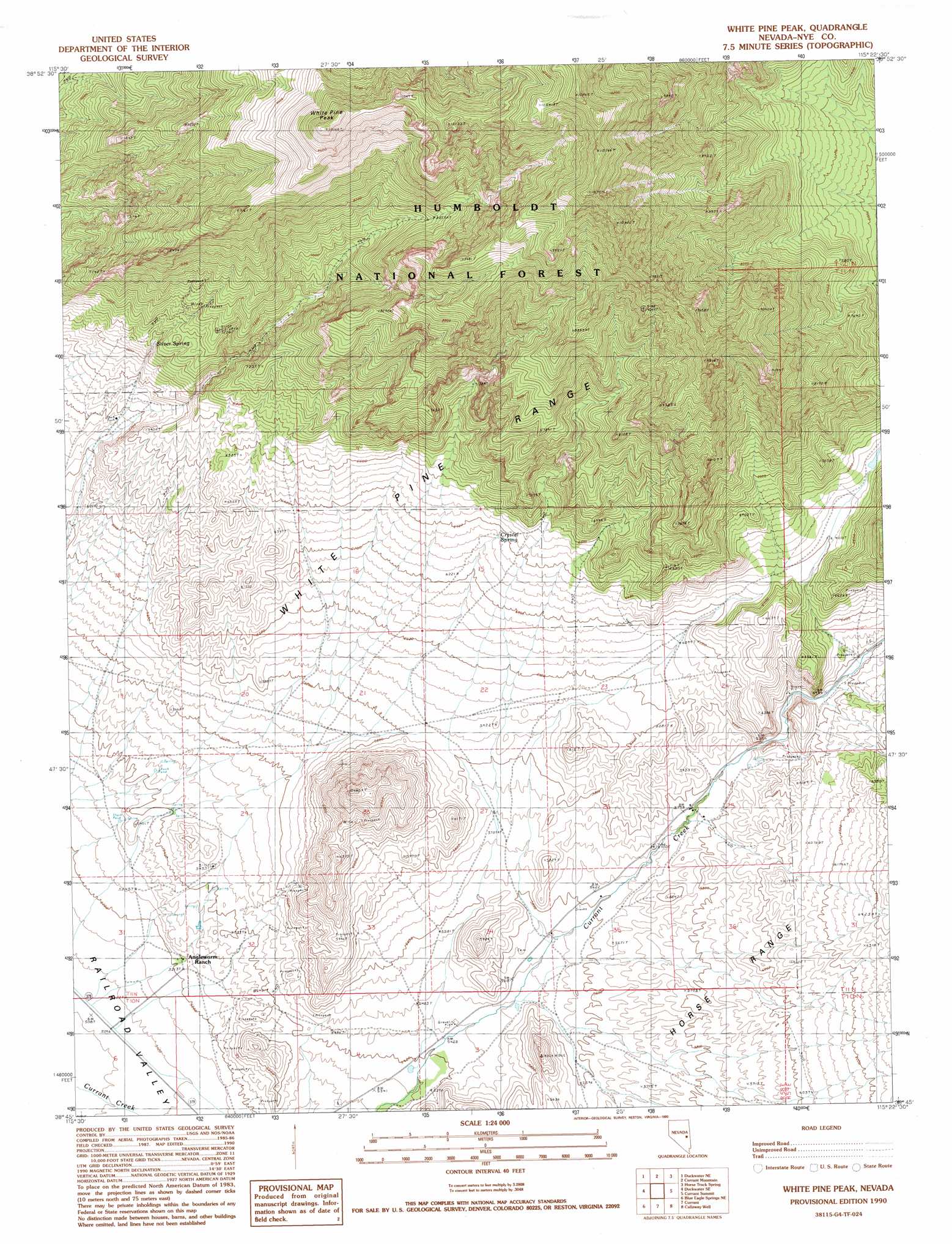
USGS Topo Quad 38115g4 - 1:24,000 scale
| Topo Map Name: | White Pine Peak |
| USGS Topo Quad ID: | 38115g4 |
| Print Size: | ca. 21 1/4" wide x 27" high |
| Southeast Coordinates: | 38.75° N latitude / 115.375° W longitude |
| Map Center Coordinates: | 38.8125° N latitude / 115.4375° W longitude |
| U.S. State: | NV |
| Filename: | o38115g4.jpg |
| Download Map JPG Image: | White Pine Peak topo map 1:24,000 scale |
| Map Type: | Topographic |
| Topo Series: | 7.5´ |
| Map Scale: | 1:24,000 |
| Source of Map Images: | United States Geological Survey (USGS) |
| Alternate Map Versions: |
White Pine Peak NV 1990, updated 1990 Download PDF Buy paper map White Pine Peak NV 2012 Download PDF Buy paper map White Pine Peak NV 2014 Download PDF Buy paper map |
| FStopo: | US Forest Service topo White Pine Peak is available: Download FStopo PDF Download FStopo TIF |
1:24,000 Topo Quads surrounding White Pine Peak
Green Springs Sw |
Green Springs |
Indian Garden Mountain |
Easter Springs |
Blackjack Springs |
Duckwater |
Duckwater Ne |
Currant Mountain |
Horse Track Spring |
Badger Hole Spring |
Bradshaw Spring |
Duckwater Se |
White Pine Peak |
Currant Summit |
Douglas |
Meteorite Crater |
Blue Eagle Springs Ne |
Currant |
Callaway Well |
Moorman Spring Nw |
Blue Eagle Springs Sw |
Blue Eagle Springs |
Blue Eagle Mountain |
Wells Station |
Moorman Spring |
> Back to 38115e1 at 1:100,000 scale
> Back to 38114a1 at 1:250,000 scale
> Back to U.S. Topo Maps home
White Pine Peak topo map: Gazetteer
White Pine Peak: Dams
Manzonie Dam elevation 1985m 6512′White Pine Peak: Forests
White Pine Ranger District elevation 1894m 6213′White Pine Peak: Reservoirs
Manzonie Reservoir elevation 1985m 6512′White Pine Peak: Springs
Angle Worm Spring elevation 1632m 5354′Crystal Spring elevation 1940m 6364′
Silver Spring elevation 2113m 6932′
White Pine Peak: Summits
White Pine Peak elevation 3065m 10055′White Pine Peak digital topo map on disk
Buy this White Pine Peak topo map showing relief, roads, GPS coordinates and other geographical features, as a high-resolution digital map file on DVD: