Green Springs Sw Topo Map Nevada
To zoom in, hover over the map of Green Springs Sw
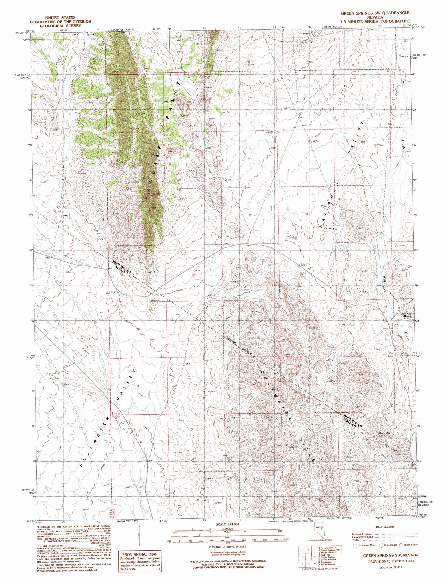
USGS Topo Quad 39115a6 - 1:24,000 scale
| Topo Map Name: | Green Springs Sw |
| USGS Topo Quad ID: | 39115a6 |
| Print Size: | ca. 21 1/4" wide x 27" high |
| Southeast Coordinates: | 39° N latitude / 115.625° W longitude |
| Map Center Coordinates: | 39.0625° N latitude / 115.6875° W longitude |
| U.S. State: | NV |
| Filename: | o39115a6.jpg |
| Download Map JPG Image: | Green Springs Sw topo map 1:24,000 scale |
| Map Type: | Topographic |
| Topo Series: | 7.5´ |
| Map Scale: | 1:24,000 |
| Source of Map Images: | United States Geological Survey (USGS) |
| Alternate Map Versions: |
Green Springs SW NV 1990, updated 1990 Download PDF Buy paper map Green Springs SW NV 2012 Download PDF Buy paper map Green Springs SW NV 2014 Download PDF Buy paper map |
1:24,000 Topo Quads surrounding Green Springs Sw
Pinto Summit Sw |
Black Point |
Pancake Summit Sw |
Seligman Canyon |
Hamilton |
Moody Peak Nw |
Pogues Station |
Green Springs Nw |
Mount Hamilton |
Treasure Hill |
Moody Peak |
Bull Fork |
Green Springs Sw |
Green Springs |
Indian Garden Mountain |
Brown Summit Nw |
Brown Summit |
Duckwater |
Duckwater Ne |
Currant Mountain |
Brown Summit Sw |
Sand Spring |
Bradshaw Spring |
Duckwater Se |
White Pine Peak |
> Back to 39115a1 at 1:100,000 scale
> Back to 39114a1 at 1:250,000 scale
> Back to U.S. Topo Maps home
Green Springs Sw topo map: Gazetteer
Green Springs Sw: Dams
Bull Creek Dam Number Two elevation 1769m 5803′Green Springs Sw: Reservoirs
Bull Creek Reservoir elevation 1769m 5803′Green Springs Sw: Springs
Big Bull Spring elevation 1777m 5830′Green Springs Sw: Streams
Green Springs Wash elevation 1781m 5843′Green Springs Sw: Summits
Black Point elevation 1879m 6164′Green Springs Sw digital topo map on disk
Buy this Green Springs Sw topo map showing relief, roads, GPS coordinates and other geographical features, as a high-resolution digital map file on DVD: