San Antonio Well Topo Map Nevada
To zoom in, hover over the map of San Antonio Well
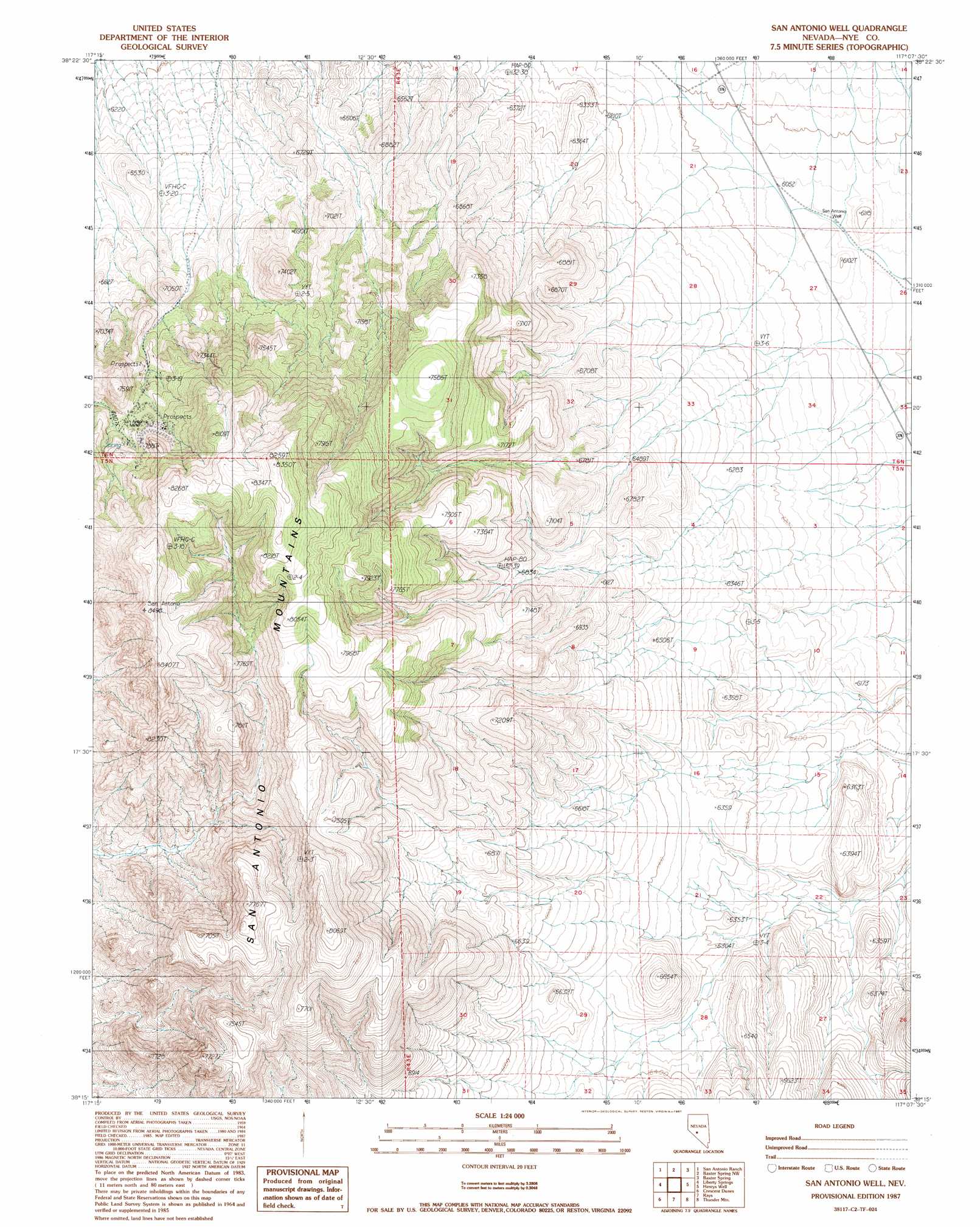
USGS Topo Quad 38117c2 - 1:24,000 scale
| Topo Map Name: | San Antonio Well |
| USGS Topo Quad ID: | 38117c2 |
| Print Size: | ca. 21 1/4" wide x 27" high |
| Southeast Coordinates: | 38.25° N latitude / 117.125° W longitude |
| Map Center Coordinates: | 38.3125° N latitude / 117.1875° W longitude |
| U.S. State: | NV |
| Filename: | o38117c2.jpg |
| Download Map JPG Image: | San Antonio Well topo map 1:24,000 scale |
| Map Type: | Topographic |
| Topo Series: | 7.5´ |
| Map Scale: | 1:24,000 |
| Source of Map Images: | United States Geological Survey (USGS) |
| Alternate Map Versions: |
San Antonio Well NV 1987, updated 1987 Download PDF Buy paper map San Antonio Well NV 2012 Download PDF Buy paper map San Antonio Well NV 2014 Download PDF Buy paper map |
1:24,000 Topo Quads surrounding San Antonio Well
Secret Basin |
Peavine Ranch |
Seyler Peak |
Manhattan |
Belmont West |
Rainier Mountain |
San Antonio Ranch |
Baxter Spring Nw |
Baxter Spring |
Big Ten Peak West |
San Antonio Ranch Sw |
Liberty Springs |
San Antonio Well |
Henrys Well |
Antelope Spring |
Millers |
Crescent Dunes |
Rays |
Thumder Mountain |
Hannapah |
Lone Mountain |
Mount Butte |
Tonopah |
East Of Tonopah |
Mckinney Tanks |
> Back to 38117a1 at 1:100,000 scale
> Back to 38116a1 at 1:250,000 scale
> Back to U.S. Topo Maps home
San Antonio Well topo map: Gazetteer
San Antonio Well: Mines
Cimarron Mine elevation 2260m 7414′San Antonio Mine elevation 2235m 7332′
San Antonio Well: Populated Places
Potomic (historical) elevation 2182m 7158′San Antonio Well: Summits
San Antonio Mountain elevation 2350m 7709′San Antonio Well: Wells
San Antonio Well elevation 1841m 6040′San Antonio Well digital topo map on disk
Buy this San Antonio Well topo map showing relief, roads, GPS coordinates and other geographical features, as a high-resolution digital map file on DVD: