San Antonio Ranch Topo Map Nevada
To zoom in, hover over the map of San Antonio Ranch
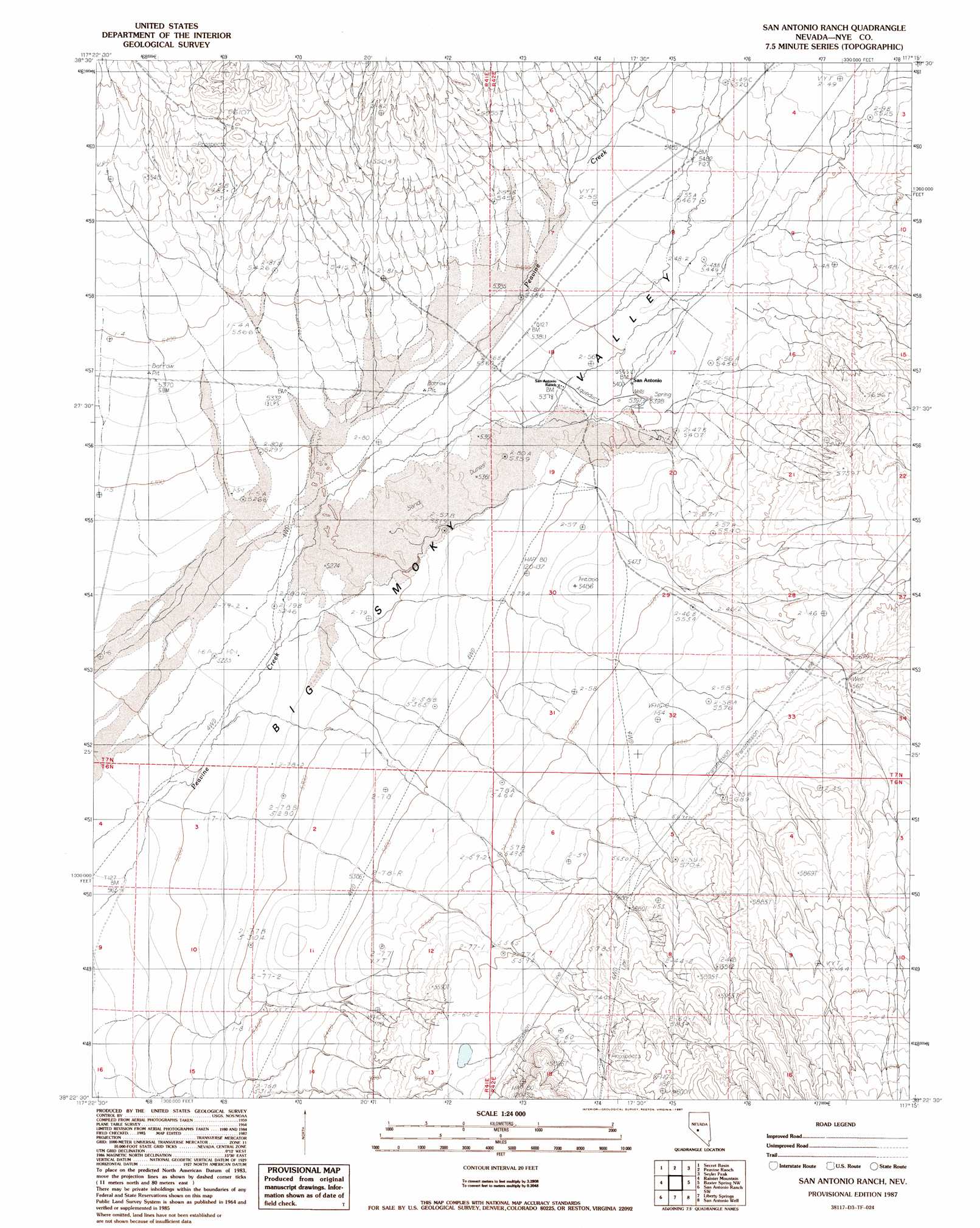
USGS Topo Quad 38117d3 - 1:24,000 scale
| Topo Map Name: | San Antonio Ranch |
| USGS Topo Quad ID: | 38117d3 |
| Print Size: | ca. 21 1/4" wide x 27" high |
| Southeast Coordinates: | 38.375° N latitude / 117.25° W longitude |
| Map Center Coordinates: | 38.4375° N latitude / 117.3125° W longitude |
| U.S. State: | NV |
| Filename: | o38117d3.jpg |
| Download Map JPG Image: | San Antonio Ranch topo map 1:24,000 scale |
| Map Type: | Topographic |
| Topo Series: | 7.5´ |
| Map Scale: | 1:24,000 |
| Source of Map Images: | United States Geological Survey (USGS) |
| Alternate Map Versions: |
San Antonio Ranch NV 1987, updated 1987 Download PDF Buy paper map San Antonio Ranch NV 2012 Download PDF Buy paper map San Antonio Ranch NV 2014 Download PDF Buy paper map |
1:24,000 Topo Quads surrounding San Antonio Ranch
Mount Ardivey |
Farrington Canyon |
Toms Canyon |
Pablo Canyon Ranch |
Round Mountain |
Cloverdale Ranch |
Secret Basin |
Peavine Ranch |
Seyler Peak |
Manhattan |
Outlaw Springs Ne |
Rainier Mountain |
San Antonio Ranch |
Baxter Spring Nw |
Baxter Spring |
Outlaw Springs Se |
San Antonio Ranch Sw |
Liberty Springs |
San Antonio Well |
Henrys Well |
Crow Springs |
Millers |
Crescent Dunes |
Rays |
Thumder Mountain |
> Back to 38117a1 at 1:100,000 scale
> Back to 38116a1 at 1:250,000 scale
> Back to U.S. Topo Maps home
San Antonio Ranch topo map: Gazetteer
San Antonio Ranch: Populated Places
San Antonio (historical) elevation 1647m 5403′San Antonio Ranch: Post Offices
San Antonio Post Office (historical) elevation 1647m 5403′San Antonio Ranch: Springs
Indian Springs elevation 1648m 5406′San Antonio Ranch: Streams
Cottonwood Creek elevation 1614m 5295′San Antonio Ranch: Wells
Peavine Well elevation 1712m 5616′San Antonio Ranch digital topo map on disk
Buy this San Antonio Ranch topo map showing relief, roads, GPS coordinates and other geographical features, as a high-resolution digital map file on DVD: