Bennett Topo Map Colorado
To zoom in, hover over the map of Bennett
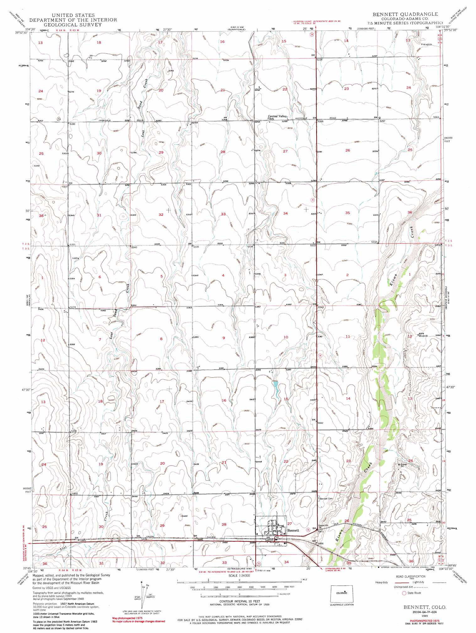
USGS Topo Quad 39104g4 - 1:24,000 scale
| Topo Map Name: | Bennett |
| USGS Topo Quad ID: | 39104g4 |
| Print Size: | ca. 21 1/4" wide x 27" high |
| Southeast Coordinates: | 39.75° N latitude / 104.375° W longitude |
| Map Center Coordinates: | 39.8125° N latitude / 104.4375° W longitude |
| U.S. State: | CO |
| Filename: | o39104g4.jpg |
| Download Map JPG Image: | Bennett topo map 1:24,000 scale |
| Map Type: | Topographic |
| Topo Series: | 7.5´ |
| Map Scale: | 1:24,000 |
| Source of Map Images: | United States Geological Survey (USGS) |
| Alternate Map Versions: |
Bennett CO 1949 Download PDF Buy paper map Bennett CO 1949, updated 1963 Download PDF Buy paper map Bennett CO 1949, updated 1963 Download PDF Buy paper map Bennett CO 1949, updated 1975 Download PDF Buy paper map Bennett CO 1949, updated 1986 Download PDF Buy paper map Bennett CO 2010 Download PDF Buy paper map Bennett CO 2013 Download PDF Buy paper map Bennett CO 2016 Download PDF Buy paper map |
1:24,000 Topo Quads surrounding Bennett
Hudson |
Keenesburg |
Prospect Valley |
South Roggen |
Wiggins Sw |
Mile High Lakes |
Horse Creek |
Sunnydale |
Living Springs |
Leader Nw |
Box Elder School |
Manila |
Bennett |
Roper School |
Leader Sw |
Coal Creek |
Watkins |
Strasburg Nw |
Strasburg |
Byers |
Piney Creek |
Watkins Se |
Strasburg Sw |
Strasburg Se |
Byers Sw |
> Back to 39104e1 at 1:100,000 scale
> Back to 39104a1 at 1:250,000 scale
> Back to U.S. Topo Maps home
Bennett topo map: Gazetteer
Bennett: Airports
Hoy Airstrip elevation 1619m 5311′J and S Airport elevation 1621m 5318′
Yoder Airstrip elevation 1628m 5341′
Bennett: Dams
James Layne Dam elevation 1658m 5439′Bennett: Populated Places
Bennett elevation 1672m 5485′Bennett: Reservoirs
Layne Reservoir elevation 1658m 5439′Bennett digital topo map on disk
Buy this Bennett topo map showing relief, roads, GPS coordinates and other geographical features, as a high-resolution digital map file on DVD: