Box Elder School Topo Map Colorado
To zoom in, hover over the map of Box Elder School
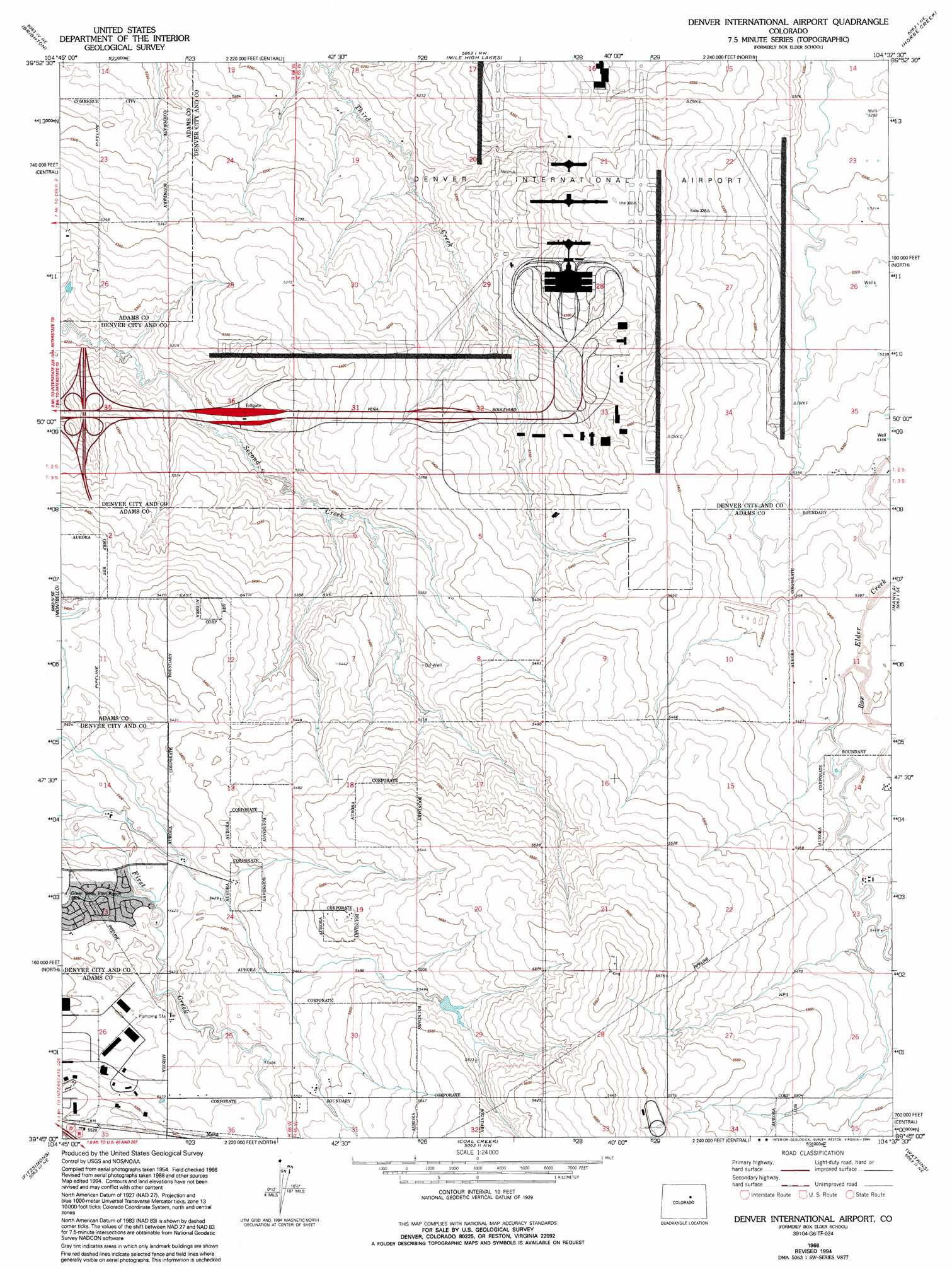
USGS Topo Quad 39104g6 - 1:24,000 scale
| Topo Map Name: | Box Elder School |
| USGS Topo Quad ID: | 39104g6 |
| Print Size: | ca. 21 1/4" wide x 27" high |
| Southeast Coordinates: | 39.75° N latitude / 104.625° W longitude |
| Map Center Coordinates: | 39.8125° N latitude / 104.6875° W longitude |
| U.S. State: | CO |
| Filename: | o39104g6.jpg |
| Download Map JPG Image: | Box Elder School topo map 1:24,000 scale |
| Map Type: | Topographic |
| Topo Series: | 7.5´ |
| Map Scale: | 1:24,000 |
| Source of Map Images: | United States Geological Survey (USGS) |
| Alternate Map Versions: |
Box Elder School CO 1957, updated 1958 Download PDF Buy paper map Box Elder School CO 1957, updated 1958 Download PDF Buy paper map Box Elder School CO 1957, updated 1963 Download PDF Buy paper map Box Elder School CO 1966, updated 1967 Download PDF Buy paper map Box Elder School CO 1966, updated 1967 Download PDF Buy paper map Denver International Airport CO 1966, updated 1994 Download PDF Buy paper map Denver International Airport CO 1966, updated 1994 Download PDF Buy paper map Denver International Airport CO 2010 Download PDF Buy paper map Denver International Airport CO 2013 Download PDF Buy paper map Denver International Airport CO 2016 Download PDF Buy paper map |
1:24,000 Topo Quads surrounding Box Elder School
Frederick |
Fort Lupton |
Hudson |
Keenesburg |
Prospect Valley |
Eastlake |
Brighton |
Mile High Lakes |
Horse Creek |
Sunnydale |
Commerce City |
Sable |
Box Elder School |
Manila |
Bennett |
Englewood |
Fitzsimons |
Coal Creek |
Watkins |
Strasburg Nw |
Highlands Ranch |
Parker |
Piney Creek |
Watkins Se |
Strasburg Sw |
> Back to 39104e1 at 1:100,000 scale
> Back to 39104a1 at 1:250,000 scale
> Back to U.S. Topo Maps home
Box Elder School topo map: Gazetteer
Box Elder School: Airports
Denver International Airport elevation 1655m 5429′Sky Ranch Airport elevation 1669m 5475′
Box Elder School: Dams
Terminal Dam elevation 1647m 5403′Box Elder School: Mines
Scranton Mine elevation 1659m 5442′Two Shafts Mine elevation 1712m 5616′
Box Elder School: Reservoirs
Terminal Reservoir elevation 1647m 5403′Box Elder School digital topo map on disk
Buy this Box Elder School topo map showing relief, roads, GPS coordinates and other geographical features, as a high-resolution digital map file on DVD: